Chrisman, Illinois
Chrisman is a city in Ross Township, Edgar County, Illinois, United States. The population was 1,343 at the 2010 census.
Chrisman | |
|---|---|
 Location of Chrisman in Edgar County, Illinois. | |
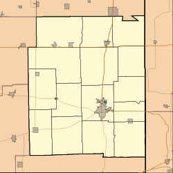
 Chrisman Chrisman's location in Edgar County | |
| Coordinates: 39°48′13″N 87°40′25″W | |
| Country | |
| State | |
| County | Edgar |
| Township | Ross |
| Area | |
| • Total | 0.72 sq mi (1.86 km2) |
| • Land | 0.72 sq mi (1.86 km2) |
| • Water | 0.00 sq mi (0.00 km2) |
| Elevation | 650 ft (198 m) |
| Population (2010) | |
| • Total | 1,343 |
| • Estimate (2019)[2] | 1,265 |
| • Density | 1,759.39/sq mi (679.58/km2) |
| ZIP code | 61924 |
| Area code(s) | 217 |
| FIPS code | 17-14273 |
| Website | www |
Geography

Chrisman is located at 39°48′15″N 87°40′32″W (39.804038, -87.675669).[3] It is on U.S. Route 150 less than a mile north of its intersection with U.S. Route 36. Two railroad lines intersect in Chrisman, both operated by CSX Transportation.[4]
According to the 2010 census, Chrisman has a total area of 0.75 square miles (1.94 km2), all land.[5]
Demographics
| Historical population | |||
|---|---|---|---|
| Census | Pop. | %± | |
| 1880 | 541 | — | |
| 1890 | 820 | 51.6% | |
| 1900 | 905 | 10.4% | |
| 1910 | 1,193 | 31.8% | |
| 1920 | 1,101 | −7.7% | |
| 1930 | 1,092 | −0.8% | |
| 1940 | 1,112 | 1.8% | |
| 1950 | 1,071 | −3.7% | |
| 1960 | 1,221 | 14.0% | |
| 1970 | 1,285 | 5.2% | |
| 1980 | 1,413 | 10.0% | |
| 1990 | 1,136 | −19.6% | |
| 2000 | 1,318 | 16.0% | |
| 2010 | 1,343 | 1.9% | |
| Est. 2019 | 1,265 | [2] | −5.8% |
| U.S. Decennial Census[6] | |||
As of the census[7] of 2000, there were 1,318 people, 531 households, and 340 families residing in the city. The population density was 1,801.6 people per square mile (697.1/km2). There were 597 housing units at an average density of 816.0 per square mile (315.8/km2). The racial makeup of the city was 99.17% White, 0.15% African American, 0.08% Native American, 0.23% Asian, and 0.38% from two or more races. Hispanic or Latino of any race were 0.30% of the population.
There were 531 households out of which 29.2% had children under the age of 18 living with them, 53.5% were married couples living together, 7.9% had a female householder with no husband present, and 35.8% were non-families. 32.8% of all households were made up of individuals and 18.1% had someone living alone who was 65 years of age or older. The average household size was 2.27 and the average family size was 2.89.
In the city, the population was spread out with 22.3% under the age of 18, 7.5% from 18 to 24, 23.6% from 25 to 44, 21.2% from 45 to 64, and 25.3% who were 65 years of age or older. The median age was 43 years. For every 100 females, there were 83.3 males. For every 100 females age 18 and over, there were 73.9 males.
The median income for a household in the city was $33,167, and the median income for a family was $42,321. Males had a median income of $32,313 versus $21,875 for females. The per capita income for the city was $16,651. About 5.1% of families and 10.7% of the population were below the poverty line, including 11.0% of those under age 18 and 14.0% of those age 65 or over.
Notable person
- Harry Woodyard, Illinois state legislator, lived in Chrisman.[8]
Barack Obama visited the city while campaigning in Edgar County for the Illinois Senate. Abraham Lincoln also stayed in a hotel outside Chrisman.
References

- "2019 U.S. Gazetteer Files". United States Census Bureau. Retrieved July 14, 2020.
- "Population and Housing Unit Estimates". United States Census Bureau. May 24, 2020. Retrieved May 27, 2020.
- "US Gazetteer files: 2010, 2000, and 1990". United States Census Bureau. 2011-02-12. Retrieved 2011-04-23.
- "Illinois Railroad Map" (PDF). Archived from the original (PDF) on 2007-08-22. Retrieved 2007-10-11.
- "G001 - Geographic Identifiers - 2010 Census Summary File 1". United States Census Bureau. Archived from the original on 2020-02-13. Retrieved 2015-12-26.
- "Census of Population and Housing". Census.gov. Retrieved June 4, 2015.
- "U.S. Census website". United States Census Bureau. Retrieved 2008-01-31.
- 'Illinois Blue Book 1997-1998,' Biographical Sketch of Harry "Babe" Woodyard, pg. 57