Chiusi della Verna
Chiusi della Verna is a comune (municipality) in the Province of Arezzo in the Italian region Tuscany, located about 60 kilometres (37 mi) east of Florence and about 25 kilometres (16 mi) north of Arezzo. It is in the Casentino traditional region.
Chiusi della Verna | |
|---|---|
| Comune di Chiusi della Verna | |
 Coat of arms | |
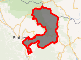
Location of Chiusi della Verna 
| |
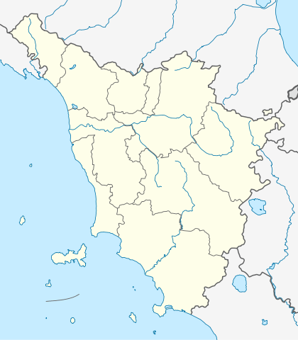
 Chiusi della Verna Location of Chiusi della Verna in Italy  Chiusi della Verna Chiusi della Verna (Tuscany) | |
| Coordinates: 43°42′N 11°56′E | |
| Country | Italy |
| Region | Tuscany |
| Province | Arezzo (AR) |
| Frazioni | La Beccia, La Verna, Biforco, Compito, Corezzo, Corsalone, Dama, Case Nuove, Frassineta, Giampereta, La Rocca, Rimbocchi, Sarna, Val della Meta, Vallebona, Vezzano |
| Government | |
| • Mayor | Umberto Betti |
| Area | |
| • Total | 102.5 km2 (39.6 sq mi) |
| Elevation | 960 m (3,150 ft) |
| Population (Dec. 2004)[2] | |
| • Total | 2,240 |
| • Density | 22/km2 (57/sq mi) |
| Demonym(s) | Chiusini |
| Time zone | UTC+1 (CET) |
| • Summer (DST) | UTC+2 (CEST) |
| Postal code | 52010 |
| Dialing code | 0575 |
| Patron saint | St. Francis |
| Saint day | October 4 |
| Website | Official website |
Big church
Chiusi della Verna borders the following municipalities: Bagno di Romagna, Bibbiena, Caprese Michelangelo, Castel Focognano, Chitignano, Pieve Santo Stefano, Poppi, Subbiano, Verghereto.
In the frazione La Verna is the famous Sanctuary of St. Francis.
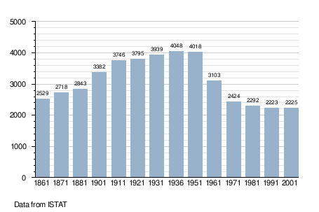
Demographic evolution

Twin towns
gollark: Oh, so two things use SQLite now.
gollark: It has an SQLite database only because I was able to trek through enough of the code to make Markov data go there.
gollark: Actually, no.
gollark: See, this works brilliantly.
gollark: What *is* `linked_chats.json`? I don't get this. What is it storing?
References
- "Superficie di Comuni Province e Regioni italiane al 9 ottobre 2011". Istat. Retrieved 16 March 2019.
- All demographics and other statistics: Italian statistical institute Istat.
| Wikimedia Commons has media related to Chiusi della Verna. |
This article is issued from Wikipedia. The text is licensed under Creative Commons - Attribution - Sharealike. Additional terms may apply for the media files.