Chemmaruthy
Chemmaruthy is a panchayat in Varkala Taluk of Thiruvananthapuram district in the state of Kerala, India. It is 7km east of Varkala city centre and 40km north of state capital Trivandrum. It is also one of the 5 panchayats that shares border with Varkala Municipality.[1]
Chemmaruthy | |
|---|---|
village | |
 Chemmaruthy Location in Kerala, India  Chemmaruthy Chemmaruthy (India) | |
| Coordinates: 8.7597°N 76.7435°E | |
| Country | |
| State | Kerala |
| District | Thiruvananthapuram |
| Talukas | Varkala Taluk |
| Government | |
| • Body | Gram panchayat |
| Area | |
| • Total | 17.54 km2 (6.77 sq mi) |
| Population (2011) | |
| • Total | 32,444 |
| • Density | 1,800/km2 (4,800/sq mi) |
| Languages | |
| • Official | Malayalam, English |
| Time zone | UTC+5:30 (IST) |
| PIN | 695146 |
| Vehicle registration | KL-80 |
Demographics
As of 2011 India census, Chemmaruthy had a population of 32444 with 14468 males and 16450 females.[1]
District HQ: Thiruvananthapuram | |||||||
| History | 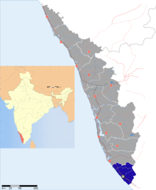 | ||||||
| Geography | |||||||
| Cities and Taluks |
| ||||||
| Transport | |||||||
| Education |
| ||||||
| Buildings | |||||||
| Culture | |||||||
| Lok Sabha constituencies | |||||||
| Sports |
| ||||||
| Museums | |||||||
District HQ: Thiruvananthapuram | |
| Chirayinkeezhu |
|
| Nedumangad | |
| Neyyattinkara |
|
| Thiruvananthapuram | |
gollark: Again: what terminal streaming implementations are there?
gollark: I assume for a big object you'd just figure out the directions for the corners and figure out whether the click was between them?
gollark: I'll just Google it when I actually need to do it.
gollark: I know roughly what it is, I just have no idea how to implement it.
gollark: Probably just needs comments.
References
- "Census of India : Villages with population 5000 & above". Registrar General & Census Commissioner, India. Archived from the original on 8 December 2008. Retrieved 10 December 2008.
This article is issued from Wikipedia. The text is licensed under Creative Commons - Attribution - Sharealike. Additional terms may apply for the media files.