Chaudière-Appalaches
Chaudière-Appalaches (French pronunciation: [ʃodjɛʁ apalaʃ]) is an administrative region in Quebec, Canada. It comprises most of what is historically known as the "Beauce" (French: La Beauce; compare with the electoral district of Beauce). It is named for the Chaudière River and the Appalachian Mountains.
Chaudière-Appalaches | |
|---|---|
Region | |
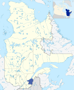 Map of Chaudière-Appalaches within Quebec. | |
| Coordinates: 46°29′N 70°37′W | |
| Country | |
| Province | |
| Government | |
| • Regional conference of elected officers | Maurice Sénécal (President) |
| Area | |
| • Land | 15,083.25 km2 (5,823.68 sq mi) |
| Population (2016)[1] | |
| • Total | 420,082 |
| • Density | 27.9/km2 (72/sq mi) |
| Website | www |
Chaudière-Appalaches has a population of 420,082 residents (as of the Canada 2016 Census) and a land area of 15,083.25 square kilometres (5,823.68 sq mi).[1] The main cities are Lévis, Saint-Georges, Thetford Mines, Sainte-Marie and Montmagny.
Subdivisions
Regional County Municipalities
| Regional County Municipality (RCM) | Population Canada 2016 Census[2] |
Land Area | Density (pop. per km2) |
Seat of RCM |
|---|---|---|---|---|
| Beauce-Sartigan | 52,406 | 1,954.50 km2 (754.64 sq mi) | 26.8 | Saint-Georges |
| Bellechasse | 37,233 | 1,751.06 km2 (676.09 sq mi) | 21.3 | Saint-Lazare-de-Bellechasse |
| La Nouvelle-Beauce | 36,785 | 905.58 km2 (349.65 sq mi) | 40.6 | Sainte-Marie |
| Les Appalaches | 42,346 | 1,912.49 km2 (738.42 sq mi) | 22.1 | Thetford Mines |
| Les Etchemins | 16,536 | 1,810.05 km2 (698.86 sq mi) | 9.1 | Lac-Etchemin |
| L'Islet | 17,798 | 2,100.02 km2 (810.82 sq mi) | 8.5 | Saint-Jean-Port-Joli |
| Lotbinière | 31,741 | 1,662.27 km2 (641.81 sq mi) | 19.1 | Sainte-Croix |
| Montmagny | 22,698 | 1,698.13 km2 (655.65 sq mi) | 13.4 | Montmagny |
| Robert-Cliche | 19,125 | 840.10 km2 (324.36 sq mi) | 22.8 | Beauceville |
Major communities
- Beauceville
- Disraeli
- Laurier-Station
- Lévis
- Montmagny
- Saint-Apollinaire
- Saint-Georges
- Saint-Joseph-de-Beauce
- Sainte-Marie
- Saint-Pamphile
- Thetford Mines
Landmarks
See: List of historic places in Chaudière-Appalaches
gollark: <@!426660245738356738>
gollark: Please don't use mouse_move. PLEASE.
gollark: <@297722510064091140> True. I must note, though, that recent CC versions (1.7 and up maybe?) allow computers to disable booting off disks, but also allows them to be put into disk drives and their files viewed.
gollark: <@297722510064091140> People can run `rom/programs/ls` and `rom/programs/edit` to see the real filesystem quite easily.
gollark: <@236628809158230018> Yes, I do.
References
- "Census Profile, 2016 Census Chaudière-Appalaches [Economic region], Quebec". Statistics Canada. Retrieved November 22, 2019.
- "Population and Dwelling Count Highlight Tables, 2016 Census". Statistics Canada. Retrieved November 26, 2019.
External links
| Wikimedia Commons has media related to Chaudière-Appalaches. |
| Regional county municipalities and equivalent territories | |
|---|---|
| Municipalities |
|
| Subdivisions | |
|---|---|
| Communities | |
| Major cities | |
| Regions | |
Portal:Canada | |
This article is issued from Wikipedia. The text is licensed under Creative Commons - Attribution - Sharealike. Additional terms may apply for the media files.