Cassiar Mountains
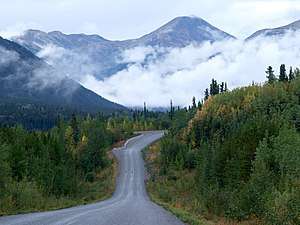
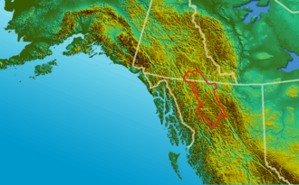
The Cassiar Mountains (French: Chaîne des Cassiars) are the most northerly group of the Northern Interior Mountains in the Canadian province of British Columbia and also extend slightly into the southernmost Yukon Territory. They lie north and west of the Omineca Mountains, west of the northernmost Rockies and the Rocky Mountain Trench, north of the Hazelton Mountains and east of the Boundary Ranges. They form a section of the Continental Divide, that, in this region, separates water drainage between the Arctic and Pacific Oceans. Physiographically, they are a section of the larger Yukon-Tanana Uplands province, which in turn are part of the larger Intermontane Plateaus physiographic division.
| Cassiar Mountains | |
|---|---|
 | |
| Highest point | |
| Peak | Thudaka Peak, British Columbia |
| Elevation | 2,748 m (9,016 ft) |
| Coordinates | 57°55′36.8″N 126°50′53.9″W |
| Geography | |
| Country | Canada |
| Provinces | British Columbia and Yukon |
| Range coordinates | 60°15′N 131°10′W |
| Parent range | Interior Mountains |
In the western Cassiar Mountains lie the remnants of a prehistoric shield volcano called the Maitland Volcano which formed between 5 and 4 million years ago during the Pliocene period.
The highest mountain in the Cassiar Mountains is Thudaka Peak, at 2,748 m (9,016 ft).[1]
Sub-ranges and major summits

References
- "Thudaka Peak". Bivouac.com.
- "Cassiar Mountains". BC Geographical Names.
- Holland, S. (1976). Landforms of British Columbia. Province of British Columbia.
