Carville Historic District
The Carville Historic District in Carville, Louisiana, is a 60-acre (24 ha) historic district that was listed on the National Register of Historic Places on November 18, 1992.[1]
Carville Historic District | |
  | |
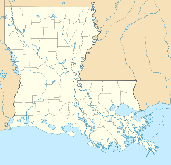
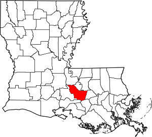
| Location | 5445 Point Clair Road, Carville, Louisiana |
|---|---|
| Coordinates | 30°11′52″N 91°07′37″W |
| Area | 60 acres (24 ha) |
| Built | 1859, 1939-1941 |
| Architect | Neill P. Thompson; Henry Howard |
| Architectural style | Classical Revival, Italianate |
| NRHP reference No. | 92001529[1] |
| Added to NRHP | November 18, 1992 |
It is also known as the Gillis W. Long Hansen's Disease Center and as Public Health Service Hospital No. 66 and served as a treatment facility for leprosy. In 1992 the district included 24 contributing buildings and two contributing structures, most built during 1939-1941 with architect/builder Neill P. Thompson.[2][3]
The "anchor" for the Carville Historic District is the Indian Camp Plantation House, the antebellum main house of a sugar plantation which is the only surviving building from the plantation. It was
designed and built by New Orleans architect Henry Howard (and perhaps his partner Albert Diettel) in 1859 for sugar planter Robert C. Camp. It is a raised stucco over brick transitional Greek Revival Italianate mansion featuring a central mass with a hexastyle double gallery and flanking two story wings. Fluted Corinthian columns over heavily rusticated pillars support the gallery. Column capitals are correctly fashioned from double rows of acanthus leaf carvings with volutess or scrolls springing from the centers. Rather thin, molded and decorated abacus blocks supply the transition from columns to architrave. / The facade is well detailed with Italianate features, including rows of brackets, segmental openings, and panels. Above the gallery is a busy entablature with a bracketed, dentiled frieze under a projecting cornice and a segmented, paneled parapet. The bracket and dentil motif of the principal frieze continues around the returning entablature to terminate at the juncture of the house and gallery, only to reappear in a modified form of elongated brackets spaced across the wings, down the sides, and onto the rear. Meanwhile, the square, post and lintel fenestration of the central block contrasts with segmental openings in the wings. These features, together with the deep rustication of the central pillars and the heavy cast-iron gallery railings, impart a heavy sculptural quality to the facade. From every angle, front and rear, a certain dynamism emerges from broken up surfaces and contrasting motifs.[2][3]
Contributing properties
The historical district contains a total of 26 contributing properties, built between 1859 and 1941:
- 1939-1941 buildings. This entry comprises several buildings:
- North and South Quadrangles of patient quarters 30°11′59″N 91°07′34″W and 30°11′54″N 91°07′28″W
- Laundry 30°11′52″N 91°07′32″W
- Sisters of Charity Quarters 30°11′47″N 91°07′32″W
- Medical Records Building 30°11′48″N 91°07′34″W.
- Old Dining Hall/Cafeteria, 30°11′56″N 91°07′31″W. Built 1923.
- Infirmary, 30°11′55″N 91°07′34″W. Built 1934.
- Protestant Chapel, 30°11′48″N 91°07′29″W. Built 1934.
- Catholic Chapel, 30°11′49″N 91°07′31″W. Built 1924.
- Isolation Building, 30°11′57″N 91°07′37″W. Built 1936.
- Power Plant, 30°11′52″N 91°07′31″W. Built 1924.
- Water Treatment Facility, 30°11′50″N 91°07′35″W.
- Greenhouse, 30°11′50″N 91°07′30″W.
- Greenhouse/Supply House, 30°11′46″N 91°07′34″W.
- Indian Camp Plantation House, 30°11′45″N 91°07′33″W. Built 1859.
- Gatehouse, 30°11′44″N 91°07′34″W.
- Training Building, 30°11′48″N 91°07′42″W.
- Unstyled Building #1, 30°11′50″N 91°07′38″W.
- Unstyled Building #2, 30°11′51″N 91°07′33″W.
- Staff Quarters #1, 30°11′44″N 91°07′36″W. Built between 1920s and 1930s.
- Staff Quarters #2, 30°11′42″N 91°07′38″W. Built between 1920s and 1930s.
- Staff Quarters #3, 30°11′41″N 91°07′40″W. Built between 1920s and 1930s.
- Staff Quarters #4, 30°11′40″N 91°07′41″W. Built between 1920s and 1930s.
- Staff Quarters #5, 30°11′39″N 91°07′43″W. Built between 1920s and 1930s.
- Staff Quarters #6, 30°11′47″N 91°07′38″W. Built between 1920s and 1930s.
- Staff Quarters #7, 30°11′45″N 91°07′40″W. Built between 1920s and 1930s.
- Staff Quarters #8, 30°11′44″N 91°07′42″W. Built between 1920s and 1930s.
- Staff Quarters #9, 30°11′43″N 91°07′44″W. Built between 1920s and 1930s.
- Staff Quarters #10, 30°11′42″N 91°07′45″W. Built between 1920s and 1930s.
- Garage, 30°11′40″N 91°07′43″W. Built between 1920s and 1930s.
References
- "National Register Information System". National Register of Historic Places. National Park Service. November 2, 2013.
- "Carville Historic District / Gillis W. Long Hansen's Disease Center / Public Health Service hospital #66" (PDF). State of Louisiana's Division of Historic Preservation. Archived from the original (PDF) on March 29, 2017. Retrieved March 28, 2017. with four photos and two maps Archived 2017-03-29 at the Wayback Machine
- William D. Reeves, Sally K. Reeves (July 1991). "National Register of Historic Places Registration Form: Carville Historic District". National Park Service. Retrieved June 19, 2018. With 28 photos from 1992.


