Cape Ray
Cape Ray is a headland located at the southwestern extremity of the island of Newfoundland in the Canadian province of Newfoundland and Labrador. It is the site of the Cape Ray Lighthouse.
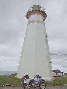 Cape Ray Lighthouse | |
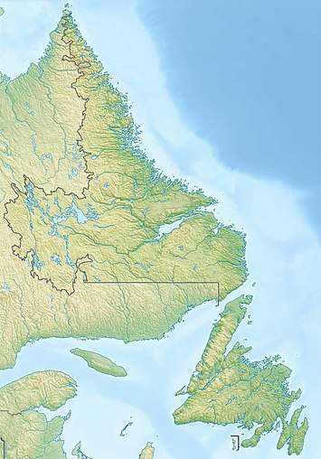 Location of Cape Ray in Newfoundland | |
| |
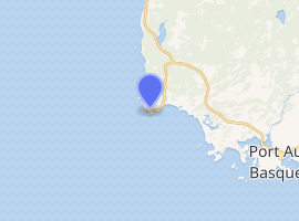
| Location | Cape Ray Newfoundland Canada |
|---|---|
| Coordinates | 47°37′16.1″N 59°18′14.2″W |
| Year first constructed | 1871 (first) 1885 (second) |
| Year first lit | 1959 (current) |
| Deactivated | 1885 (first) 1959 (second) |
| Foundation | concrete base |
| Construction | wooden tower (first and second) concrete tower (current) |
| Tower shape | hexagonal tower (first) octagonal tower with balcony and lantern (second and current) |
| Markings / pattern | white tower with a narrow red horizontal band |
| Tower height | 15 metres (49 ft) |
| Focal height | 37 metres (121 ft) |
| Range | 17 nautical miles (31 km; 20 mi) |
| Characteristic | Fl W 15s. |
| Admiralty number | H0220 |
| CHS number | CCG 173 |
| NGA number | 2492 |
| ARLHS number | CAN-645 |
| Managing agent | South West Coast Development Association[1][2] |
It is located opposite Cape North on Cape Breton Island, Nova Scotia. Cape Ray the community takes its name from this historic landmark.
See also
References
- Central and Western Newfoundland The Lighthouse Directory. University of North Carolina at Chapel Hill. Retrieved 11 February 2017
- List of Lights, Pub. 110: Greenland, The East Coasts of North and South America (Excluding Continental U.S.A. Except the East Coast of Florida) and the West Indies (PDF). List of Lights. United States National Geospatial-Intelligence Agency. 2016.
External links
- Cape Ray Lighthouse
- Aids to Navigation Canadian Coast Guard
| Wikimedia Commons has media related to Cape Ray. |
This article is issued from Wikipedia. The text is licensed under Creative Commons - Attribution - Sharealike. Additional terms may apply for the media files.