Cane Hill Township, Washington County, Arkansas
Cane Hill Township is one of 37 townships in Washington County, Arkansas, USA.[2] As of the 2010 census, its unincorporated population was 1,530.
Township of Cane Hill | |
|---|---|
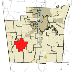 Cane Hill Township in Washington County, Arkansas | |
| Coordinates: 35°54′00″N 94°24′11″W | |
| Country | |
| State | |
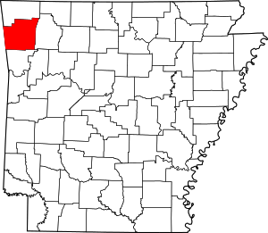
| County | Washington |
| Established | 1829[1] |
| Area | |
| • Total | 34.56 sq mi (89.5 km2) |
| • Land | 34.36 sq mi (89.0 km2) |
| • Water | 0.2 sq mi (0.5 km2) |
| Elevation | 1,309 ft (399 m) |
| Population (2010) | |
| • Total | 1,530 |
| • Density | 44.5/sq mi (17.2/km2) |
| Time zone | UTC-6 (CST) |
| • Summer (DST) | UTC-5 (CDT) |
| Area code(s) | 479 |
| GNIS feature ID | 69781 |
| U.S. Geological Survey Geographic Names Information System: Cane Hill Township, Washington County, Arkansas | |
Geography
According to the United States Census Bureau, Cane Hill Township covers an area of 34.36 square miles (89.0 km2) of land and 0.2 square miles (0.52 km2) of water for 34.56 square miles (89.5 km2) in total area.[2]
Cemeteries
The township contains eight cemeteries: Canehill, Cox, Kidd, McClellan, New Hope, Reese, Russell, and Yates.
Major routes
gollark: Well, that too.
gollark: Don't tell yemmel.
gollark: Quark is the fancy name for a new duping bug.
gollark: Fix your end base, pjals.
gollark: \🌵
References
- United States Census Bureau 2008 TIGER/Line Shapefiles
- United States Board on Geographic Names (GNIS)
- United States National Atlas
- Baker, Russell (2003). Arkansas Township Atlas 1819-1930. Little Rock, AR: Arkansas Genealogical Society. p. 148. ISBN 0-9723085-6-3.
- "Township of Cane Hill, Washington County, Arkansas." U.S. Census Bureau. Breakdown. Retrieved September 14, 2010.
External links
Places adjacent to Cane Hill Township, Washington County, Arkansas | ||||||||||
|---|---|---|---|---|---|---|---|---|---|---|
| ||||||||||
This article is issued from Wikipedia. The text is licensed under Creative Commons - Attribution - Sharealike. Additional terms may apply for the media files.