Caira County

Caira County is one of the 141 Cadastral divisions of New South Wales. It contains the city of Balranald. It is located between where the Murrumbidgee River joins the Murray River to where the Lachlan River joins the Murrumbidgee, containing much of the western Lowbidgee Floodplain. The name "Caira" is believed to derive from a local Aboriginal word.[1]

Caira
New South Wales
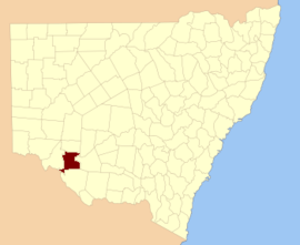
Location in New South Wales
Lands administrative divisions around Caira:
Taila County Kilfera County Waljeers County
Taila County Caira Waradgery County
Tatchera (Vic) Wakool County Wakool County

Parishes within this county

A full list of parishes found within this county; their current LGA and mapping coordinates to the approximate centre of each location is as follows:

ParishLGACoordinates
BahpungaHay Shire34°34′54″S 144°09′04″E
BallahBalranald Shire34°20′27″S 143°31′36″E
BalranaldBalranald Shire34°36′35″S 143°34′57″E
BelaimongBalranald Shire34°09′04″S 143°50′33″E
BelarMurray River Council34°43′54″S 143°40′04″E
BenongalBalranald Shire34°43′54″S 143°31′04″E
BiduraBalranald Shire34°08′05″S 143°19′47″E
BluffHay Shire34°42′54″S 144°04′04″E
BoocathanBalranald Shire34°08′41″S 144°01′57″E
BudgerieBalranald Shire34°12′09″S 143°27′10″E
BunumburtBalranald Shire34°11′27″S 143°54′19″E
ChadwickBalranald Shire34°43′54″S 143°30′04″E
ChadwickBalranald Shire34°45′44″S 143°29′56″E
ChillichillBalranald Shire34°07′24″S 143°55′10″E
CooncoonburraBalranald Shire34°21′33″S 143°39′47″E
CrokeeBalranald Shire34°26′40″S 143°24′26″E
DavyBalranald Shire34°13′17″S 143°43′45″E
DerinumHay Shire34°28′54″S 144°14′04″E
FisherMurray River Council34°44′02″S 143°50′30″E
GanawayBalranald Shire34°18′11″S 143°36′59″E
GerakiBalranald Shire34°14′55″S 143°33′11″E
Glen EmuBalranald Shire34°11′44″S 143°36′43″E
ImpimiMurray River Council34°43′54″S 143°45′04″E
JeralyHay Shire34°39′54″S 144°05′04″E
JippayBalranald Shire34°13′35″S 143°49′31″E
JuanbungBalranald Shire
KerrishBalranald Shire34°17′10″S 143°43′37″E
KiaMurray River Council34°40′54″S 143°45′04″E
KieetaMurray River Council34°35′54″S 143°41′04″E
KingiBalranald Shire34°37′13″S 143°28′42″E
LawrenceBalranald Shire34°31′28″S 143°27′17″E
LincolnHay Shire34°37′08″S 144°02′07″E
LoocalleBalranald Shire34°30′37″S 143°16′39″E
LooricaMurray River Council34°28′54″S 143°52′04″E
MacphersonBalranald Shire34°15′00″S 143°17′40″E
MamangaBalranald Shire34°43′01″S 143°33′15″E
MaremleyBalranald Shire34°24′59″S 143°40′59″E
MevnaBalranald Shire34°38′21″S 143°22′45″E
MonkemMurray River Council34°23′54″S 143°46′04″E
MonkemMurray River Council34°25′33″S 143°47′39″E
MorrisMurray River Council34°37′54″S 143°47′04″E
MuckeeBalranald Shire34°27′20″S 143°30′57″E
Nap NapMurray River Council34°20′54″S 143°52′04″E
NarahquongBalranald Shire34°21′33″S 143°47′33″E
NicholsonHay Shire34°33′54″S 144°14′04″E
NimmingHay Shire34°27′54″S 144°09′04″E
NullawongBalranald Shire34°04′26″S 143°36′14″E
PaikaBalranald Shire34°31′03″S 143°37′34″E
ParkerMurray River Council34°40′54″S 143°50′04″E
ParkerMurray River Council34°40′20″S 143°50′41″E
PenarieBalranald Shire34°25′23″S 143°35′10″E
PitarpungaBalranald Shire34°19′47″S 143°25′06″E
PollenHay Shire34°30′38″S 144°02′18″E
PungmalleeHay Shire34°26′23″S 144°05′15″E
PyboleeHay Shire34°27′54″S 143°56′04″E
QuianderryBalranald Shire34°16′42″S 143°59′23″E
RonaldBalranald Shire34°26′30″S 143°16′51″E
RookeryHay Shire34°38′54″S 144°10′04″E
RussellHay Shire34°37′54″S 144°13′04″E
St PaulsHay Shire34°41′54″S 144°09′04″E
TalaMurray River Council34°34′54″S 143°47′04″E
TalpeeMurray River Council34°27′54″S 143°42′04″E
TararieBalranald Shire34°51′05″S 143°25′30″E
TelfordHay Shire34°39′43″S 143°59′22″E
The OaksHay Shire34°42′54″S 144°13′04″E
The WillowsMurray River Council34°41′54″S 143°56′04″E
TintinBalranald Shire34°17′24″S 143°25′29″E
ToorongBalranald Shire34°13′23″S 144°00′58″E
TuyerunbyHay Shire34°23′54″S 143°56′04″E
TysonBalranald Shire34°18′48″S 143°53′42″E
WaldairaBalranald Shire34°40′33″S 143°17′57″E
WaugorahMurray River Council34°25′54″S 143°52′04″E
WeimbyBalranald Shire34°44′01″S 143°16′10″E
WilliamsonMurray River Council34°35′54″S 143°53′04″E
WilpeeMurray River Council34°27′54″S 143°46′04″E
WindomalBalranald Shire34°43′41″S 143°22′26″E
WombahMurray River Council34°46′34″S 143°34′34″E
YangaMurray River Council34°40′54″S 143°40′04″E
YarringtonBalranald Shire34°34′16″S 143°32′38″E
YarrowalBalranald Shire34°27′37″S 143°40′14″E
YoughBalranald Shire34°06′39″S 143°45′26″E
gollark: Just don't do doubly linked lists.
gollark: Due to the ownership rules, though, it can know when a thing has nothing pointing to it and deallocate it without GCing.
gollark: Data structures allocate heap space internally.
gollark: Rust is pretty good for GCing, since it doesn't have a GC.
gollark: Rust is better than Go, you see.

References

  1. "Caira". Geographical Names Register (GNR) of NSW. Geographical Names Board of New South Wales. Retrieved 3 August 2013.
This article is issued from Wikipedia. The text is licensed under Creative Commons - Attribution - Sharealike. Additional terms may apply for the media files.