Bushnell, Florida
Bushnell is a city in Sumter County, Florida, United States. The population was 2,418 at the 2010 census. According to the U.S Census estimates of 2018, the city had a population of 3,119.[5]
Bushnell, Florida | |
|---|---|
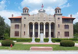
 Old Sumter County Courthouse | |
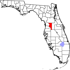
 Location in Sumter County and the state of Florida | |
| Coordinates: 28°39′54″N 82°06′46″W[1] | |
| Country | United States |
| State | Florida |
| County | Sumter |
| Government | |
| • Temporary Mayor | Bil Durham |
| Area | |
| • Total | 11.97 sq mi (31.00 km2) |
| • Land | 11.68 sq mi (30.26 km2) |
| • Water | 0.29 sq mi (0.74 km2) |
| Elevation | 75 ft (23 m) |
| Population (2010) | |
| • Total | 2,418 |
| • Estimate (2019)[3] | 3,183 |
| • Density | 272.47/sq mi (105.21/km2) |
| Time zone | UTC-5 (Eastern (EST)) |
| • Summer (DST) | UTC-4 (EDT) |
| ZIP code | 33513 |
| Area code(s) | 352 |
| FIPS code | 12-09625[4] |
| Website | cityofbushnellfl |
History
A post office called Bushnell has been in operation since 1885.[6] The City of Bushnell was named after John W. Bushnell, who was responsible for bringing the railroad to the community.[7]
Geography
Bushnell is located in west central Sumter County.
Transportation
The main roads through Bushnell include US 301 which runs north and south through the city. County Road 48 (SR 48 until 2016) and County Road 476 run east and west, and have short concurrency with US 301, as well as each other.
Interstate 75 runs along the western edge of Bushnell with Exit 314 leading to Sumter CR 314. County Road 475 begins at CR 48 and runs the CSX Wildwood Subdivision, which carried Amtrak's Palmetto until 2004.[8] The Wildwood Subdivision runs along US 301 from north of the Hernando-Sumter County Line, to Bushnell until Route 301 turns onto East Noble Avenue. From there it runs along the east side of CR 48 until that route turns west onto West Belt Avenue, then follows the east side of CR 475 until its terminus at Exit 321 on I-75 at CR 470 in Lake Panasoffkee.
Demographics
| Historical population | |||
|---|---|---|---|
| Census | Pop. | %± | |
| 1920 | 400 | — | |
| 1930 | 591 | 47.8% | |
| 1940 | 676 | 14.4% | |
| 1950 | 536 | −20.7% | |
| 1960 | 644 | 20.1% | |
| 1970 | 700 | 8.7% | |
| 1980 | 983 | 40.4% | |
| 1990 | 1,998 | 103.3% | |
| 2000 | 2,050 | 2.6% | |
| 2010 | 2,418 | 18.0% | |
| Est. 2019 | 3,183 | [3] | 31.6% |
| U.S. Decennial Census[9] | |||
At the 2000 census there were 2,050 people in 830 households, including 538 families, in the city. The population density was 871.7 inhabitants per square mile (336.8/km2). There were 1,004 housing units at an average density of 426.9 per square mile (165.0/km2). The racial makeup of the city was 83.37% White, 12.98% African American, 0.34% Native American, 0.73% Asian, 1.27% from other races, and 1.32% from two or more races. Hispanic or Latino of any race were 3.56%.[4]
Of the 830 households 25.4% had children under the age of 18 living with them, 49.4% were married couples living together, 12.4% had a female householder with no husband present, and 35.1% were non-families. 31.2% of households were one person and 17.7% were one person aged 65 or older. The average household size was 2.25 and the average family size was 2.79.
The age distribution was 20.6% under the age of 18, 8.8% from 18 to 24, 23.3% from 25 to 44, 21.5% from 45 to 64, and 25.8% 65 or older. The median age was 43 years. For every 100 females, there were 90.2 males. For every 100 females age 18 and over, there were 85.4 males.
The median household income was $26,676 and the median family income was $34,063. Males had a median income of $27,986 versus $23,125 for females. The per capita income for the city was $14,737. About 11.0% of families and 14.7% of the population were below the poverty line, including 17.5% of those under age 18 and 13.4% of those age 65 or over.
Government and infrastructure
Sumter County operates Bushnell Annex in Room 201 at 910 North Main Street.[10]
Sumter District Schools headquarters and South Sumter High School are located in Bushnell.
References
- "2019 U.S. Gazetteer Files". United States Census Bureau. Retrieved July 2, 2020.
- "Population and Housing Unit Estimates". United States Census Bureau. May 24, 2020. Retrieved May 27, 2020.
- "U.S. Census website". United States Census Bureau. Retrieved 2008-01-31.
- "Population and Housing Unit Estimates". Retrieved June 4, 2019.
- "County". Jim Forte Postal History. Missing or empty
|url=(help) - Blackstone, Lillian (Mar 23, 1952). "Into center of state". St. Petersburg Times. p. 19. Retrieved 1 November 2015.
- Map of Sumter County, 1932 (University of South Florida)
- "Census of Population and Housing". Census.gov. Retrieved June 4, 2015.
- "Support Services Archived 2008-12-25 at the Wayback Machine." Sumter County, Florida. Retrieved on December 11, 2008.
External links
| Wikimedia Commons has media related to Bushnell, Florida. |
- Bushnell City Website
- Bushnell History (Sumter Today)
