Buninga
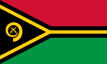
Buninga Island is an inhabited island in Shefa Province of Vanuatu in the Pacific Ocean. The island is a part of Shepherd Islands archipelago.[1][2]
| Geography | |
|---|---|
| Location | Pacific Ocean |
| Coordinates | 17°2′S 168°35′E |
| Archipelago | Vanuatu |
| Highest elevation | 209 m (686 ft) |
| Administration | |
| Province | Shefa Province |
| Demographics | |
| Population | 112 (2015) |
Geography
Buninga Island lies 2 km south-west of Tongariki Island. The island is 1.5 km in diameter.[3] The estimated terrain elevation above the sea level is some 209 metres.[4]
Population
As of 2015, the official local population was 112 people in 23 households.[5]
gollark: Also, is this sending the entire screen pixel-by-pixel on update?
gollark: Is the v2.3 code this presumably uses as a backend available on a branch somewhere?
gollark: <@205756960249741312> Mind publishing the code or whatever for this? This would probably be substantially easier than trying to make my current canvas rendering code actually work.
gollark: How about it provides *one* advanced computer feature at a time but which one it is is randomly determined every bootup?
gollark: <@565075471012855820> What would "iron computers" do? Where do they fit between normal and advanced ones?
References
- "Buninga: Vanuatu". Geographic Names. Retrieved 9 August 2018.
- "Shepherd Islands". Vanuatu Travel. Retrieved 9 August 2018.
- "Shepherd group of islands". Vanuatu Islands Travel Info. Retrieved 9 August 2018.
- "Buninga Island". Mapcarta. Retrieved 9 August 2018.
- "2015 Vanuatu National Population and Households Projections by Province and Islands" (PDF). Vanuatu National Statistics Office. Retrieved 9 August 2018.
This article is issued from Wikipedia. The text is licensed under Creative Commons - Attribution - Sharealike. Additional terms may apply for the media files.
