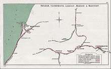
Bridgefoot railway station
Bridgefoot railway station was built by the Whitehaven, Cleator and Egremont Railway. It served the village of Bridgefoot, Cumbria, England.[3][4]
| Bridgefoot | |
|---|---|
 Site of station in 1961 | |
| Location | |
| Place | Bridgefoot |
| Area | Allerdale |
| Coordinates | 54.6503°N 3.4623°W |
| Grid reference | NY057293 |
| Operations | |
| Original company | Whitehaven, Cleator and Egremont Railway |
| Pre-grouping | LNWR & FR Joint Railway |
| Post-grouping | London, Midland and Scottish Railway |
| Platforms | 2[1] |
| History | |
| 2 April 1866 | Opened |
| 13 April 1931 | Closed[2] |
| Disused railway stations in the United Kingdom | |
| Closed railway stations in Britain A B C D–F G H–J K–L M–O P–R S T–V W–Z | |

| Whitehaven, Cleator & Egremont Railway | ||||||||||||||||||||||||||||||||||||||||||||||||||||||||||||||||||||||||||||||||||||||||||||||||||||||||||||||||||||||||||||||||||||||||||||||||||||||||||||||||||||||||||||||||||||||||||||||||||||||||||||||||||||||||||||||||||||||||||||||||||||||||||||||||||
|---|---|---|---|---|---|---|---|---|---|---|---|---|---|---|---|---|---|---|---|---|---|---|---|---|---|---|---|---|---|---|---|---|---|---|---|---|---|---|---|---|---|---|---|---|---|---|---|---|---|---|---|---|---|---|---|---|---|---|---|---|---|---|---|---|---|---|---|---|---|---|---|---|---|---|---|---|---|---|---|---|---|---|---|---|---|---|---|---|---|---|---|---|---|---|---|---|---|---|---|---|---|---|---|---|---|---|---|---|---|---|---|---|---|---|---|---|---|---|---|---|---|---|---|---|---|---|---|---|---|---|---|---|---|---|---|---|---|---|---|---|---|---|---|---|---|---|---|---|---|---|---|---|---|---|---|---|---|---|---|---|---|---|---|---|---|---|---|---|---|---|---|---|---|---|---|---|---|---|---|---|---|---|---|---|---|---|---|---|---|---|---|---|---|---|---|---|---|---|---|---|---|---|---|---|---|---|---|---|---|---|---|---|---|---|---|---|---|---|---|---|---|---|---|---|---|---|---|---|---|---|---|---|---|---|---|---|---|---|---|---|---|---|---|---|---|---|---|---|---|---|---|---|---|---|---|---|---|---|
| ||||||||||||||||||||||||||||||||||||||||||||||||||||||||||||||||||||||||||||||||||||||||||||||||||||||||||||||||||||||||||||||||||||||||||||||||||||||||||||||||||||||||||||||||||||||||||||||||||||||||||||||||||||||||||||||||||||||||||||||||||||||||||||||||||
History
The station opened on 2 April 1866. The owning company was taken over by the LNWR and Furness Railway in 1879 as a Joint Line, whereafter the northern section through Bridgefoot was usually worked by the LNWR.[5]
Passenger traffic consisted of three trains a day in each direction, with an extra on Whitehaven market day and none on Sundays.[6] From opening, northbound passenger trains terminated at Marron Junction station where passengers changed for destinations beyond. In 1897 Marron Junction station closed, with trains running west through to Workington Main thereafter, a much better arrangement for most passengers. Passengers who would otherwise have changed at Marron Junction to head east to Brigham or beyond simply changed at the first stop after Marron Junction - Camerton.
Goods traffic typically consisted of a two daily turns Up and Down.
Mineral traffic was the dominant flow, typically six loaded and six empty through to Workington, though this was subject to considerable fluctuation with trade cycles. Stations and signalling along the line north of Rowrah were changed during the Joint regime to conform to LNWR standards.[7][8]
The station closed on 13 April 1931 when normal passenger traffic ended along the line. Goods trains continued to pass through the station until 1954.[9] An enthusiasts' special ran through on 5 September 1954. After scant occasional use the line was abandoned in 1960 and subsequently lifted.
Afterlife
In 2013 the course of the line through the village was clear to see and the trackbed to the south had been made into a public footpath.
| Preceding station | Disused railways | Following station | ||
|---|---|---|---|---|
| Marron Junction Line and station closed |
Whitehaven, Cleator and Egremont Railway | Branthwaite Line and station closed |
References
- Suggitt 2008, p. 58.
- Butt 1995, p. 43.
- Smith & Turner 2012, Map 26.
- Jowett 1989, Map 36.
- McGowan Gradon 2004, p. 12.
- Bradshaw 1985, p. 510.
- "W McGowan Gradon's 1942 Furness Railway study, via cumberlandarchives.co.uk". Archived from the original on 26 January 2016. Retrieved 6 January 2016.
- Atterbury 2009, p. 207.
- Marshall 1981, p. 163.
Sources
- Atterbury, Paul (2009). Along Lost Lines. Newton Abbot: David and Charles. ISBN 978-0-7153-2706-7.CS1 maint: ref=harv (link)
- Bradshaw, George (1985) [July 1922]. Bradshaw's General Railway and Steam Navigation guide for Great Britain and Ireland: A reprint of the July 1922 issue. Newton Abbot: David and Charles. ISBN 978-0-7153-8708-5. OCLC 12500436.
- Butt, R. V. J. (1995). The Directory of Railway Stations: details every public and private passenger station, halt, platform and stopping place, past and present (1st ed.). Sparkford: Patrick Stephens Ltd. ISBN 978-1-85260-508-7. OCLC 60251199.
- Jowett, Alan (March 1989). Jowett's Railway Atlas of Great Britain and Ireland: From Pre-Grouping to the Present Day (1st ed.). Sparkford: Patrick Stephens Ltd. ISBN 978-1-85260-086-0. OCLC 22311137.
- Marshall, John (1981). Forgotten Railways: North West England. Newton Abbot: David and Charles. ISBN 978-0-7153-8003-1.CS1 maint: ref=harv (link)
- Smith, Paul; Turner, Keith (2012). Railway Atlas Then and Now. Shepperton: Ian Allan Publishing. ISBN 978-0-7110-3695-6.CS1 maint: ref=harv (link)
- Suggitt, Gordon (2008). Lost Railways of Cumbria (Railway Series). Newbury: Countryside Books. ISBN 978-1-84674-107-4.CS1 maint: ref=harv (link)
Further reading
- Anderson, Paul (April 2002). Hawkins, Chris (ed.). "Dog in the Manger? The Track of the Ironmasters". British Railways Illustrated. Clophill: Irwell Press Ltd. 11 (7). ISSN 0961-8244.CS1 maint: ref=harv (link)
- Bairstow, Martin (April 1995). Railways In The Lake District. Martin Bairstow. ISBN 978-1-871944-11-2.CS1 maint: ref=harv (link)
- Conolly, W Philip (1998). British railways pre-grouping atlas and gazetteer (9th impression; 5th ed.). Shepperton: Ian Allan. ISBN 978-0-7110-0320-0. OCLC 221481275.
- Joy, David (December 1983). Lake Counties (Regional History of the Railways of Great Britain, Volume 14). Newton Abbot: David and Charles. ISBN 978-0-946537-02-0.CS1 maint: ref=harv (link)
- McGowan Gradon, William (2004) [1952]. The Track of the Ironmasters: A History of the Cleator and Workington Junction Railway. Grange-over-Sands: Cumbrian Railways Association. ISBN 978-0-9540232-2-5.CS1 maint: ref=harv (link)
- Marsh, John; Garbutt, John (April 2002). Images of Cumbrian Railways. Sutton Publishing Ltd. ISBN 978-0-7509-2834-2.CS1 maint: ref=harv (link)
- Welbourn, Nigel (September 2010). Lost Lines: Joint Railways. Shepperton: Ian Allan Publishing. ISBN 978-0-7110-3428-0.CS1 maint: ref=harv (link)
- Western, Robert (2001). The Cockermouth, Keswick and Penrith Railway. Usk: Oakwood Press. ISBN 978-0-85361-564-4. OL113.CS1 maint: ref=harv (link)
External links
- Map of the line with photos in RAILSCOT
- The station on overlain OS maps surveyed from 1898 in National Library of Scotland
- The closed station on a 1948 OS Map in npe maps
- The station in Rail Map Online
- The railways of Cumbria in Cumbrian Railways Association
- Photos of Cumbrian railways in Cumbrian Railways Association
- The railways of Cumbria in Railways of Cumbria
- Cumbrian Industrial History in Cumbria Industrial History Society
- The line's and station's Engineer's Line References in Railway Codes
- Furness Railtour using many West Cumberland lines 5 September 1954 in Six Bells Junction
- A video tour-de-force of the region's closed lines in Cumbria Film Archive