Brady Township, Lycoming County, Pennsylvania
Brady Township is a township in Lycoming County, Pennsylvania, United States. The population was 494 at the 2000 census. It is part of the Williamsport, Pennsylvania Metropolitan Statistical Area.
Brady Township, Lycoming County, Pennsylvania | |
|---|---|
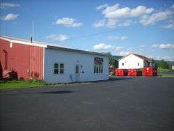 Township municipal building | |
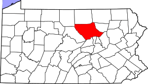
 Map of Lycoming County, Pennsylvania highlighting Brady Township | |
 Map of Lycoming County, Pennsylvania | |
| Coordinates: 41°10′26″N 76°56′39″W | |
| Country | United States |
| State | Pennsylvania |
| County | Lycoming |
| Settled | 1790 |
| Formed | 1855 |
| Area | |
| • Total | 9.05 sq mi (23.45 km2) |
| • Land | 8.84 sq mi (22.90 km2) |
| • Water | 0.21 sq mi (0.54 km2) |
| Elevation | 659 ft (201 m) |
| Population (2010) | |
| • Total | 521 |
| • Estimate (2016)[2] | 536 |
| • Density | 60.62/sq mi (23.40/km2) |
| Time zone | UTC-5 (Eastern Time Zone (North America)) |
| • Summer (DST) | UTC-4 (EDT) |
| ZIP code | 17752 |
| Area code(s) | 570 |
| FIPS code | 42-081-08136 |
| GNIS feature ID | 1216741[3] |
History
Brady Township was formed from Washington Township on January 31, 1855. It was named for the Brady family, several of whom lived within its limits. Until 1861, Brady Township also included what is now Gregg Township, Union County.[4]
One of the most prominent early residents of Brady Township was Judge William Piatt. Piatt was born and raised in the area that is now Brady Township. His father, John Piatt, moved to the southern part of Lycoming County from New Jersey and established a tannery. William was born on January 29, 1795 and followed his father into the tannery business. He soon took an interest in the local political scene and was elected to the Pennsylvania General Assembly in 1830. He served as a legislator for three terms. Piatt became an associate judge in 1855. Piatt also served Lycoming County and Brady Township as a county auditor and as a president of both a turnpike and a bridge company.[4]
Geography
Brady Township borders Clinton Township to the east, the West Branch Susquehanna River on the southeast, Union County to the southwest, Washington Township to the west, and Armstrong Township to the northwest. As the crow flies, Lycoming County is about 130 miles (209 km) northwest of Philadelphia and 165 miles (266 km) east-northeast of Pittsburgh.[5]
According to the United States Census Bureau, the township has a total area of 8.6 square miles (22 km2), all of it land. It is the location of the Lycoming County Landfill and the northern part of the Federal Correctional Institute, Allenwood.
Demographics
| Historical population | |||
|---|---|---|---|
| Census | Pop. | %± | |
| 2010 | 521 | — | |
| Est. 2016 | 536 | [2] | 2.9% |
| U.S. Decennial Census[6] | |||
As of the census[7] of 2000, there were 494 people, 177 households, and 149 families residing in the township. The population density was 57.2 people per square mile (22.1/km2). There were 186 housing units at an average density of 21.6/sq mi (8.3/km2). The racial makeup of the township was 99.80% White, and 0.20% from two or more races. Hispanic or Latino of any race were 0.20% of the population.
There were 177 households, out of which 31.6% had children under the age of 18 living with them, 73.4% were married couples living together, 5.1% had a female householder with no husband present, and 15.8% were non-families. 11.9% of all households were made up of individuals, and 5.6% had someone living alone who was 65 years of age or older. The average household size was 2.79 and the average family size was 2.96.
In the township the population was spread out, with 24.5% under the age of 18, 5.9% from 18 to 24, 30.2% from 25 to 44, 28.5% from 45 to 64, and 10.9% who were 65 years of age or older. The median age was 40 years. For every 100 females there were 114.8 males. For every 100 females age 18 and over, there were 103.8 males.
The median income for a household in the township was $43,958, and the median income for a family was $45,313. Males had a median income of $30,294 versus $24,531 for females. The per capita income for the township was $17,789. About 2.9% of families and 6.7% of the population were below the poverty line, including 7.3% of those under age 18 and 14.3% of those age 65 or over.
See also
References
- "2016 U.S. Gazetteer Files". United States Census Bureau. Retrieved Aug 14, 2017.
- "Population and Housing Unit Estimates". Retrieved June 9, 2017.
- "US Board on Geographic Names". United States Geological Survey. 2007-10-25. Retrieved 2008-01-31.
- Meginness, John Franklin (1892). "Washington, Clinton, Armstrong, and Brady". History of Lycoming County, Pennsylvania: including its aboriginal history; the colonial and revolutionary periods; early settlement and subsequent growth; organization and civil administration; the legal and medical professions; internal improvement; past and present history of Williamsport; manufacturing and lumber interests; religious, educational, and social development; geology and agriculture; military record; sketches of boroughs, townships, and villages; portraits and biographies of pioneers and representative citizens, etc. etc (1st ed.). Chicago: Brown, Runk & Co. ISBN 0-7884-0428-8. Retrieved 2007-02-20.
(Note: ISBN refers to Heritage Books July 1996 reprint. URL is to a scan of the 1892 version with some OCR typos).
- "2007 General Highway Map Lycoming County Pennsylvania" Check
|url=value (help) (PDF) (Map). 1:65,000. Pennsylvania Department of Transportation, Bureau of Planning and Research, Geographic Information Division. Retrieved 2009-12-24. - "Census of Population and Housing". Census.gov. Retrieved June 4, 2016.
- "U.S. Census website". United States Census Bureau. Retrieved 2008-01-31.
Municipalities and communities of Lycoming County, Pennsylvania, United States | ||
|---|---|---|
| City | | |
| Boroughs | ||
| Townships |
| |
| CDPs | ||
| Unincorporated communities | ||
| Ghost town | ||
| Footnotes | ‡This populated place also has portions in an adjacent county | |