Bosmie-l'Aiguille
Bosmie-l'Aiguille (Occitan: Bòsc Mian) is a commune in the Haute-Vienne department in the Nouvelle-Aquitaine region in western France.
Bosmie-l'Aiguille | |
|---|---|
.svg.png) Coat of arms | |
Location of Bosmie-l'Aiguille 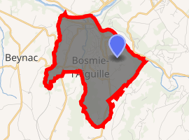
| |
 Bosmie-l'Aiguille  Bosmie-l'Aiguille | |
| Coordinates: 45°46′07″N 1°13′39″E | |
| Country | France |
| Region | Nouvelle-Aquitaine |
| Department | Haute-Vienne |
| Arrondissement | Limoges |
| Canton | Aixe-sur-Vienne |
| Intercommunality | Val de Vienne |
| Government | |
| • Mayor (2001–2008) | Maurice Leboutet |
| Area 1 | 8.01 km2 (3.09 sq mi) |
| Population (2017-01-01)[1] | 2,579 |
| • Density | 320/km2 (830/sq mi) |
| Time zone | UTC+01:00 (CET) |
| • Summer (DST) | UTC+02:00 (CEST) |
| INSEE/Postal code | 87021 /87110 |
| Elevation | 210–375 m (689–1,230 ft) |
| 1 French Land Register data, which excludes lakes, ponds, glaciers > 1 km2 (0.386 sq mi or 247 acres) and river estuaries. | |
Geography
The river Briance forms all of the commune's north-eastern border, then flows into the Vienne, which forms part of its northern border.
Inhabitants are known as Bosmiauds.
gollark: DokuWiki is more lightweighter.
gollark: MediaWiki bad.
gollark: It is also an EVIL strategy.
gollark: no.
gollark: > NB: 'just run off the bottom of the screen and keep going' is not an official strategy, it only arises from a bug in the osmarks.tk implementation. The original Emu War code prevents trying to run off the edge of the screen, but osmarks forgot to update these when he updated the gamefield size, foolishly assuming that the variables for gamefield size actually controlled the other relevant bits.
References
- "Populations légales 2017". INSEE. Retrieved 6 January 2020.
| Wikimedia Commons has media related to Bosmie-l'Aiguille. |
| Authority control |
|
|---|
This article is issued from Wikipedia. The text is licensed under Creative Commons - Attribution - Sharealike. Additional terms may apply for the media files.