Bošáca
Bošáca (Hungarian: Bosác) is a village and municipality in Nové Mesto nad Váhom District in the Trenčín Region of western Slovakia.
Bošáca | |
|---|---|
Village | |
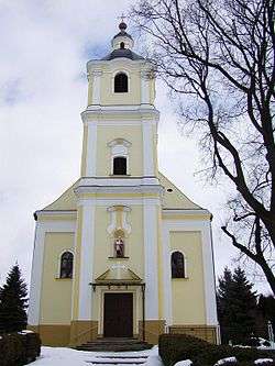
 A church in Bošáca | |
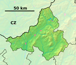
 Bošáca Location of Bošáca in the Trenčín Region  Bošáca Bošáca (Slovakia) | |
| Coordinates: 48°45′00″N 17°50′00″E | |
| Country | Slovakia |
| Region | Trenčín |
| District | Nové Mesto nad Váhom |
| First mentioned | 1380 |
| Area | |
| • Total | 19.598 km2 (7.567 sq mi) |
| Elevation | 235 m (771 ft) |
| Population (2005) | |
| • Total | 1,342 |
| • Density | 68/km2 (180/sq mi) |
| Postal code | 913 07 |
| Area code(s) | +421-32 |
| Car plate | NM |
| Website | www.bosaca.sk |
Etymology
The name is derived from an adjective bosý (in Slovak but also in some other Slavic languages - barefoot, bosáci - barefooted, poor people, hist. Bośáci > Bošáci).[1]
History
In historical records, the village was first mentioned in 1380 as Bosach.
Geography
The municipality lies at an altitude of 235 metres and covers an area of 19.598 km². It has a population of about 1342 people.
Genealogical resources
The records for genealogical research are available at the state archive "Statny Archiv in Bratislava, Slovakia"
- Roman Catholic church records (births/marriages/deaths): 1691-1895 (parish A)
- Lutheran church records (births/marriages/deaths): 1784-1900 (parish B)
gollark: My computer does full boot to usable desktop with internet connectivity within 25 seconds, including entering my encryption key. It spends 5 seconds in firmware, which I can't really do anything about.
gollark: If so, it's doing it anyway.
gollark: Do you have "Fast Startup" on?
gollark: Hibernating is where it saves program RAM or something to disk.
gollark: No, dehibernating.
References
- Krajčovič, Rudolf (2007). "Z lexiky stredovekej slovenčiny s výkladmi názvov obcí a miest (4)". Kultúra slova (in Slovak). Martin: Vydavateľstvo Matice slovenskej (4): 216.
This article is issued from Wikipedia. The text is licensed under Creative Commons - Attribution - Sharealike. Additional terms may apply for the media files.