Birsinghpur
Birsinghpur is a sub district in Satna District in the state of Madhya Pradesh, India
Birsinghpur | |
|---|---|
city | |
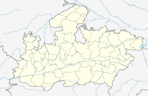
 Birsinghpur Location in Madhya Pradesh, india  Birsinghpur Birsinghpur (India) | |
| Coordinates: 24.4758°N 80.5819°E | |
| Country | |
| State | Madhya Pradesh |
| District | Satna District |
| Area | |
| • Total | 289 km2 (112 sq mi) |
| Area rank | 9 |
| Population (2011) | |
| • Total | 132,469 |
| • Rank | 3 |
| • Density | 460/km2 (1,200/sq mi) |
| Languages | |
| • Official | Hindi |
| Time zone | UTC+5:30 (IST) |
| PIN | 485226 |
| Telephone code | 07671 |
| Vehicle registration | MP 19 |
| Website | satna |
Demographics
As of 2011 India census,[1] Birsinghpur had a population of 14339. Males constituted 52.21% of the population and females 47.79%.
Geography
Birsinghpur is a Nagar Parishad on Madhya Pradesh and a tehseel of 134 villages and 1 Nagar Parishad. The city area is 43.5 kilometres (27.0 mi) in east, 37.2 kilometres (23.1 mi) is west, 37.9 kilometres (23.5 mi) north and 26.4 kilometres (16.4 mi) south. Birsinghpur is situated on the north east in Satna district, at a distance of about 36 km from Satna and 61 km from Rewa. Another two road goes from Birsinghpur to Rewa via Semariya and second Chitrakoot via Majhgawan at a distance of about 60 kilometres (37 mi). Another road goes from Birsinghpur to Satna, Madhya Pradesh via Jaitwar, Kothi (MP SH-52). Birsinghpur has a 10th century temple of Lord Shiva, which is also known as the Gaivinath temple. Birsinghpur is a one of major pilgrim center for local area around Satna and Rewa district.
Infrastructure
There is a government hospital in Birsinghpur. The nearest airport is in Satna. There is also a Government Industrial Training Institute in Birsinghpur.
See also
References
- "Census of India 2001: Data from the 2001 Census, including cities, villages and towns (Provisional)". Census Commission of India. Archived from the original on 16 June 2004. Retrieved 1 November 2008.