Amarpatan
Amarpatan is a town and a nagar panchayat in Satna district in the state of Madhya Pradesh, India.
Amarpatan | |
|---|---|
Town | |
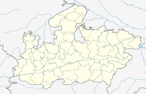
 Amarpatan Location in Madhya Pradesh, India  Amarpatan Amarpatan (India) | |
| Coordinates: 24.32°N 80.98°E | |
| Country | |
| State | Madhya Pradesh |
| District | Satna |
| Elevation | 358 m (1,175 ft) |
| Population (2001) | |
| • Total | 16,365 |
| Languages | |
| • Official | Hindi |
| Time zone | UTC+5:30 (IST) |
| PIN | 485775 |
| Telephone code | 07675 |
| ISO 3166 code | IN-MP |
| Vehicle registration | MP-19 |
Geography
Amarpatan is located at 24.32°N 80.98°E.[1] It has an average elevation of 358 metres (1174 feet). Multiple villages surround the town. It is on National Highway No.7 and connects Rewa to Maihar.
History
There is an old Garhi in town which was built by the Lodhi community in ancient times. There is a Jagannath Swami temple inside the Garhi.
Demographics
As of 2001 Indian census,[2] Amarpatan had a population of 16,365. Males constitute 53% of the population and females 47%. 17% of the population is under 6 years of age.
gollark: No they don't. Just guess.
gollark: Some of them are basically just static images which do not change per-visit, so they probably aren't.
gollark: I think generally they're required to say so, or come from some terrible company like Google.
gollark: REALER men connect the Ethernet cable to a really fast LED and some switches.
gollark: I'll unblock ads which are clearly separated from regular content, are static text/images, do not do any persistent tracking stuff, and are not in stupid places, which something like two websites I use do.
References
- Falling Rain Genomics, Inc - Amarpatan
- "Census of India 2001: Data from the 2001 Census, including cities, villages and towns (Provisional)". Census Commission of India. Archived from the original on 16 June 2004. Retrieved 1 November 2008.
This article is issued from Wikipedia. The text is licensed under Creative Commons - Attribution - Sharealike. Additional terms may apply for the media files.