Birch Tree, Missouri
Birch Tree is a city in Shannon County, Missouri, United States. The population was 679 at the 2010 census.
Birch Tree, Missouri | |
|---|---|
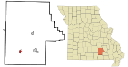 Location of Birch Tree, Missouri | |
| Coordinates: 36°59′35″N 91°29′37″W | |
| Country | United States |
| State | Missouri |
| County | Shannon |
| Township | Birch Tree |
| Government | |
| • Mayor | Gordon A. Williamson |
| Area | |
| • Total | 1.38 sq mi (3.58 km2) |
| • Land | 1.38 sq mi (3.58 km2) |
| • Water | 0.00 sq mi (0.00 km2) |
| Elevation | 991 ft (302 m) |
| Population | |
| • Total | 679 |
| • Estimate (2019)[3] | 649 |
| • Density | 469.95/sq mi (181.51/km2) |
| Time zone | UTC-6 (Central (CST)) |
| • Summer (DST) | UTC-5 (CDT) |
| ZIP code | 65438 |
| Area code(s) | 573 |
| FIPS code | 29-05734[4] |
| GNIS feature ID | 0748866[5] |
History
A post office called Birch Tree has been in operation since the 1860s.[6] The community was named for a grove of birch trees near the original town site.[7]
Geography
Birch Tree is located at 36°59′35″N 91°29′37″W (36.993041, -91.493663).[8]
According to the United States Census Bureau, the city has a total area of 1.38 square miles (3.57 km2), all land.[9]
Demographics
| Historical population | |||
|---|---|---|---|
| Census | Pop. | %± | |
| 1890 | 535 | — | |
| 1910 | 497 | — | |
| 1920 | 452 | −9.1% | |
| 1930 | 505 | 11.7% | |
| 1940 | 495 | −2.0% | |
| 1950 | 409 | −17.4% | |
| 1960 | 420 | 2.7% | |
| 1970 | 573 | 36.4% | |
| 1980 | 622 | 8.6% | |
| 1990 | 599 | −3.7% | |
| 2000 | 634 | 5.8% | |
| 2010 | 679 | 7.1% | |
| Est. 2019 | 649 | [3] | −4.4% |
| U.S. Decennial Census[10] | |||
2010 census
As of the census[2] of 2010, there were 679 people, 298 households, and 167 families living in the city. The population density was 492.0 inhabitants per square mile (190.0/km2). There were 347 housing units at an average density of 251.4 per square mile (97.1/km2). The racial makeup of the city was 92.78% White, 0.29% Black or African American, 0.88% Native American, 0.74% Asian, 3.09% from other races, and 2.21% from two or more races. Hispanic or Latino of any race were 6.92% of the population.
There were 298 households, of which 29.5% had children under the age of 18 living with them, 39.6% were married couples living together, 12.8% had a female householder with no husband present, 3.7% had a male householder with no wife present, and 44.0% were non-families. 39.3% of all households were made up of individuals, and 17.5% had someone living alone who was 65 years of age or older. The average household size was 2.28 and the average family size was 3.04.
The median age in the city was 38.9 years. 24.9% of residents were under the age of 18; 9.1% were between the ages of 18 and 24; 23.6% were from 25 to 44; 25.1% were from 45 to 64; and 17.4% were 65 years of age or older. The gender makeup of the city was 48.3% male and 51.7% female.
2000 census
As of the census[4] of 2000, there were 634 people, 276 households, and 170 families living in the city. The population density was 478.0 people per square mile (184.1/km2). There were 323 housing units at an average density of 243.5 per square mile (93.8/km2). The racial makeup of the city was 95.11% White, 0.32% African American, 2.05% Native American, 0.79% from other races, and 1.74% from two or more races. Hispanic or Latino of any race were 1.58% of the population.
There were 276 households, out of which 30.1% had children under the age of 18 living with them, 42.4% were married couples living together, 14.5% had a female householder with no husband present, and 38.4% were non-families. 35.9% of all households were made up of individuals, and 18.8% had someone living alone who was 65 years of age or older. The average household size was 2.30 and the average family size was 2.95.
In the city the population was spread out, with 27.1% under the age of 18, 7.7% from 18 to 24, 26.8% from 25 to 44, 22.2% from 45 to 64, and 16.1% who were 65 years of age or older. The median age was 36 years. For every 100 females there were 84.3 males. For every 100 females age 18 and over, there were 77.7 males.
The median income for a household in the city was $14,236, and the median income for a family was $18,182. Males had a median income of $16,932 versus $14,531 for females. The per capita income for the city was $7,695. About 38.3% of families and 46.0% of the population were below the poverty line, including 59.2% of those under age 18 and 41.7% of those age 65 or over.
Education
Mountain View-Birch Tree R-III School District operates Birch Tree Elementary School in the community.[11]
The town has a lending library, the Birch Tree City Library.[12]
Notable people
- Mel Carnahan, Governor of Missouri (1993–2000), the only person to be posthumously elected to the U.S. Senate; born in Birch Tree.[13]
- Bob Holden, Governor of Missouri (2001–2005); raised in Birch Tree.[14]
References
- "2019 U.S. Gazetteer Files". United States Census Bureau. Retrieved July 26, 2020.
- "U.S. Census website". United States Census Bureau. Retrieved 2012-07-08.
- "Population and Housing Unit Estimates". United States Census Bureau. May 24, 2020. Retrieved May 27, 2020.
- "U.S. Census website". United States Census Bureau. Retrieved 2008-01-31.
- "US Board on Geographic Names". United States Geological Survey. 2007-10-25. Retrieved 2008-01-31.
- "Shannon County Place Names, 1928–1945". The State Historical Society of Missouri. Archived from the original on June 24, 2016. Retrieved December 25, 2016.
- Eaton, David Wolfe (1918). How Missouri Counties, Towns and Streams Were Named. The State Historical Society of Missouri. p. 363.
- "US Gazetteer files: 2010, 2000, and 1990". United States Census Bureau. 2011-02-12. Retrieved 2011-04-23.
- "US Gazetteer files 2010". United States Census Bureau. Archived from the original on 2012-01-25. Retrieved 2012-07-08.
- "Census of Population and Housing". Census.gov. Retrieved June 4, 2015.
- "Mountain View-Birch Tree R-III School District". Great Schools. Retrieved 17 March 2018.
- "Missouri Public Libraries". PublicLibraries.com. Archived from the original on 10 June 2017. Retrieved 17 March 2018.
- "Missouri Governor Mel Eugene Carnahan". National Governors Association. Retrieved October 30, 2012.
- "Missouri Governor Robert L. Holden". National Governors Association. Retrieved October 30, 2012.
External links
- Historic maps of Birch Tree in the Sanborn Maps of Missouri Collection at the University of Missouri
Municipalities and communities of Shannon County, Missouri, United States | ||
|---|---|---|
| Cities | 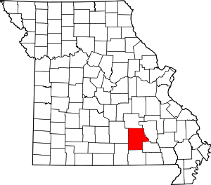 Map of Missouri highlighting Shannon County | |
| Townships | ||
| CDP | ||
| Unincorporated communities | ||
| Ghost towns | ||
| Footnotes | ‡This populated place also has portions in an adjacent county or counties | |