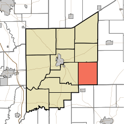
Bigger Township, Jennings County, Indiana
Bigger Township is one of eleven townships in Jennings County, Indiana, United States. As of the 2010 census, its population was 726 and it contained 298 housing units.[1]
Bigger Township | |
|---|---|
 Location in Jennings County | |
| Coordinates: 38°57′23″N 85°29′40″W | |
| Country | United States |
| State | Indiana |
| County | Jennings |
| Government | |
| • Type | Indiana township |
| Area | |
| • Total | 30.74 sq mi (79.6 km2) |
| • Land | 30.69 sq mi (79.5 km2) |
| • Water | 0.05 sq mi (0.1 km2) 0.16% |
| Elevation | 745 ft (227 m) |
| Population (2010) | |
| • Total | 726 |
| • Density | 23.7/sq mi (9.2/km2) |
| GNIS feature ID | 0453111 |
History
Bigger Township was established in 1840. It was named for Samuel Bigger, seventh Governor of Indiana.[2]
Benville Bridge was listed on the National Register of Historic Places in 1996.[3]
Geography
According to the 2010 census, the township has a total area of 30.74 square miles (79.6 km2), of which 30.69 square miles (79.5 km2) (or 99.84%) is land and 0.05 square miles (0.13 km2) (or 0.16%) is water.[1]
Unincorporated towns
Adjacent townships
- Campbell Township (north)
- Shelby Township, Ripley County (east)
- Monroe Township, Jefferson County (southeast)
- Lancaster Township, Jefferson County (south)
- Lovett Township (west)
- Vernon Township (west)
Cemeteries
The township contains three cemeteries: Bethel, Callicotte and Hughes.
Airports and landing strips
- Broomsage Ranch Airport
gollark: If only I could have autobotrobot potatonize the queues for me.
gollark: ~np
gollark: ?remind 1m10s A
gollark: ~np
gollark: We are never going to reach the end of this maybe possibly.
References
- "Bigger Township, Jennings County, Indiana". Geographic Names Information System. United States Geological Survey. Retrieved 2009-09-24.
- United States Census Bureau cartographic boundary files
- "Population, Housing Units, Area, and Density: 2010 - County -- County Subdivision and Place -- 2010 Census Summary File 1". United States Census. Archived from the original on 2020-02-12. Retrieved 2013-05-10.
- Jennings Co. Historical Society (1999). Jennings Co, Indiana - Pictorial. Turner Publishing Company. p. 29.
- "National Register Information System". National Register of Historic Places. National Park Service. July 9, 2010.
This article is issued from Wikipedia. The text is licensed under Creative Commons - Attribution - Sharealike. Additional terms may apply for the media files.