Beringin Airport
Beringin Airport (IATA: GXA, ICAO: WAOM) (Indonesian: Bandar Udara Beringin) is an airport in Muara Teweh,[1] the capital city of the North Barito Regency in Central Kalimantan, Indonesia.
Beringin Airport Bandar Udara Beringin | |||||||||||
|---|---|---|---|---|---|---|---|---|---|---|---|
| Summary | |||||||||||
| Airport type | Public | ||||||||||
| Operator | North Barito Government | ||||||||||
| Serves | Muara Teweh, North Barito Regency, Central Kalimantan, Indonesia | ||||||||||
| Elevation AMSL | 38.6 m / 127 ft | ||||||||||
| Coordinates | 00°56′34″S 114°53′40″E | ||||||||||
| Map | |||||||||||
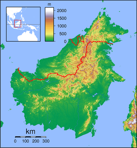
 WAOM Location of airport in Kalimantan (Borneo) | |||||||||||
| Runways | |||||||||||
| |||||||||||
Facilities
The airport resides at an elevation of 38.6 metres (126.6 ft) above mean sea level. It has one runway designated 13/31 with an asphalt surface measuring 904 by 23 metres (2,966 ft × 75 ft) so it becomes 13/31 size 1,950 by 45 metres (6,398 ft × 148 ft) with asphalt surface and a height of 39 meters above ground. Next year at the airport runway will be extended to 2,050 by 65 metres (6,726 ft × 213 ft).
Airlines and destinations
The following airlines offer direct passenger flights from this airport.
| Airlines | Destinations |
|---|---|
| Aviastar | Palangkaraya[4] |
| Susi Air | Banjarmasin, Palangkaraya[5] |
gollark: --radio_connect
gollark: --magic reload_ext
gollark: --radio_connect
gollark: --magic reload_ext
gollark: bee!!!!
References
- "BERINGIN (MTW / WAOM)". Directorate General of Civil Aviation, Ministry of Transportation Republic of Indonesia. Retrieved August 28, 2012.
- "Beringin Airport (Muara Teweh) / Coordinates 0°56'34"S 114°53'40"E". Wikimapia. Retrieved August 28, 2012.
- id:Bandar Udara Beringin
- http://www.antaranews.com/berita/273290/kabut-asap-batalkan-penerbangan-ke-muara-teweh
- bisnis.tempo.co/read/news/2016/01/29/090740678/susi-air-layani-lagi-rute-subsidi-muara-teweh-palangkaraya
External links
This article is issued from Wikipedia. The text is licensed under Creative Commons - Attribution - Sharealike. Additional terms may apply for the media files.