Basford, Cheshire
Basford is a hamlet and civil parish in the unitary authority of Cheshire East and the ceremonial county of Cheshire, England, lying immediately south of Crewe. Nearby villages include Shavington, Weston, Hough and Chorlton.[1][2] The population was around 250 in 2011. Basford was first recorded in the Domesday survey and had a moated manor. The modern parish is bisected by the A500 and the Crewe-to-Stafford railway line, and includes Basford Hall Sorting Sidings.
| Basford | |
|---|---|
.jpg) Locomotives at Basford Hall railway yard | |
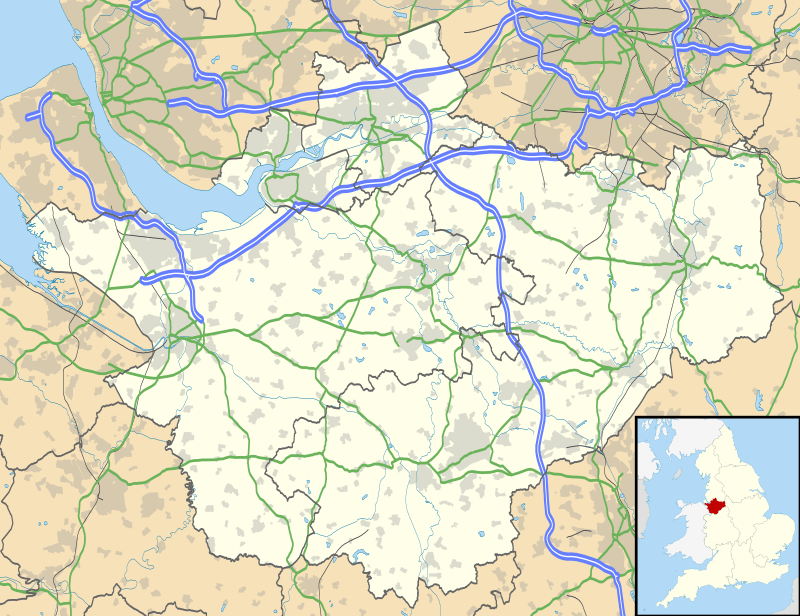 Basford Location within Cheshire | |
| Population | 256 (2011) |
| OS grid reference | SJ715522 |
| Civil parish |
|
| Unitary authority | |
| Ceremonial county | |
| Region | |
| Country | England |
| Sovereign state | United Kingdom |
| Post town | CREWE |
| Postcode district | CW2 |
| Dialling code | 01270 |
| Police | Cheshire |
| Fire | Cheshire |
| Ambulance | North West |
| UK Parliament | |
History
Tools and weapons made of flint have been discovered in the parish.[3] Berchesford was a small manor at the time of the Domesday survey in 1086.[3][4] The name is thought to mean either "ford near birch trees" or the ford associated with a personal name, such as Beorcal, Borkr or Barkr.[3] Three separate manors are recorded, which probably represent Basford, Weston and Hough, held by Owine, Erlekin and Leofric.[5] Basford Hall was formerly a moated manor; the building was lost to fire in around 1700, and the remains were covered by the railway development. Basford formerly had a railway station. The A500 bypass opened in 2003.[3][6]
Governance
The civil parish is administered by Weston and Basford Parish Council, jointly with the adjacent larger parish of Weston.[7][8] From 1974 the civil parish was served by Crewe and Nantwich Borough Council, which was succeeded on 1 April 2009 by the new unitary authority of Cheshire East.[9] Basford falls in the parliamentary constituency of Crewe and Nantwich,[2] and has been represented by Kieran Mullan since the 2019 General Election.[10]
Geography and transport
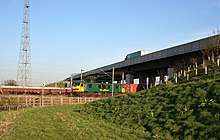
The civil parish has a total area of 297.57 hectares (735.3 acres).[11] The A500 runs east–west through the parish,[2] and the Crewe-to-Stafford railway line runs north west to south east through it; there are currently no stations within Basford (as of 2020). To the north of the A500 is Basford Hall Sorting Sidings.[1][2] Weston Lane runs east–west south of the A500, connecting Shavington and Weston. Back Lane and Casey Lane run south and south west, respectively, from Weston Lane to meet immediately north east of Hough, on the southern boundary of Basford parish. Casey Lane crosses the railway at Casey Bridge.[1][2] The South Cheshire Way and the Crewe and Nantwich Circular Walk long-distance footpaths go through the south-east corner, crossing Basford Brook at a footbridge.[1]
Most of the existing settlement in the parish lies to the south of the A500;[2] large housing developments in the northern area were under consideration in late 2017.[12] The hamlet of Basford lies along Weston Lane and at the junction with Back Lane.[1][2]
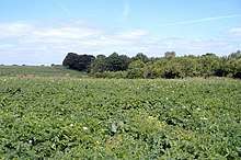
The terrain is predominantly flat, sloping gently upwards from an elevation of around 50 metres (160 ft) in the north to 60–65 metres (197–213 ft) in the south. Swill Brook runs along part of the western boundary, Gresty Brook along part of the northern boundary, and Basford Brook along or just inside parts of the eastern boundary. Small areas of woodland are located near the eastern boundary, including Burrow Coppice and an unnamed woodland flanking Basford Brook. There are occasional ponds or meres scattered across the area.[1][2]
Demography
According to the 2001 census Basford had a population of 266,[13] reducing slightly to 256 in 115 households at the 2011 census.[11] This is an increase on the 19th-century population; the historical figures are 55 (1801), 69 (1851), 77 (1881), 69 (1901) and 229 (1951).[13][14]
Education
There are no educational facilities in Basford. The civil parish falls within the catchment area of Shavington Academy; the area to the west of the railway line falls in the catchment of Shavington Primary School, and that to the east, Weston Village Primary School.[2]
References
- Crewe & Nantwich: Whitchurch & Tattenhall (OS Explorer series 257), Ordnance Survey, 2000, ISBN 0-319-21893-7
- Search at Cheshire East Council Public Map Viewer (accessed 4–5 March 2020)
- Neighbourhood Plan, p. 8
- Husain, frontispiece
- Neighbourhood Plan, pp. 4–5, 8
- "Bypass could drive jobs boom", Warrington Guardian, 29 May 2003, retrieved 4 March 2020
- Parish Councils N – W, Cheshire East Council, retrieved 5 March 2020
- "Parish Council", Weston & Basford Online, retrieved 2 March 2012
- The Cheshire (Structural Changes) Order 2008, The National Archives, 4 March 2008, retrieved 3 March 2020
- Crewe & Nantwich Parliamentary constituency, BBC, retrieved 4 March 2020
- Basford Parish: Local Area Report, Nomis, retrieved 4 March 2020
- Neighbourhood Plan, pp. 11–12
- Basford, UK & Ireland Genealogy, retrieved 5 March 2020
- "Basford Tn/CP through time: Population Statistics: Total Population: Table view", A Vision of Britain through Time, University of Portsmouth, retrieved 4 March 2020
- Sources
- B. M. C. Husain (1973), Cheshire under the Norman Earls: 1066–1237. A History of Cheshire Vol. 4 (J. J. Bagley, ed.), Cheshire Community Council
- Weston and Basford Neighbourhood Plan Steering Group (November 2017), Weston & Basford Neighbourhood Plan 2015 – 2030 (PDF), Cheshire East Council, retrieved 4 March 2020
External links
| Wikimedia Commons has media related to Basford, Cheshire. |
Cheshire Portal | |
| Unitary authorities | |
| Major settlements |
|
| Rivers | |
| Topics | |