Barmby Moor
Barmby Moor is a village and civil parish in the East Riding of Yorkshire, England. It is situated approximately 1.5 miles (2.4 km) west of Pocklington. It lies north of the A1079 road where it is met by the B1246 road that passes through the village.
| Barmby Moor | |
|---|---|
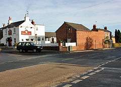 The Boot and Slipper | |
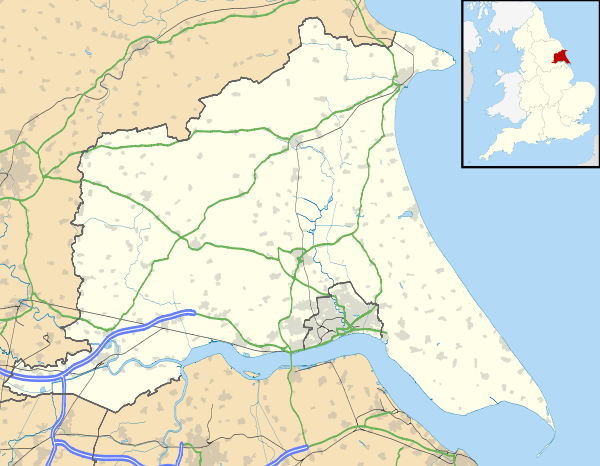 Barmby Moor Location within the East Riding of Yorkshire | |
| Population | 1,114 (2011 census)[1] |
| OS grid reference | SE777489 |
| • London | 170 mi (270 km) S |
| Civil parish |
|
| Unitary authority | |
| Ceremonial county | |
| Region | |
| Country | England |
| Sovereign state | United Kingdom |
| Post town | YORK |
| Postcode district | YO42 |
| Dialling code | 01759 |
| Police | Humberside |
| Fire | Humberside |
| Ambulance | Yorkshire |
| UK Parliament | |
According to the 2011 UK census, Barmby Moor parish had a population of 1,114,[1] an increase on the 2001 UK census figure of 1,065.[2]
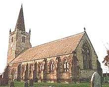
The village was originally a market town with a coaching inn.[3] It has a church, dedicated to St Catherine, chapel, village hall and a primary school. The former school house now houses a Kids Club and a Pre-School, both are charities run by locals. There is also a post office and a pub, The Boot & Slipper. The church and the Manor House were designated as Grade II* listed buildings in 1967 and are now recorded in the National Heritage List for England, maintained by Historic England.[4][5]
Each July a traditional fete - the Barmby Feast - is held in the village.[6]
Education
Barmby Moor Primary School is a Church of England school. The foundation governors are appointed by the church.[7] The school maintains close links with St Catherine's Church and other church schools within the Diocese of York.
Barmby Moor's pre-school offers child-care and early education.
References
- UK Census (2011). "Local Area Report – Barmby Moor Parish (1170211136)". Nomis. Office for National Statistics. Retrieved 14 February 2018.
- UK Census (2001). "Local Area Report – Barmby Moor Parish (1543504183)". Nomis. Office for National Statistics. Retrieved 24 November 2018.
- Baggs, A P; Kent, G H R; Purdy, J D (1976). Allison, K J (ed.). Barmby Moor. A History of the County of York East Riding: Volume 3: Ouse and Derwent wapentake, and part of Harthill wapentake. Institute of Historical Research. pp. 140–147. Retrieved 20 November 2014.
- Historic England. "Church of St. Catherine (1083879)". National Heritage List for England. Retrieved 19 August 2013.
- Historic England. "The Manor House (1309940)". National Heritage List for England. Retrieved 19 August 2013.
- "Barmby Feast organisers plan fun-filled weekend". Pocklington Post. 15 May 2014. Retrieved 20 November 2014.
- "Instrument of Government" (PDF). East Riding of Yorkshire Council. Retrieved 20 November 2014.
- Gazetteer — A–Z of Towns Villages and Hamlets. East Riding of Yorkshire Council. 2006. p. 3.
External links

- Historic England. "Details from listed building database (1083879)". National Heritage List for England.
- Barmby Moor CE Primary School
- Barmby Moor Parish Council
- Barmby Moor Pre school
- Barmby Moor in the Domesday Book