Azzun Atma
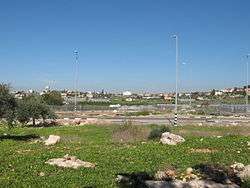
'Azzun 'Atma (Arabic: عزون عتمة) is a Palestinian village in the Qalqilya Governorate in the western West Bank, located 5 kilometers South-east of Qalqilya. According to the Palestinian Central Bureau of Statistics, 'Azzun 'Atma had a population of approximately 1,670 inhabitants in mid-year 2006.[2] 3.9% of the population of 'Azzun 'Atma were refugees in 1997.[3] The healthcare facilities for 'Azzun 'Atma are designated as MOH level 2.[4]
'Azzun 'Atma | |
|---|---|
| Arabic transcription(s) | |
 Azzun Atma | |
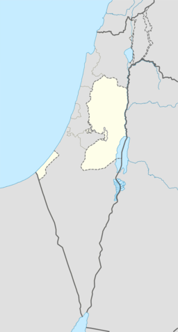 'Azzun 'Atma Location of 'Azzun 'Atma within Palestine | |
| Coordinates: 32°07′23″N 35°00′58″E | |
| Palestine grid | 152/169 |
| State | State of Palestine |
| Governorate | Qalqilya |
| Government | |
| • Type | Village council |
| Population (2006) | |
| • Total | 1,670 |
| Name meaning | "The wild olive of Ibn 'Atmeh"[1] |
Location
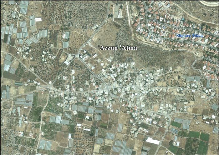
‘Azzun ‘Atma is located 8.82 km south of Qalqiliya. It is bordered by Mas-ha and Sha'arei Tikva to the east, Az Zawiya to the south, Oranit to the west, and Beit ‘Amin and ‘Izbat Salman to the north.[5]
History
Potsherds from the Iron Age II, Persian, Hellenistic, Byzantine, Byzantine/Umayyad, Crusader/Ayyubid and Mamluk eras have been found.[6] Old stones have been reused in homes, and the mosque is possibly an old church.[7]
Ottoman era
The place appeared in 1596 Ottoman tax registers as 'Azzun, being in the Nahiya of Jabal Qubal of the Liwa of Nablus. It had a population of 29 households and 2 bachelors, all Muslim. The villagers paid a fixed tax rate of 33,3%, on wheat, barley, summer crops, olives, goats and beehives; a total of 4,200 akçe.[8] Potsherds from the early Ottoman era have also been found here.[6]
When the French explorer Victor Guérin visited the place in 1870 it was described it as a large Arab village, then deserted. Many small, square houses were still partly standing, and near the mosque he noticed old columns and large stone from older buildings. Old fig trees and beautiful mimosa were scattered through the ruins.[9] In the PEF's Survey of Western Palestine (1882), it is also described as a "ruined village".[10]
Jordanian Era
In the wake of the 1948 Arab–Israeli War, and after the 1949 Armistice Agreements, Azzun Atma came under Jordanian rule. It was annexed by Jordan in 1950.
Post-1967
Since the Six-Day War in 1967, Azzun Atma has been under Israeli occupation.
After the 1995 accords, about 3.8% of village land was classified as Area B, the remaining 96.2% as Area C.[11] Israel has confiscated 2,689 dunams of village land in order to construct three Israeli settlements of Sha'are Tikva, Oranit and Zamarot (Zamarot becoming part of Oranit), in addition to land for the Israeli West Bank barrier, which almost entirely surrounds Azzun Atma, and which also isolate the village from much of its remaining land behind the wall.[12]
See also
References
- Palmer, 1881, p. 225
- Projected Mid -Year Population for Qalqilya Governorate by Locality 2004- 2006 Palestinian Central Bureau of Statistics.
- Palestinian Population by Locality and Refugee Status Palestinian Central Bureau of Statistics
- "Archived copy" (PDF). Archived from the original on 2006-03-13. Retrieved 2016-05-24.CS1 maint: archived copy as title (link) CS1 maint: BOT: original-url status unknown (link)
- ‘Azzun ‘Atma Village Profile, ARIJ, p. 4
- Finkelstein et al., 1997, p. 290
- Dauphin, 1998, p. 808
- Hütteroth and Abdulfattah, 1977, p. 135
- Guérin, 1875, pp. 143-144
- Conder and Kitchener, 1882, SWP II, p. 305
- ‘Azzun ‘Atma Village Profile, ARIJ, p. 15
- ‘Azzun ‘Atma Village Profile, ARIJ, p. 16
Bibliography
- Conder, C.R.; Kitchener, H.H. (1881). The Survey of Western Palestine: Memoirs of the Topography, Orography, Hydrography, and Archaeology. 2. London: Committee of the Palestine Exploration Fund.
- Dauphin, Claudine (1998). La Palestine byzantine, Peuplement et Populations. BAR International Series 726 (in French). III : Catalogue. Oxford: Archeopress. ISBN 0-860549-05-4.
- Finkelstein, I.; Lederman, Zvi, eds. (1997). Highlands of many cultures. Tel Aviv: Institute of Archaeology of Tel Aviv University Publications Section. ISBN 965-440-007-3.
- Guérin, V. (1875). Description Géographique Historique et Archéologique de la Palestine (in French). 2: Samarie, pt. 2. Paris: L'Imprimerie Nationale.
- Hütteroth, Wolf-Dieter; Abdulfattah, Kamal (1977). Historical Geography of Palestine, Transjordan and Southern Syria in the Late 16th Century. Erlanger Geographische Arbeiten, Sonderband 5. Erlangen, Germany: Vorstand der Fränkischen Geographischen Gesellschaft. ISBN 3-920405-41-2.
- Palmer, E.H. (1881). The Survey of Western Palestine: Arabic and English Name Lists Collected During the Survey by Lieutenants Conder and Kitchener, R. E. Transliterated and Explained by E.H. Palmer. Committee of the Palestine Exploration Fund.
External links
- Survey of Western Palestine, Map 14: IAA, Wikimedia commons
- ‘Azzun ‘Atma Village (Fact Sheet), Applied Research Institute–Jerusalem, ARIJ
- ‘Azzun ‘Atma Village Profile, ARIJ
- ‘Azzun ‘Atma, aerial photo, ARIJ
- Development Priorities and Needs in ‘Azzun ‘Atma, ARIJ
- Azzun- Atma: A village encircled by the Wall 17, May, 2004, POICA
- Israeli Occupation Forces Expands its Siege on Residents of Azzun Atma – Qalqiliya Governorate 16, May, 2006, POICA
- New Stage for completing the Segregation wall around 'Azzun 'Atma village in Qalqilyia, 02, October, 2006, POICA
- Azzun Atme village engulfed by two walls 05, November, 2007, POICA
- Azzun Atmeh village completely sealed off by the Segregation Wall 01, March, 2009, POICA
- Settlers of the Israeli Settlement of "Oranit" Set Lands of 'Azzun 'Atma village Ablaze 09, November, 2009, POICA
- Israeli Colonists Pump Sewage towards a Palestinian School in 'Azzun 'Atma village 23, February, 2010, POICA
- Azzun Atma Wall Section - Qalqiliya Governorate 06, December, 2011, POICA
| Cities |  | |
|---|---|---|
| Municipalities |
| |
| Villages |
| |