Auxerre – Branches Aerodrome
Auxerre – Branches Aerodrome (French: Aérodrome d'Auxerre - Branches[2]) (IATA: AUF[4][5], ICAO: LFLA) is an airport serving Auxerre and Branches, both communes of the Yonne department[1] in the Bourgogne region of France. The airport is located 8.5 km (4.6 NM) northwest of Auxerre[1] and approximately 4 km (2.2 NM) southeast of Branches.[6]
Auxerre - Branches Aerodrome Aérodrome d'Auxerre - Branches | |||||||||||
|---|---|---|---|---|---|---|---|---|---|---|---|
| Summary | |||||||||||
| Airport type | Public | ||||||||||
| Operator | CCI de l'Yonne | ||||||||||
| Serves | Auxerre / Branches, Yonne, France | ||||||||||
| Elevation AMSL | 523 ft / 159 m | ||||||||||
| Coordinates | 47°50′47″N 003°29′48″E | ||||||||||
| Website | http://www.auxerre.aeroport.fr | ||||||||||
| Map | |||||||||||
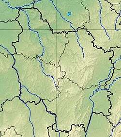 LFLA Location of airfield in Burgundy region Location of Burgundy region in France 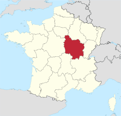 | |||||||||||
| Runways | |||||||||||
| |||||||||||
Facilities
The airport resides at an elevation of 523 feet (159 m) above mean sea level. It has one runway designated 01/19 with an asphalt surface measuring 1,650 by 30 metres (5,413 ft × 98 ft).[1]
gollark: It's weird how so many of these bad password programs just reboot and shutdown whenever you do it wrong.
gollark: ```lualocal wireless_modems = {peripheral.find("modem", function(_, o) return o.isWireless() end)}```
gollark: You can also pass it a second argument to do filtering.
gollark: For example,```lua-- write "hi" on a monitorlocal mon = peripheral.find "monitor"mon.write "hi"```or```lua-- write "hello" in blue on all monitorslocal mons = {peripheral.find "monitor"}for _, m in pairs(mons) do m.setTextColor(colors.blue) m.write "hello"end```
gollark: You pass it the type of peripheral you want and it returns all peripherals matching that, as wrapped peripheral objects.
References
- LFLA – Auxerre Branches. AIP from French Service d'information aéronautique, effective 13 August 2020.
- "Aérodrome d'Auxerre - Branches". Union des Aéroports Français. Archived from the original on 25 January 2010. Retrieved 12 May 2010.
- Airport information for LFLA from DAFIF (effective October 2006)
- Airport information for AUF at Great Circle Mapper. Source: DAFIF (effective October 2006).
- "Auxerre-Branches Airport (AUF / LFLA)". Aviation Safety Network. Retrieved 12 May 2010.
- "Aerial image with distances to airport from Auxerre and Branches". WikiMapia. Retrieved 12 May 2010.
External links
- (in French) Official Auxerre Airport website
- (in French) CCI de l'Yonne
- Aeronautical chart and airport information for LFLA at SkyVector
This article is issued from Wikipedia. The text is licensed under Creative Commons - Attribution - Sharealike. Additional terms may apply for the media files.