Atahualpa, Montevideo
Atahualpa is a barrio (neighbourhood or district) of Montevideo, Uruguay.
Atahualpa | |
|---|---|
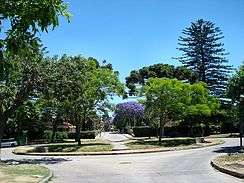 Plaza Atahualpa | |
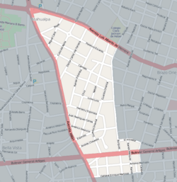 Street map of Atahualpa | |
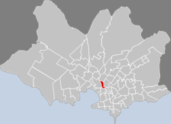 Map of Montevideo highlighting the barrio | |
| Coordinates: 34°51′53″S 56°11′23″W | |
| Country | |
| Department | Montevideo Department |
| City | Montevideo |
| Website | http://www.barrioatahualpa.com/mapa.php |
Location
Atahualpa shares borders with Prado to the west, Aires Puros to the north, Brazo Oriental to the east and Reducto to the south.
gollark: I mildly dislike your political ideology!
gollark: Wow. You are very centrist.
gollark: can't find it. Though you could try 8values: https://8values.github.io/quiz.html
gollark: I'll try and find it in my history.
gollark: Oh no.
See also
External links
| Wikimedia Commons has media related to Atahualpa, Montevideo. |
- Comisión de Vecinos del Barrio Atahualpa
- Intendencia de Montevideo / Historia / Barrios / (see section) El paseo del Prado
- Revista Raices / Historia del barrio Atahualpa
This article is issued from Wikipedia. The text is licensed under Creative Commons - Attribution - Sharealike. Additional terms may apply for the media files.