Arikaree River
The Arikaree River is a 156-mile-long (251 km)[3] river in the central Great Plains of North America. It lies mostly in the American state of Colorado, draining land between the North and South Forks of the Republican River, and it flows into the North Fork in Nebraska after flowing a short distance through Kansas.[4] It is a designated area within the Colorado Natural Areas Program to protect native and uncommon species that may be endangered or threatened.
| Arikaree River Arikara Fork Republican River | |
|---|---|
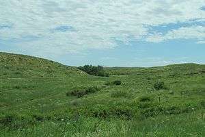
 Arikaree River Valley at the location of the Battle of Beecher Island near Wray, Colorado | |
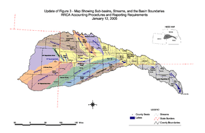
 Republican River watershed; the Arikaree is in orange at far left | |
| Etymology | Arikaree for horn |
| Native name | Ononio'he |
| Location | |
| Country | United States |
| State | Colorado, Kansas, Nebraska |
| Physical characteristics | |
| Source | |
| • location | Elbert County, Colorado |
| • coordinates | 39°22′36″N 103°46′44″W |
| • elevation | 5,908 ft (1,801 m) |
| Mouth | Republican River |
• location | Haigler, Nebraska |
• coordinates | 40°01′13″N 101°56′17″W[1] |
• elevation | 3,241 ft (988 m) |
| Length | 156 mi (251 km) |
| Basin size | 1,743 sq mi (4,510 km2) |
| Discharge | |
| • location | USGS 06821500 at Haigler, NE[2] |
| • average | 16.7 cu ft/s (0.47 m3/s) |
| • minimum | 0 cu ft/s (0 m3/s) |
| • maximum | 17,000 cu ft/s (480 m3/s) |
| Basin features | |
| Tributaries | |
| • left | North Fork Arikaree River - Black Wolf Creek |
| Watersheds | Arikaree-Republican-Kansas- Missouri-Mississippi |
Geography
The source of the Arikaree River is in extreme eastern Elbert County, Colorado on the western edge of the High Plains region of the Great Plains.[4][7] From there, the river flows generally northeast across the High Plains in eastern Colorado. It then crosses the extreme northwestern corner of Kansas before entering far southwestern Nebraska. At the town of Haigler, the Arikaree joins with the North Fork Republican River to form the Republican River.[4]
The point where the Arikaree River flows out of Yuma County, Colorado and into Cheyenne County, Kansas, located at 39°58′41″N 102°03′06″W, is the lowest point in Colorado at an elevation of 3,317 feet (1,011 m). It holds the distinction of being the highest low point of any U.S. state, higher than the highest points of 18 states and the District of Columbia.[8]
History
Along the river is the site of the 1868 Battle of Beecher Island.
Arikaree River Natural Area
The Arikaree River has been made one of the designated areas under the Colorado Natural Areas Program because it is "part of the largest and best remaining example of a naturally functioning Great Plains river system in Colorado." It has several species of reptiles, fish, and amphibians that are native and uncommon. The area is a sanctuary for many bird species, including burrowing owls, ferruginous hawks, and greater prairie chickens. The habitat is near-pristine and there are high-quality riparian and native prairie plants.[9]
See also
- Arikaree Breaks
- Beecher Island
- List of Colorado rivers
- List of Kansas rivers
- List of Nebraska rivers
References
- "Arikaree River". Geographic Names Information System. United States Geological Survey. Retrieved 2011-02-01.
- "Water-Data Report 2012 - 06821500 Arikaree River at Haigler, NE" (PDF). U.S. Geological Survey. Retrieved 2015-12-04.
- "National Hydrography Dataset". National Hydrography Dataset. United States Geological Survey. Retrieved 14 June 2011.
- "Colorado [Map]" (PDF). Colorado Department of Transportation. Retrieved 2015-12-04.
- Dawson, John Frank (1954). Place names in Colorado: why 700 communities were so named, 150 of Spanish or Indian origin. Denver, CO: The J. Frank Dawson Publishing Co. p. 7.
- Gannett, Henry (1905). The Origin of Certain Place Names in the United States. U.S. Government Printing Office. p. 28.
- "Physiographic Provinces of Colorado". Colorado Geological Survey. Retrieved 2015-12-04.
- U.S. Geological Survey. "Elevations and Distances". Archived from the original on 31 August 2006. Retrieved 2006-09-08.
- "Arikaree River - CNAP". Colorado Parks and Wildlife. Retrieved November 17, 2016.
External links
| Wikimedia Commons has media related to Arikaree River. |