Arakandanallur
Arakandanallur is a panchayat town in Viluppuram district in the state of Tamil Nadu, India. The place is known for the historic Atulya Nadheswarar Temple built in rock-cut architecture on a small hillock.
Arakandanallur | |
|---|---|
panchayat town | |
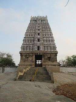 Tower of Atulya Nadeswarar temple | |
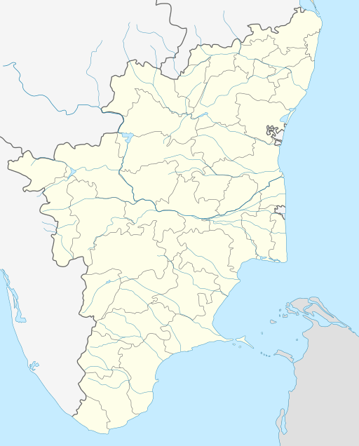 Arakandanallur Location in Tamil Nadu, India | |
| Coordinates: 11°58′58″N 79°13′41″E | |
| Country | |
| State | Tamil Nadu |
| District | Viluppuram |
| Population (2001) | |
| • Total | 4,450 |
| Languages | |
| • Official | Tamil |
| Time zone | UTC+5:30 (IST) |
Demographics
As of 2001 India census,[1] Arakandanallur had a population of 4450. Males constitute 50% of the population and females 50%. Arakandanallur has an average literacy rate of 75%, higher than the national average of 59.5%; with 58% of the males and 42% of females literate. 10% of the population is under 6 years of age.
Places of interest
Athulya Nadheswara Temple - This is a 1500-year-old temple where Saint Thirugnanasambandar in the 7th Century and Ramana Maharishi in August 1896 experienced God in the form of Light. This is also one of the 275 Devara Paadal Petra Sthalams [Aalayam Kanden -
Anthili Lakshmi Narasimhaswamy Temple - Anthili is about 3 km from Arakandanallur. This temple is on top of a hillock shaped like Garuda who is said to have done penance here to witness Lord Vishnu in the form of Lakshmi Narasimha [Aalayam Kanden -
Schools and colleges
Though in this town Panchayat, Many Colleges and schools were present. Some of the places are:
- Government Polytechnic College
- Valliammai college of arts and Science for Women
- Government Higher Secondary School
- Sri Lakshmi Vidhyalaya Higher Secondary School
- Balamandir Matriculation Higher Secondary school
References
- "Census of India 2001: Data from the 2001 Census, including cities, villages and towns (Provisional)". Census Commission of India. Archived from the original on 16 June 2004. Retrieved 1 November 2008.