Araguaína Airport
Araguaína Airport (IATA: AUX, ICAO: SWGN) is the airport serving Araguaína, Brazil.
Araguaína Airport Aeroporto de Araguaína | |||||||||||
|---|---|---|---|---|---|---|---|---|---|---|---|
 | |||||||||||
| Summary | |||||||||||
| Airport type | Public | ||||||||||
| Operator | Esaero | ||||||||||
| Serves | Araguaína | ||||||||||
| Time zone | Time in Brazil (UTC−03:00) | ||||||||||
| Elevation AMSL | 235 m / 771 ft | ||||||||||
| Coordinates | 07°13′42″S 048°14′27″W | ||||||||||
| Map | |||||||||||
 AUX Location in Brazil | |||||||||||
| Runways | |||||||||||
| |||||||||||
It is operated by Esaero.
History
The airport is the main gateway to the Northern region of the state of Tocantins, and Southern region of the states of Pará and Maranhão.
The airport has been renovated and works included the ramp, runway, runway lighting, and the terminal building.
Airlines and destinations
| Airlines | Destinations |
|---|---|
| Gol Transportes Aéreos operated by Voepass | Brasília |
Access
The airport is located 8 km (5 mi) from downtown Araguaína.
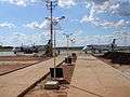
Gallery

gollark: <@!341618941317349376>
gollark: ~~cough Rust~~
gollark: It pushes ME to run away!
gollark: ?star stats <@!258639553357676545>
gollark: Always blame C++.
See also
References
- "Aeródromos". ANAC (in Portuguese). 22 August 2019. Retrieved 11 July 2020.
External links
- Airport information for SWGN at World Aero Data. Data current as of October 2006.Source: DAFIF.
- Airport information for SWGN at Great Circle Mapper. Source: DAFIF (effective October 2006).
- Current weather for SWGN at NOAA/NWS
- Accident history for AUX at Aviation Safety Network
This article is issued from Wikipedia. The text is licensed under Creative Commons - Attribution - Sharealike. Additional terms may apply for the media files.