Anupgarh Tehsil
Anupgarh Tehsil is the one of ten tehsils of Sri Ganganagar District in Rajasthan, India. The tehsil headquarters are located at the town of Anupgarh.
Anupgarh Tehsil | |
|---|---|
Tehsil | |
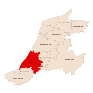 Map of Sri Ganganagar District with Anupgarh Tehsil highlighted | |
| Country | India |
| State | Rajasthan |
| District | Sri Ganganagar |
| Headquarters | Anupgarh |
| Population (2011)[1] | |
| • Tehsil | 184,423 |
| • Urban | 30,877 |
| • Rural | 153,546 |
Demographics
People have migrated from other tehsils of Sri Gangagnagar district, and from Bikaner, Punjab and Haryana. Hinduism (Jaatism) and Sikhism are practised by the majority of people. Islam is a third important religion.
As of the Census of India 2011, Anupgarh Tehsil had 184,423 residents, with 153,546 (83.26%) people living in rural areas and 30,877 (16.74%) people living in urban areas. The 2001 census counted a total of 174,413 residents.[1]
Geography
Anupgarh Tehsil is located in the southern part of Sri Ganganagar District.
Adjacent tehsils
- Raisinghnagar Tehsil (north)
- Vijaynagar Tehsil (east)
- Gharsana Tehsil (southwest)
- Chhatargarh Tehsil, Bikaner District (southeast)
- Haroonabad Tehsil, Bahawalnagar District, Punjab, Pakistan (northwest)
- Fort Abbas Tehsil, Bahawalnagar District, Punjab, Pakistan (southwest)
Physical geography
The northern portion of the tehsil is part of the Nali region, a central area of the Sri Ganganagar District characterized by the flow of the Ghaggar River. The terrain of the southern portion of the tehsil can be characterized by sand dunes. This portion is being irrigated by branches of the Indira Gandhi Canal Project.[1]
Languages
Hindi is the official language. Bagri, a dialect of the Rajasthani language, and Punjabi languages are spoken by the majority of people. Sindhi and Sikh Bawri are also spoken by a few people. Odh and Bawri people speak their unique languages.
Transport
Almost all big villages are connected with roads. Anupgarh and Ramsinghpur are connected with a railway line in this tehsil.
Settlements
Major towns and villages within the tehsil include:
- Anupgarh
- Ramsinghpur (59Gb)
- 11L.M.
- Patroda
- 27 A
- 80Gb
- 74Gb
- KHALL (4 KAM)
References
- "Rajasthan District Census Handbook: Ganganagar" (PDF). Census of India. 2011.