Andaç, Uludere
Andaç (historically Alamon)[1] is a village in the district of Uludere in Şırnak Province, in southeastern Turkey.[2] The village is around 48 kilometres (30 mi) away from the district of Uludere and it is located in southeastern Turkey, just on the western border of the Hakkari province. The village was historically populated by Assyrians and populated by Kurds from the Jirki tribe today.[3]
Andaç | |
|---|---|
Village | |
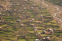 The village in springtime. | |
 Andaç Location in Turkey | |
| Coordinates: 37°21′22″N 43°15′38″E | |
| Country | |
| Province | Şırnak |
| District | Uludere |
| Government | |
| • Headman | Edis İzettin |
| Elevation | 1,330 m (4,360 ft) |
| Population (2012) | |
| • Total | 2,960 |
| Time zone | UTC+2 (EET) |
| • Summer (DST) | UTC+3 (EEST) |
| Area code(s) | 0482 |
| Licence plate | 47 |
History
The village was destroyed by the Ottoman Army in June 1915,[4] and later rebuilt and populated by Kurds.[3]
gollark: It's still subjective even if people agree on it a lot!
gollark: WRONG!
gollark: You talk about subjective things, and then tell everyone that citing some source on them means they're somehow objective.
gollark: Rewrite potatOS in Lua bytecode.
gollark: no.
References
- Nişanyan, Sevan (2010). Adını unutan ülke: Türkiye'de adı değiştirilen yerler sözlüğü (in Turkish). p. 294.
- https://www.yerelnet.org.tr/koyler/koy.php?koyid=266339
- Aşiretler raporu (in Turkish). Kaynak Yayınları. 1998. p. 159.
- Yacoub, Joseph (2016). Year of the Sword: The Assyrian Christian Genocide, A History. Oxford University Press. p. 166. ISBN 9780190694630.
Andaç, Uludere in Şırnak Province of Turkey | |||||||||||||||||||||||||||
|---|---|---|---|---|---|---|---|---|---|---|---|---|---|---|---|---|---|---|---|---|---|---|---|---|---|---|---|
| Districts | 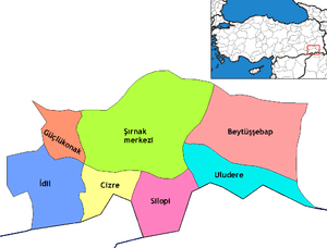 Districts of Şırnak | ||||||||||||||||||||||||||
| |||||||||||||||||||||||||||
Metropolitan municipalities are bolded. | |||||||||||||||||||||||||||
This article is issued from Wikipedia. The text is licensed under Creative Commons - Attribution - Sharealike. Additional terms may apply for the media files.