Akeld
Akeld is a village and civil parish in Northumberland, England.[1] It is situated to the west of Wooler, and in 2001 had a population of 82,[2] increasing at the 2011 Census to 221, although this was partly due to the parish merging with that of Kirknewton.[3] Its name is Anglo-Saxon Old English ac-helde, 'oak slope'.
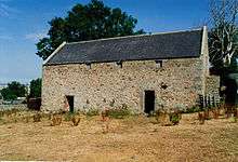
Akeld Bastle
| Akeld | |
|---|---|
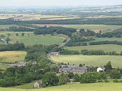 View over Akeld from the south | |
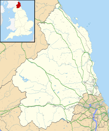 Akeld Location within Northumberland | |
| Population | 221 (2011 census(including Kirknewton)) |
| OS grid reference | NT955295 |
| Unitary authority | |
| Ceremonial county | |
| Region | |
| Country | England |
| Sovereign state | United Kingdom |
| Post town | WOOLER |
| Postcode district | NE71 |
| Dialling code | 01668 |
| Police | Northumbria |
| Fire | Northumberland |
| Ambulance | North East |
| UK Parliament | |
Akeld is dominated by the buildings of Akeld Manor and Country Club. To the south is Akeld Bastle, a sixteenth-century bastle house. Only the ground floor remains of the original building, the rest having been rebuilt in the eighteenth century.
History
From 1887 to 1930 the village was served by Akeld railway station.
Governance
Akeld is in the parliamentary constituency of Berwick-upon-Tweed.
gollark: Unfortunately, unlike our superior silicon overlords I need sleep.
gollark: * working
gollark: However, I would have to turn off said expensive server when not worknig.
gollark: Ideatic!
gollark: I could rent extremely expensive cloud GPU servers for that much.
References
- Local history Archived 2007-08-26 at the Wayback Machine
- "Census 2001". Archived from the original on 13 June 2011. Retrieved 31 January 2009.
- "Parish population 2011". Retrieved 3 July 2015.
This article is issued from Wikipedia. The text is licensed under Creative Commons - Attribution - Sharealike. Additional terms may apply for the media files.