Atchutapuram
Atchutapuram is a neighbourhood in Visakhapatnam district, located in the Indian state of Andhra Pradesh.[1]
Atchutapuram | |
|---|---|
Neighbourhood | |
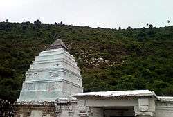 Dharapalem Temple is near to Atchutapuram | |
.svg.png) Atchutapuram Location in Andhra Pradesh, India  Atchutapuram Atchutapuram (India) | |
| Coordinates: 17°33′42″N 82°58′28″E | |
| Country | India |
| State | Andhra Pradesh |
| District | Visakhapatnam |
| Languages | |
| • Official | Telugu |
| Time zone | UTC+5:30 (IST) |
| Vehicle registration | AP |
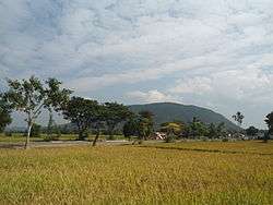
Paddy Fields at Kondakarla in Achutapuram mandal
Transport
- APSRTC routes
| Route Number | Start | End | Via |
|---|---|---|---|
| 500A | Atchutapuram | RTC Complex | Anakapalle, Lankelapalem, Kurmannaplem, Old Gajuwaka, BHPV, Airport, NAD Kotharoad, Birla Junction, Gurudwar |
| 777 | Atchutapuram | RTC Complex | Anakapalle, Lankelapalem, Kurmannaplem, Old Gajuwaka, BHPV, Airport, NAD Kotharoad, Birla Junction, Gurudwar |
| 568 | Brandix | Simhachalam | Atchutapuram, Anakapalle, Sankaram, Sabbavaram, Pinagadi, Vepagunta |
gollark: Do you know when the argument occured?
gollark: That information requires POTAT-O3 clearance.
gollark: Initiating APIOSEARCH™.
gollark: https://discord.com/channels/346530916832903169/348702212110680064/757264289965932645 is a *minor* argument I found.
gollark: Regarding what?
References
- "Mandal wise list of villages in Visakhapatnam district" (PDF). Chief Commissioner of Land Administration. National Informatics Centre. Archived from the original (PDF) on 19 March 2015. Retrieved 6 March 2016.
This article is issued from Wikipedia. The text is licensed under Creative Commons - Attribution - Sharealike. Additional terms may apply for the media files.