526 Antioch earthquake
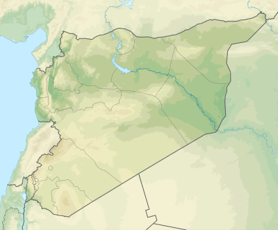
The 526 Antioch earthquake hit Syria (region) and Antioch in the Byzantine Empire in 526. It struck during late May, probably between 20–29 May, at mid-morning, killing approximately 250,000 people.[3] The earthquake was followed by a fire that destroyed most of the buildings left standing by the earthquake. The maximum intensity in Antioch is estimated to be between VIII (Severe) and IX (Violent) on the Mercalli intensity scale.
 | |
| Local date | probably 20–29 May 526 |
|---|---|
| Local time | Mid-morning |
| Magnitude | 7.0 Ms[1] |
| Epicenter | 36.23°N 36.12°E[2] |
| Areas affected | Byzantine Empire (now Turkey and Syria) |
| Max. intensity | VIII–IX |
| Casualties | ~250,000 |
Tectonic setting
The site of Antioch lies close to the complex triple junction between the northern end of the Dead Sea Transform, the mainly transform boundary between the African Plate and the Arabian Plate, the southwestern end of the East Anatolian Fault, the mainly transform boundary between the Anatolian Plate and the Arabian Plate, and the northeastern end of the Cyprus Arc, the boundary between the Anatolian and African Plates. The city lies on the Antakya Basin, part of the Amik Basin, filled by Pliocene to recent alluvial sediments. The area has been affected by many large earthquakes during the last 2,000 years.[4]
Earthquake
The estimated magnitude for the earthquake is 7.0 on the surface wave magnitude scale.[1] It was followed by 18 months of aftershocks.[3] Intensity estimates on the Mercalli scale are: VIII–IX for Antioch;[1][3] VII for both Daphne, a suburb of Antioch, and the port town of Seleucia Pieria.
Damage
The earthquake caused severe damage to many of the buildings in Antioch, including Constantine's great octagonal church Domus Aurea built on an island in the Orontes River. Only houses built close to the mountain are said to have survived. Most of the damage however, was a result of the fires that went on for many days in the immediate aftermath of the earthquake, made worse by the wind.[3] The Great Church was destroyed by the fire seven days after the earthquake.[3] Amongst the many victims was Euphrasius, the Patriarch of Antioch, who died by falling into a cauldron of pitch being used by wineskin makers, with only his head remaining unburnt.[5]
In the port of Seleucia Pieria an uplift of 0.7–0.8 m has been estimated, and the subsequent silting up of the harbour left it unusable.[6]
Estimates of the death toll for this earthquake vary between 250,000 and 300,000, with 250,000 being the most commonly reported.[3] It has been suggested that the very high number of casualties was a result of there being a large number of visitors in the city from the surrounding countryside, there to celebrate Ascension Day.[7]
Aftermath
In Constantinople, Justin I reportedly reacted to the news of the earthquake by removing his diadem and crimson chlamys. He entered the church without these symbols of his rank and publicly lamented the destruction of Antioch. He arranged for ambassadors to be sent to the city with sufficient money for both immediate relief and to start Antioch's reconstruction.[7] The rebuilding of the Great Church and many other buildings was overseen by Ephraim, the comes Orientis, whose efforts saw him replace Euphrasius as the Chalcedonian Patriarch of Antioch.[8][9] Many of the buildings erected after the earthquake were destroyed by another major earthquake in November 528, although there were far fewer casualties.[3]
See also
References
- National Geophysical Data Center. "Comments for the Significant Earthquake". Retrieved 22 September 2011.
- Online catalogue of strong earthquakes in Italy 461 BC to 1997 and Mediterranean area 760 BC to 1500
- Sbeinati, M.R.; Darawcheh, R. & Mouty, M. (2005). "The historical earthquakes of Syria: an analysis of large and moderate earthquakes from 1365 B.C. to 1900 A.D." (PDF). Annals of Geophysics. 48 (3): 347–435. Retrieved 22 September 2011.
- Çaktı, E.; Bikçe M.; Özel O.; Geneş C.; Kaçın S. & Kaya Y. (2011). "Antakya Basin Strong Ground Motion Network" (PDF). Retrieved 22 September 2011.
- Witakowski, W. (1996). Chronicle: known also as the Chronicle of Zuqnin, Part 3. Translated texts for historians. 22. Liverpool University Press. pp. 46–47. ISBN 978-0-85323-760-0.
- Erol, O. & Pirazzoli, P.A. 2007. Seleucia Pieria: an ancient harbour submitted to two successive uplifts. International Journal of Nautical Archaeology, 21, 317–327.
- Meier, M. (2007). "Natural Disasters in the Chronographia ofJohn Malalas : Reflections on their Function --An Initial Sketch". The Medieval History Journal. 10 (1–2): 237–266. CiteSeerX 10.1.1.1025.7374. doi:10.1177/097194580701000209.
- Martindale, J.R. (1980). The Prosopography of the Later Roman Empire. Prosopography of the Later Roman Empire. 2. Cambridge University Press. p. 395. ISBN 978-0-521-20159-9.
- Andrade, N.J. (2009). "The Syriac life of John of Tella and the frontier Politeia" (PDF). Hugoye: Journal of Syriac Studies. 12 (2): 199–234. Archived from the original (PDF) on 27 September 2011. Retrieved 22 September 2011.