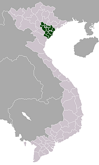
Ứng Hòa District
Ứng Hòa is a southern district (huyện) of Hanoi in the Red River Delta region of Vietnam. The River Đáy forms much of the western boundary with Mỹ Đức District. It covers an area of 183.72 square kilometres (70.93 sq mi), and as of 2005 it had a population of 193,731 people. It has 28 communes and one town.[1]
Ứng Hòa District Huyện Ứng Hòa | |
|---|---|
 Map of Ứng Hòa District | |
 Ứng Hòa District Map of Ứng Hòa District | |
| Coordinates: 20°56′12″N 105°50′35″E | |
| Country | |
| Province | Hanoi |
| Number of towns | 1 |
| Number of communes | 28 |
| Area | |
| • Total | 183.72 km2 (70.93 sq mi) |
| Population (2005) | |
| • Total | 193,731 |
| Time zone | UTC+7 (ICT) |
Administrative divisions
The district contains the following subdivisions:[1]
- Vân Đình (town)
Communes:
- Đại Hùng
- Đồng Tân
- Hòa Lâm
- Hòa Xá
- Liên Bạt
- Phù Lưu
- Sơn Công
- Trung Tú
- Viên An
- Cao Thành
- Đội Bình
- Đồng Tiến
- Hòa Nam
- Hồng Quang
- Lưu Hoàng
- Phương Tú
- Tảo Dương Văn
- Trường Thịnh
- Viên Nội
- Đại Cường
- Đông Lỗ
- Hoa Sơn
- Hòa Phú
- Kim Đường
- Minh Đức
- Quảng Phú Cầu
- Trầm Lộng
- Vạn Thá
gollark: Well, if you have multiple stats and they interact in certain ways you can do it.
gollark: I am not certain of context, but you can probably arrange the goodness of things such that X beats Y, Y beats Z, but Z beats X.
gollark: I added 4 bismuth emojis to heavserver.
gollark: Precisely.
gollark: We only have two.
References
- "Ứng Hòa" (in Vietnamese). Hanoi.gov.vn. Retrieved 15 August 2014.

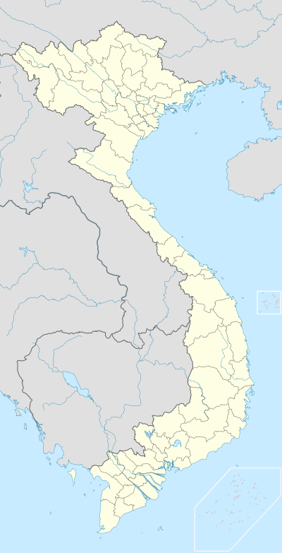
Districts of the Red River Delta | ||
|---|---|---|
| Hanoi city |
|  |
| Haiphong city |
| |
| Bắc Ninh Province | ||
| Hà Nam Province | ||
| Hải Dương Province |
| |
| Hưng Yên Province | ||
| Nam Định Province | ||
| Ninh Bình Province | ||
| Thái Bình Province | ||
| Vĩnh Phúc Province |
| |
※ denotes provincial seat. | ||
This article is issued from Wikipedia. The text is licensed under Creative Commons - Attribution - Sharealike. Additional terms may apply for the media files.