Yaremche
Yaremche (Ukrainian: Яремчe, Polish: Jaremcze or Jaremcza) is a city in Ivano-Frankivsk Oblast (province) of west Ukraine. It is administratively incorporated as a town of oblast significance and is the center of Yaremche Municipality which includes the urban-type settlement of Vorokhta, a ski resort, and five other villages: Mykulychyn, Polianytsia, Tatariv, Voronenko, and Yablunytsia.[1] The city is located at the altitude of around 580 metres (1,900 ft) above mean sea level. Population: 8,208 (2016 est.)[2]. The total population of the whole municipality is 23,127 with 12,478 living in Yaremche and Vorokhta.
Yaremche Яремчe Jaremcze | |
|---|---|
City | |
 | |
 Flag  Coat of arms | |
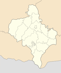 Yaremche Location of Yaremche, Ukraine 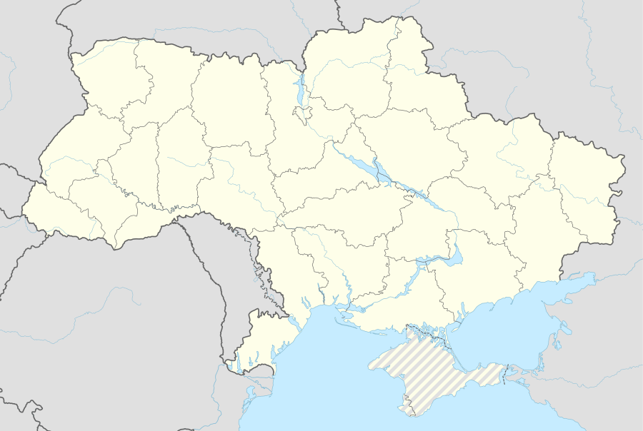 Yaremche Yaremche (Ukraine) | |
| Coordinates: 48°27′37″N 24°33′31″E | |
| Country | |
| Oblast | |
| Raion | Yaremche Municipality |
| Established | 1787 |
| Area | |
| • Total | 657 km2 (254 sq mi) |
| Elevation | 585 m (1,919 ft) |
| Population (2016) | |
| • Total | 8,208 |
| • Density | 12/km2 (32/sq mi) |
| Time zone | UTC+2 (EET) |
| • Summer (DST) | UTC+3 (EEST) |
| Postal index | 78500 |
| Area code | +380-3434 |
Yaremche hosts the headquarters of the nearby Carpathian National Nature Park.
History
| Year | Pop. | ±% |
|---|---|---|
| 2007 | 11,926 | — |
| 2008 | 11,956 | +0.3% |
| 2009 | 12,007 | +0.4% |
| 2010 | 12,091 | +0.7% |
| 2016 | 12,478 | +3.2% |
| Note: Population of Vorokhta included 2010 data is valid thru October Source: Regional Statistics Office | ||
A possible root of the word "Yaremche" comes from the Turkish. In Turkic languages "yarım" means "half" and "yarımca" means "little half".[3] It was founded in 1787 and received city status on December 30, 1977. In the interwar period (1918–1939) it belonged to Poland and was the most popular tourist center in eastern part of the Carpathian Mountains (in the late 1920s more than 6 000 guests came there yearly). Yaremche was growing year by year in importance and number of tourists. According to some, it had the chance to achieve same importance as other key Polish mountain spas, Zakopane and Krynica. However, in September 1939 it was captured by Soviet troops and became a part of Soviet Union as part of the Ukrainian SSR. During the World War II it was part of the Distrikt Galizien and was liberated by the Soviet forces in 1944. On December 30, 1977, the city of Yaremcha became a municipality within Ivano-Frankivsk Oblast. Since 1991 it has been a part of independent Ukraine.
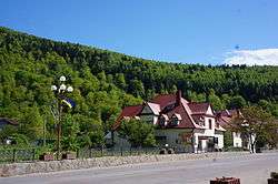
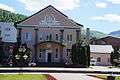
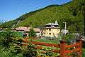
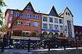
There are a number of interesting houses with long sloping roofs. There is a wooden Orthodox church and an impressive rail viaduct, located over the Prut valley at the height of 30 meters (98 feet). Next to this there is a swinging pedestrian toll bridge.
On December 14, 2006, the Parliament of Ukraine, officially renamed the city from Yaremcha to "Yaremche". The decision was based on the results of a city referendum, as well as the recommendations of City Council, and Ivano-Frankivsk Oblast Council.
Gallery

.jpg) Greek-Catholic church
Greek-Catholic church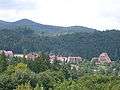 Panorama
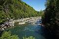 Prut river in Yaremche
Location
- Local orientation
Places adjacent to Yaremche | ||||||||||
|---|---|---|---|---|---|---|---|---|---|---|
| ||||||||||
- Regional orientation
Places adjacent to Yaremche | |
|---|---|
References
- Yaremche at Verkhovna Rada web-site
- "Чисельність наявного населення України (Actual population of Ukraine)" (PDF) (in Ukrainian). State Statistics Service of Ukraine. Retrieved 19 July 2016.
External links
| Wikimedia Commons has media related to Yaremche. |
- The Parliament renamed Yaremcha
- Yaremche - photographs
- Yaremche
| Cities | Coat of arms of Yaremche Municipality | |
|---|---|---|
| Settlements | ||
| Raions | |||||
|---|---|---|---|---|---|
| Hromadas | |||||
| Cities |
| ||||
| |||||