Ivano-Frankivsk
Ivano-Frankivsk (Ukrainian: Іва́но-Франкі́вськ [iˈwɑno frɐnˈkiu̯sʲk] (![]()
Ivano-Frankivsk Івано-Франківськ Stanisławów | |
|---|---|
      | |
 Flag | |
| Nickname(s): Franyk (Франик) | |
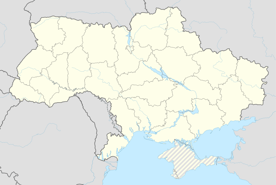 Ivano-Frankivsk Location of Ivano-Frankivsk 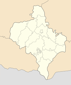 Ivano-Frankivsk Ivano-Frankivsk (Ivano-Frankivsk Oblast) | |
| Coordinates: 48°55′22″N 24°42′38″E | |
| Country | |
| Oblast | |
| Established | 1663 |
| Subdivisions | List
|
| Government | |
| • Mayor | Ruslan Martsinkiv (Svoboda)[1] |
| Area | |
| • Total | 119.73 km2 (46.23 sq mi) |
| Elevation | 244 m (801 ft) |
| Population (2016) | |
| • Total | 230,929 |
| • Density | 1,900/km2 (5,000/sq mi) |
| Time zone | UTC+2 (EET) |
| • Summer (DST) | UTC+3 (EEST) |
| Postal code | 76000–76030 |
| Area code | +380 342 |
| Website | mvk |

Built in the mid-17th century as a fortress of the Polish Potocki family, Stanisławów was annexed to the Habsburg Empire during the First Partition of Poland in 1772, after which it became the property of the State within the Austrian Empire. The fortress was slowly transformed into one of the most prominent cities at the foothills of the Carpathian Mountains. After World War I, for several months, it served as a temporary capital of the West Ukrainian People's Republic. Following Peace of Riga, Stanisławów became part of the Second Polish Republic. After the Soviet invasion of Poland at the onset of World War II, the city was annexed by the Soviet Union, only to be occupied by Nazi Germany two years later. With the liberation of Soviet Ukraine in 1944 and the shifting of borders, the Communist regime ran the city for the next four-and-a-half decades. A few years before the fall of the Soviet Union, the blue-yellow flag was raised in the city as the symbol of an independent Ukraine.
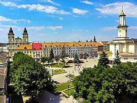
A city visitor may find elements of various cultures intertwined within Ivano-Frankivsk, the Polish city hall, the Austro-Hungarian city's business center, the Soviet prefabricated apartment blocks at the city's rural–urban fringe, and others. Ivano-Frankivsk is also one of the principal cities of the Carpathian Euroregion.
Name
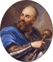
Stanisławów was founded as a fortress and was named after the Polish hetman Stanisław "Rewera" Potocki.[5][6] Some sources claim it was named after his grandson Stanisław.[7] Following the First Partition of Poland in 1772, the name was transliterated as Stanislau in German, as the city became part of the Austrian Empire (future Austria-Hungary); however, after the revolution of 1848, the city carried three different linguistic renderings of its name: German, Polish, and Ruthenian (German: Stanislau, pronounced [ˈʃtaːnɪslaʊ]; Polish: Stanisławów, pronounced [staɲiˈswavuf]; Ukrainian: Станісла́вів Stanislaviv, pronounced [stɐn⁽ʲ⁾iˈslɑwiu̯], or Станиславiв[8] Stanyslaviv, pronounced [stɐnɪˈslɑwiu̯]). Other spellings used in the local press media included Russian: Станиславов and Yiddish: סטאַניסלאוו.
After World War II it was changed by the Soviet authorities into a simplified version Stanislav (Ukrainian: Станісла́в, pronounced [stɐn⁽ʲ⁾iˈslɑu̯]; Russian: Станисла́в, pronounced [stənʲɪˈslaf]). In 1962, on the city's 300th anniversary, it was renamed to honor the Ukrainian writer Ivan Franko. Due to the city's wordy name, unofficially it is sometimes called simply Franyk (Франик)[9] by its residents. Even though Ivano-Frankivsk is the officially accepted name, the city's original name has never been fully abandoned and/or forgotten and can be found throughout the city in all kinds of variations.
The name of the city was altered several times through the centuries. It was founded as Stanisławów; but in 1772 transliteration changed to Stanislau, in 1919 to Stanislaviv and again to Stanisławów. In 1939 transliteration changed to Stanislav, in 1941 to Stanislau, in 1944 again to Stanislav. And finally, on November 9, 1962, the name was officially changed by the First Secretary Nikita Khrushchev, reportedly as an honour to poet Ivan Franko.
History
.jpg)
The town of Stanisławów was founded as a fortress in order to protect the Polish–Lithuanian Commonwealth from Tatar invasions and to defend the multi-ethnic population of the region in case of armed conflicts such as the Khmelnytsky Uprising of 1648. The fort was originally built next to Zabolotiv village (known since 1435),[10] and Knyahynyn (1449).[7] The village of Zabolotiv and the land around it were purchased by Andrzej Potocki from another Polish nobleman, Rzeczkowski. Stanisławów was issued by Potocki and his declaration establishing the city with Magdeburg rights on May 7, 1662; but the city and its rights, however, were not recognized by the Polish Crown until August 14, 1663, when John Casimir had finally approved it. By 1672, the fortress had been rebuilt from wood to stone, brick, and mortar. Also a new large fortified Potocki palace was erected in the place of an older wood structure. Today this building serves as the military hospital. In the same year Jews were granted the right to become permanent residents, who could work, conduct commerce and travel in and out of the city as they pleased.[11]
Originally the city was divided into two districts: Tysmenytsia and Halych. Sometime in 1817–1819 the neighbouring village of Zabolottya, that had a special status, was incorporated into the city as a new district, while Tysmenytsia district was divided into Tysmenytsia and Lysets districts. Each district had its main street corresponded with its name: Halych Street (Halych district), Tysmenytsia Street which today is Independence Street (Tysmenytsia district), Zabolotiv Street – Mykhailo Hrushevsky Street and Street of Vasylyanok (Zabolottya district), and Lysets Street – Hetman Mazepa Street (Lysets district). Later the city was split into six small districts: midtown where the rich Catholic population and patricians lived, pidzamche (subcastle), and four suburbs – Zabolotiv, Tysmenytsia, Halych and Lysets where the plebeians lived.[12]
In October 1918, the Austro-Hungarian Empire collapsed and the Western Ukrainian People's Republic (ZUNR) was proclaimed.[13] In the early months of 1919 (from January to May) the city became a temporary capital of the West Ukrainian National Republic, while still recovering from World War I. All state affairs took place in the building of Dnister Hotel where the Act Zluky (Unification Act) was composed and signed on January 22, 1919 by the Ukrainian People's Republic.[14][15] The same year it was subjected to the Polish–Ukrainian and the Romanian-Ukrainian skirmishes eventually being annexed by Poland as part of the Second Polish Republic as the centre of the Stanisławów Voivodeship. It was occupied by the Romanian army for the summer months from May 25 through August 21, 1919. During the Polish–Soviet War in 1920, the Red Army took over the city for a brief period. After the Soviet retreat, Ukrainian troops loyal to Symon Petlura occupied the city for a few days. At this period of history the city was in complete disorder.[16]
In the 1939 invasion of Poland by German and Soviet forces, the territory was captured by the Soviets in September 1939 and included into the Ukrainian SSR. Between September 1939 and June 1941, the Soviet regime ordered thousands of inhabitants of the city to leave their houses and move to Siberia, where most of them perished. Numerous people were taken out of the city prison and simply shot outside of the city when Soviet forces were leaving it in 1941. Ivano-Frankivsk was occupied by German forces from July 2, 1941 to July 27, 1944. There were more than 40,000 Jews in Stanisławów when it was occupied by the Nazi Germany on July 26, 1941. During the occupation (1941–44), more than 600 educated Poles and most of the city's Jewish population were murdered.[17][18]
In early 1944, the city became part of the Soviet Union and was renamed 'Stanislav'. The Soviets forced most of the Polish population to leave the city, most of them settled in the Recovered Territories. During the post-war period the city was part of the Carpathian Military District housing the 38th Army (70th Motor Rifle Division) that participated in the Operation Dunai.
Timeline
- 1650–1662: establishing a private fortress of Potocki and seeking the Magdeburg rights
- 1662–1772: Stanisławów, Polish–Lithuanian Commonwealth (within the Kingdom of Poland),
- 1772–1815: Stanislau, Austrian Monarchy (within the Kingdom of Galicia and Lodomeria),
- 1815–1918: Stanislau, Austrian Empire, then Austria–Hungary,
- November 1918 – May 1919: Stanyslaviv, West Ukrainian People's Republic,
- May 1919 – September 1939: Stanisławów, Poland, seat of the Stanisławów Voivodeship,
- October 1939 – June 1941: Stanyslaviv, Ukrainian Soviet Socialist Republic,
- July 1941 – August 1944: Stanislau, seat of the Stanislau Kreis, District of Galicia, General Government,
- August 1944 – November 9, 1962: Stanislav,
- November 9, 1962: renamed as Ivano-Frankivsk, oblast seat, Ukrainian SSR,
- Post–1991: Ivano-Frankivsk, independent Ukraine.
Climate and geography
As is the case with most of Ukraine, the climate is moderate continental with warm summers, and fairly cold winters. The following climate data provided is for the past 62 years. The average number of days with precipitation is 170 spread almost equally throughout a year. Most precipitation takes place during the winter months and least – early fall. Thunderstorms occur mostly in summer months averaging around 25 annually.[19] Ivano-Frankivsk averages about 296 days of fog or misty days with about 24 per month.[19]
| Climate data for Ivano-Frankivsk (1981–2010, extremes 1948–present) | |||||||||||||
|---|---|---|---|---|---|---|---|---|---|---|---|---|---|
| Month | Jan | Feb | Mar | Apr | May | Jun | Jul | Aug | Sep | Oct | Nov | Dec | Year |
| Record high °C (°F) | 16.1 (61.0) |
20.9 (69.6) |
26.0 (78.8) |
30.4 (86.7) |
32.2 (90.0) |
33.9 (93.0) |
37.1 (98.8) |
37.2 (99.0) |
36.3 (97.3) |
28.4 (83.1) |
22.1 (71.8) |
19.1 (66.4) |
37.2 (99.0) |
| Average high °C (°F) | 0.5 (32.9) |
2.3 (36.1) |
7.2 (45.0) |
14.4 (57.9) |
20.3 (68.5) |
22.8 (73.0) |
25.0 (77.0) |
24.4 (75.9) |
19.4 (66.9) |
13.7 (56.7) |
6.4 (43.5) |
1.2 (34.2) |
13.1 (55.6) |
| Daily mean °C (°F) | −3.3 (26.1) |
−2.1 (28.2) |
2.2 (36.0) |
8.5 (47.3) |
14.0 (57.2) |
17.0 (62.6) |
19.0 (66.2) |
18.2 (64.8) |
13.4 (56.1) |
8.1 (46.6) |
2.4 (36.3) |
−2.2 (28.0) |
7.9 (46.2) |
| Average low °C (°F) | −7.0 (19.4) |
−5.9 (21.4) |
−2.1 (28.2) |
3.2 (37.8) |
8.2 (46.8) |
11.6 (52.9) |
13.6 (56.5) |
12.8 (55.0) |
8.4 (47.1) |
3.6 (38.5) |
−1.1 (30.0) |
−5.4 (22.3) |
3.3 (37.9) |
| Record low °C (°F) | −33.9 (−29.0) |
−32.5 (−26.5) |
−26.1 (−15.0) |
−11.1 (12.0) |
−3.9 (25.0) |
0.0 (32.0) |
3.9 (39.0) |
3.4 (38.1) |
−4.0 (24.8) |
−14.2 (6.4) |
−18.7 (−1.7) |
−35.7 (−32.3) |
−35.7 (−32.3) |
| Average precipitation mm (inches) | 27 (1.1) |
32 (1.3) |
36 (1.4) |
49 (1.9) |
75 (3.0) |
88 (3.5) |
91 (3.6) |
74 (2.9) |
63 (2.5) |
42 (1.7) |
33 (1.3) |
36 (1.4) |
644 (25.4) |
| Average precipitation days | 19.6 | 18.0 | 18.4 | 13.1 | 13.6 | 13.2 | 11.3 | 8.7 | 11.4 | 11.7 | 13.8 | 17.7 | 170.5 |
| Average snowy days | 14 | 13 | 9 | 3 | 0 | 0 | 0 | 0 | 0 | 1 | 7 | 13 | 60 |
| Average relative humidity (%) | 83.4 | 80.5 | 74.9 | 68.0 | 70.2 | 73.2 | 74.6 | 75.4 | 78.5 | 80.9 | 84.8 | 86.6 | 77.6 |
| Source 1: Pogoda.ru.net[20] | |||||||||||||
| Source 2: Climatebase.ru(humidity and precipitation days),[21] Weatherbase (snow days)[19] | |||||||||||||
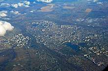
The city is situated in the Carpathian region northeast of the mountain range, sitting approximately 120 metres (390 ft) above mean sea level.[22] One of the several main geographical features is the Vovchynets Hill also known as the Vovchynets Mountains. The hill reaches 300-350 metres (1,150 ft) above the sea level and is part of the Pokuttya Highland (Upland). Around the hill Bystrytsia River branches into Bystrytsia of Nadvirna, Bystrytsia of Solotvyn, and Vorona. The last two rivers serve as a natural border between the Pokuttya Highland and Stanislav Basin. The Vovchynets Hill is located just outside and northeast of Ivano-Frankivsk. Located southeast from the Stanislav Basin in the direction of the Prut Valley is the Khorosnen (Prut-Bystrytsia) Highland. The highest point of that highland is Mount Hostra, 425 metres (1,394 ft).
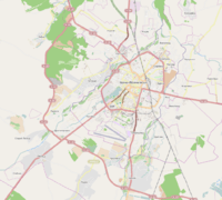
The closest neighboring city is Tysmenytsia, less than 10 kilometres (6.2 mi) to the east. Other cities that lie in the radius of 25 to 30 km (16 to 19 mi) are Tlumach (east), Nadvirna (south), Kalush (west), and Halych (north). The city also administers five adjacent villages that surround it: Mykytyntsi, Krykhivtsi, Vovchynets, Uhornyky, and Khryplyn.
Population and demographics
| Year | Pop. | ±% |
|---|---|---|
| 1732 | 3,300 | — |
| 1792 | 5,448 | +65.1% |
| 1849 | 11,000 | +101.9% |
| 1869* | 14,786 | +34.4% |
| 1880 | 18,626 | +26.0% |
| 1900* | 27,012 | +45.0% |
| 1910* | 29,850 | +10.5% |
| 1914 | 64,000 | +114.4% |
| 1921 | 51,391 | −19.7% |
| 1931 | 60,626 | +18.0% |
| 2007 | 222,538 | +267.1% |
| 2008 | 223,634 | +0.5% |
| 2009 | 224,401 | +0.3% |
| 2012 | 242,549 | +8.1% |
| 2017 | 255,100 | +5.2% |
Note: Historical population record is taken out of Ivano-Frankivsk portal,[23] more recent – the Regional Directorate of Statistics.[24] There is also other information on a population growth such as the JewishGen.[25] With asterisk there are identified years of approximate data. In the 18th century, differentiation among Poles and Ukrainians was by religious background rather than ethnic (Catholics vs. Orthodox).
|
|
|
|
|
|
|
Administration
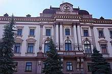
Both city and oblast administrations as well as the regional council are all located in a massive white building on Hrushevsky Street locally known as Bily Dim or Bily Budynok. In front of the building, there is a big open space bordered by Shpytalna Street on the north-east, Hrushevsky Street on the south-east, and Melnychuk Street on the south-west. Next to the building, there is a memorial to the Unification of the Western Ukraine with the rest of Ukraine. The main feature of the memorial is a tall marble stele, the both sides of which are adorned with statues: kamenyar (west) and kobzar (east).
City Council
The city council currently consists of 60 deputies. The political representation of the V convocation by political blocs was elected as such: Our Ukraine 22 (Our Ukraine 9, Rukh 8, United Centre 1, Industrialists and Entrepreneurs 2, no affiliation 2), BYuT 17 (Batkivschyna 14, USDP 2, no affiliation 1), Ukrainian People's Party 14 (UPP 3, CUN 1, United Centre 3, Sobor 1, no affiliation 6), Party of Regions 4 (Party of Regions 3, no affiliation 1), PORA 3 (PORA 2, no affiliation 1).
Recent city mayors
- Bohdan Borovych (OUN) July 1994 – June 1998
- Zinoviy Shkutiak (Our Ukraine) March 1998 – 26 March 2006
- Viktor Anushkevychus (UPP) 26 March 2006 – 2015
- Ruslan Martsinkiv (All-Ukrainian Union «Svoboda») 2015 - present
Streets
All street names[26] reflecting the city's Soviet or Russian past have been returned to their former names, or given new names of national historic importance, or other non-controversial names. For example, Gagarin Street (connecting the city with its suburbs) became Vovchynets Street, Suvorov Street is now Harbar Street, and Soviet Street is Independence Street.
_%D0%86%D0%B2%D0%B0%D0%BD%D0%BE-%D0%A4%D1%80%D0%B0%D0%BD%D0%BA%D1%96%D0%B2%D1%81%D1%8C%D0%BA_%D0%B2%D1%83%D0%BB._%D0%9D%D0%B5%D0%B7%D0%B0%D0%BB%D0%B5%D0%B6%D0%BD%D0%BE%D1%81%D1%82%D1%96%2C_4.JPG)
Around 100 other streets were renamed.
- Important transportation arteries
- Independence Street (vulytsya Nezalezhnosti) / Tysmenytsya Road (doroha Tysmenetska)
- Halych Road (vulytsya Halytska)
- Hetman Mazepa Street (vulytsya Hetmana Mazepy) / Krykhivtsi Road (doroha Krykhivetska)
- Yevhen Konovalets Road (vulytsya Yevhena Konovaltsya)
- Vovchynets Street (vulytsya Vovchynetska)
- Vasyl Stefanyk Shore Drive (naberezhna Vasylya Stefanyka)
City squares
The city has seven main city squares, four of them located in the "old town" part of the city.
- Viche Maidan
- Market Square
- Sheptytsky Square
- Pryvokzalna Square
- Mickiewicz Square (Mickiewicz Park)
- Liberation Square
- European Square
Rural-urban fringe districts
Like a lot of regional centers in Ukraine and the former Soviet Union, Ivano-Frankivsk is well known for its rural-urban fringe panel building residential districts, too.
- BAM
- Kaskad
- Positron
- Budivelnykiv
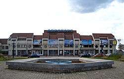
Transport
.jpg)
- Public transportation
The city of Ivano-Frankivsk has an extensive network of public transport including buses, trolleybuses, and taxis. There are nine trolleybus routes and about 52 for regular buses. Some of the routes run beyond the city into nearby villages.
- Railway transportation
There is one railway terminal that serves the Ivano-Frankivsk train station. There are also smaller railway stations in adjacent villages, including Uhryniv and Khryplyn. All of them are part of Lviv Railways.
- Bus transportation
Until 2008, the railway terminal also housed a bus terminal which provided several inter-city bus routes, including some to international destinations. In 2000, construction began on a new bus terminal next to the railway terminus on Zaliznychna Street. Inauguration of the new bus terminal took place on 22 May 2010. At the opening ceremony the Mayor of the city, Viktor Anushkevychus, noted that the new bus terminal was only partially completed, and for a period it would be necessary to offload passengers at the Pryvokzalna Square, which is already saturated with traffic. He also emphasised the need for another bus station on the outskirts of the city.[27]
- Airways transportation
The city is served by Ivano-Frankivsk International Airport, which was granted international status in 1992. The airport shares its facilities with the 114 Brigade of the Ukrainian Air Force. Since 2002, the airport has been leased to the private enterprise company Yavson, and from 2005 the Public limited company Naftokhimik Prykarpattia, a (subsidiary of Ukrnafta). The contract with Naftokhimik Prykarpattia expired in 2013.
- Lodging
There are many lodging options in Ivano-Frankivsk. Ivano-Frankivsk has one four-star hotel ("Park Hotel"[28]) and three three-star hotels ("Nadia",[29] "Auscoprut",[30] "Pid Templem"[31]).
Education
The city has over 25 public schools of general education for grades 1 through 11. There are also some privately owned schools and lyceums. In addition, the city has several professional public institutes.
There also numerous sports schools: Fitness Sport Association "Ukraine" – 5 schools, MVK – 3 schools, Fitness Sport Association "Spartak" – 2 schools, Fitness Sport Association "Kolos" – 1 school, and the others.
Universities
The city has six universities, the Ivano-Frankivsk Institute of Management that is a local campus of Ternopil National Economic University, and the Ivano-Frankivsk Institute of Management and Economics "Halytska Akademia". All of those universities are state funded.
- Vasyl Stefanyk Precarpathian National University
- Ivano-Frankivsk National Technical University of Oil and Gas (University of Oil and Gas)
- Ivano-Frankivsk National Medical University
- King Daniel of Galicia Ivano-Frankivsk University of Law
- Ivano-Frankivsk Theological Academy of Greek-Catholic Church
- West Ukrainian University of Economics and Law
Culture and sports
_%D0%86%D0%B2%D0%B0%D0%BD%D0%BE-%D0%A4%D1%80%D0%B0%D0%BD%D0%BA%D1%96%D0%B2%D1%81%D1%8C%D0%BA_%D0%9C%D0%B0%D0%B9%D0%B4%D0%B0%D0%BD_%D0%A8%D0%B5%D0%BF%D1%82%D0%B8%D1%86%D1%8C%D0%BA%D0%BE%D0%B3%D0%BE%2C_22.JPG)
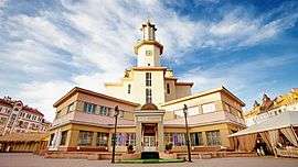
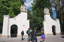
National landmarks
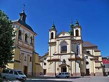
- the Church of the Holy Resurrection (Greek Catholic Cathedral),
- the Church of Virgin Mary (at the moment used as museum of Sacred Art of Galicia)
- Latin Collegiate
- the Armenian church (presently used by one of the Ukrainian Orthodox Churches).
- City Brewery
Other attractions
- Market Square with the city's old town hall, today hosting an ethno-cultural museum.
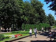
- Shevchenko Park, a big park that consists of an amusement park, a big lake with swans, couple of full-size football fields, and many other interesting places which are worth a visit.
- Bily Budynok, a big white building in the middle of the city and next to the Market place. It is the main administration building of Ivano-Frankivsk and Ivano-Frankivsk Oblast. In front of the building, there are two full-size sculptural monuments to Franko and Shevchenko.
- Bazaar, a huge area that covers the old market and the new market with a couple of supermarket stores locally known as the universal stores.
- 100 m (328.08 ft) stretch (stometrivka), unofficial local name for a part of Independence Street that consists of numerous shops and is restricted to pedestrian traffic only.
.jpg) The building of Church of Virgin Mary which is used for the Regional Art Museum
The building of Church of Virgin Mary which is used for the Regional Art Museum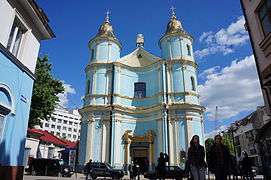 Former Armenian cathedral, which today belongs to Ukrainian Autocephalous Orthodox Church
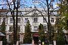
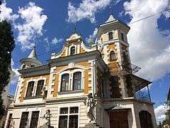 Old Villa
_%D0%86%D0%B2%D0%B0%D0%BD%D0%BE-%D0%A4%D1%80%D0%B0%D0%BD%D0%BA%D1%96%D0%B2%D1%81%D1%8C%D0%BA_%D0%B2%D1%83%D0%BB._%D0%A1._%D0%93%D0%BE%D1%80%D0%B4%D0%B8%D0%BD%D1%81%D1%8C%D0%BA%D0%BE%D0%B3%D0%BE%2C_20.JPG) Ave Maria Church
Ave Maria Church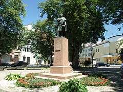 Adam Mickiewicz Monument
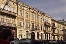
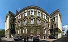
Architecture
- Stanislav fortress compound and Potocki palace
- Cathedral of the Holy Resurrection, locally known as Katedra (Greek-Catholic Cathedral)
- Jesuit Kostel, the second building of Jesuits after they were forced to surrender Katedra
- Fara, also known as the Collegiate Church of Virgin Mary and Saint Stanislaus (today – the Regional Art Museum)
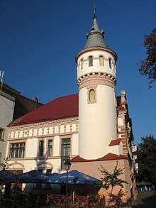
- Ratusha, a former city hall
- Battle of Grunwald monument – commemorating the victory of the Poland on Grunwald fields in 1410.
- Monument to Adam Mickiewicz (1930) – it was reconstructed in 1989, located in Adam Mickiewicz Square next to a regional concert (philharmonic) hall. It is the oldest surviving monument in the city and was built on 20 November 1898 (sculptor Tadeusz Błotnicki).
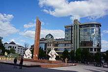
- Monument to Stepan Bandera and Museum of the Insurgent Army in European Square were awarded the best architectural project of 2007 designed by a local architecture company "Atelie Arkhitektury"[32]
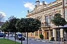
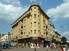
_%D0%86%D0%B2%D0%B0%D0%BD%D0%BE-%D0%A4%D1%80%D0%B0%D0%BD%D0%BA%D1%96%D0%B2%D1%81%D1%8C%D0%BA_%D0%B2%D1%83%D0%BB._%D0%9D%D0%B5%D0%B7%D0%B0%D0%BB%D0%B5%D0%B6%D0%BD%D0%BE%D1%81%D1%82%D1%96._19.JPG) A Historic Building (1897) in so-called 'Banking Quarter'
A Historic Building (1897) in so-called 'Banking Quarter'_%D0%86%D0%B2%D0%B0%D0%BD%D0%BE-%D0%A4%D1%80%D0%B0%D0%BD%D0%BA%D1%96%D0%B2%D1%81%D1%8C%D0%BA_%D0%B2%D1%83%D0%BB._%D0%A8%D0%B0%D1%88%D0%BA%D0%B5%D0%B2%D0%B8%D1%87%D0%B0%2C_2.JPG) House of Leon Grauwer (1905)
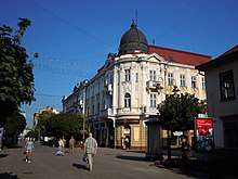
House of Leon Grauwer (1905)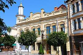 Architecture in the city center
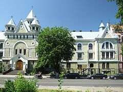 Monastery of Basilian Sisters
.jpg) The District Court building
The District Court building
Theaters and Cinemas
- Ivan Franko Academic Regional Music and Drama Theater
- Mariika Pidhirianka Academic Regional Puppet Theater
- Ivan Tobilevich Ukrainian National Theater
- Regional Philharmonic Society
- Lumiere Movie Theater (previously, Ivan Franko Movie Theater)
- Cosmos Movie Theater
- Former
- Patriot Movie Theater
- Shevchenko Movie Theater (previously "Pioneer")
- "Videotech"
- Gorky Movie Theater
- Komsomolets Movie Theater
- Shevchenko Movie Theater (original)
- Trembita, a summer movie theater
City parks
- Shevchenko Park
- Park of Warriors-Internationalists
- Park "Valy"
- Pryvokzalny park
- Memorial Park, near Ivan Franko Academic Regional Music and Drama Theater
Festivals
- «Sviato Kovaliv» (Blacksmiths festival)
- «Karpatskyi Prostir» (Carpathian Space)
- «Kolyada na Mayzlyakh» Christmas Festival
- «Burak Fest» Festival of Street Food
- «Prykarpattya Honey Fest»
- «Holiday of Grapes and Wine»
- «Stanislavska Marmulada»
Night life
- Bomba
- Panorama Plaza
- Pasage Gartenberg
- eL Dorado
- Deja Vu
Sports
Ivano-Frankivsk is home to a number of sports teams. Most notably, it was home to the football club FC Spartak Ivano-Frankivsk (Prykarpattya) that participated on the national level since the 1950s. Since 2007, the club only fields its youth team Spartak-93 and competes in the Children-Youth Football League of Ukraine. The former president of Spartak Anatoliy Revutskiy reorganized the local university (University of Oil and Gas) team in 2007 into the new "FSK Prykarpattia" with support of the city mayor Anushkevychus making it the main football club in the region and replacing Spartak. Previously during the interbellum period, the city was home to another football club based on the local Polish garrison and called Rewera Stanisławów (1908). That club competed at a regional level that had evolved at that period. With the start of World War II, that club was disbanded. During the Soviet period among several others there was another club "Elektron" that successfully participated at a regional level around the 1970s.
The city also is the home to a futsal team, PFC Uragan Ivano-Frankivsk, that competes in the Ukrainian Futsal Championship. They were the Ukrainian champions having won the 2010/11 season playoffs and therefore took part in the 2011–12 UEFA Futsal Cup for the first time.
The city had an ice hockey team, HC Vatra Ivano-Frankivsk, which previously played in the Ukrainian Hockey Championship.
Ivano-Frankivsk is also the hometown of Ukrainian gymnasts; one of them is Dariya Zgoba who won gold on the uneven bars in the 2007 European Championships and became a finalist on the Beijing Olympics; the other one is Yana Demyanchuk, who won gold on the balance beam at the 2009 European Championships.
Other clubs include:
- Hoverla Ivano-Frankivsk (basketball)
- Roland Ivano-Frankivsk (rugby)
- Uragan (futsal)
- Main Stadiums and Sport Complexes
- MCS Rukh, a sport complex consisting of the major arena and two auxiliary fields next to it
- Yunist Stadium (Youth)
- Hirka Stadium, property of the Ivano-Frankivsk Locomotive Maintenance Plant
- Nauka Stadium (Science), which belongs to Vasyl Stefanyk Precarpathian National University
- Stadium of Oil and Gas University
- Sport-Recreational Center "Tsunami", which contains an ice arena for the local hockey events and a waterpark[33]
City's radio, television, press media
- Press
- "Reporter" – Ivano-Frankivsk weekly[34]
- "Halytsky Korrespondent" – a social-political weekly[35]
- "Halychyna" – regional newspaper[36]
- Radio
- Television
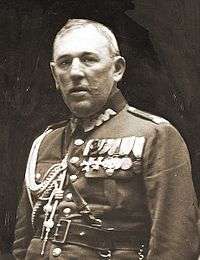
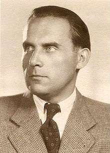
Notable people
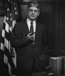
- Eliezer Adler (born 1866), founder of the Jewish Community in Gateshead, England
- Svetlana Alexievich, Belarusian journalist and writer, winner of the 2015 Nobel Prize for Literature
- Yuri Andrukhovych (born 1960), Ukrainian writer
- Daniel Auster (1893–1963), Mayor of Jerusalem
- Menachem Avidom (1908–1995), Israeli composer
- John Banner (1910–1973), Austrian-American actor. Star of Hogan's Heroes
- Naftali Blumenthal (born 1922), Israeli Member of the Knesset
- Maxim Bugzester (1909–1978), Polish painter
- Arthur F. Burns (1904–1987), American-Jewish economist and politician
- Ana Casares, Polish-Argentine actress
- Zbigniew Cybulski (1927–1967), Polish actor
- Yana Demyanchuk (born 1993), Ukrainian gymnast and 2009 European Champion on balance beam
- Bolesław Wieniawa-Długoszowski (1881–1942), Polish general, politician and diplomat
- Albin Dunajewski, Roman Catholic cardinal
- Wiktor Eckhaus (1930–2000), Polish–Dutch mathematician
- Feliks Falk, Polish film director
- Moshe Flimann (1905–1973), Mayor of Haifa
- Fritz Grossmann (1902–1984), art historian and Professor of Art History
- Ludwik Hass (1918–2008), Polish historian
- Moses Horowitz (1844–1910), playwright and actor of Yiddish theatre
- Alfred Johann Theophil Jansa von Tannenau, Austrian general
- GreenJolly, Ukrainian rap band
- Tina Karol (born 1985), Ukrainian singer, actress, and television presenter
- Maria Antonina Kratochwil (1881–1942), nun beatified by Pope John Paul II who tried to save Jews during the Holocaust
- František Kriegel (1908—1979), Czechoslovak politician and physician
- Manfred H. Lachs (1914–1993), Polish diplomat and British jurist[42]
- Oksana Lada, Ukrainian actress
- Chaim David Lippe (1823–1900), Austrian Jewish publisher and bibliographer
- Alfreda Markowska (born 1926), Polish-Romani woman who during World War II saved approximately 50 Jewish and Roma children from death in the Holocaust and the Porajmos genocide
- Leo Aryeh Mayer (1895–1959), Israeli scholar of Islamic art and rector of the Hebrew University of Jerusalem
- Bernard Mond (1887–1957), Jewish general of the Polish Army
- Itzhak Nener (1919–2012), Israeli jurist
- Yevhen Nakonechny (1931–2006), Ukrainian historian, librarian, library scientist, and linguist
- Daniel Passent, Polish journalist
- Józef Potocki, son of the Polish founder of the city
- Mikhail Prusak, Russian politician
- Horacy Safrin (1899–1980), Polish poet, comedian, author, and translator
- Max Schur (1897–1969), physician
- Anna Seniuk (born 1942), Polish actress
- Stanislav Shcherbatykh (Tryzuby Stas), a representative of the Ukrainian humorous original songs, bard
- Klemens Stefan Sielecki (1903–1980), Polish engineer and technical director of Fablok
- Stanisław Sosabowski, Polish general
- Myroslav Stupar, Ukrainian football referee
- Mordechai Surkis (1908–1995), Israeli politician
- Gabriel Talphir (1901–1990), Israeli poet, art critic, publisher, editor, and translator
- Vasyl Velychkovsky, bishop of Ukrainian Greek-Catholic Church
- Vasyl Virastyuk, Ukrainian strongman athlete 2004 World's Strongest Man
- Taras Voznyak (born 1957), Ukrainian political scientist, editor-in-chief and founder of Independent Cultural Journal "Ї", director of Lviv National Art Gallery
- Alexander Wagner (1868–1942), Polish chess theoretician
- Ksenia Zsikhotska (born 1989), Professional dancer
Twin towns – sister cities
Ivano-Frankivsk is twinned with:[43]


In February 2016 Ivano-Frankivsk City Council terminated its twinned relations with the Russian cities Surgut, Serpukhov and Veliky Novgorod due to the Ukrainian crisis.[44]
Partner cities
Ivano-Frankivsk cooperates with:[43]


Orientation
- Local orientation
Places adjacent to Ivano-Frankivsk | ||||||||||
|---|---|---|---|---|---|---|---|---|---|---|
| ||||||||||
- Regional orientation
See also
References
Bibliography
- "Endure, Defy and Remember", by Joachim Nachbar, 1977
- Evans, Andrew (1 March 2007). Ukraine: The Bradt Travel Guide. Bradt Travel Guides. ISBN 978-1-84162-181-4. Retrieved 7 March 2010.
- "False papers: deception and survival in the Holocaust", by Robert Melson, Univ. of Illinois Press, 2000. Dr. Melson is a professor of political science at Purdue, whose grandfather owned the Mendelsohn factory in Stanislawow.
- "I'm not even a grown up, the diary of Jerzy Feliks Urman", translated by Anthony Rudolf and Joanna Voit, ed. by Anthony Rudolf. London: Menard Press, 1991. 11-yr old in Stanislaw commits suicide to avoid capture by Nazis.
- "Living Longer than Hate", by C.S. Ragsdale
- Mokotoff, Gary; Amdur Sack, Sallyann; Sharon, Alexander (November 2002). Where once we walked: a guide to the Jewish communities destroyed in the Holocaust. Avotaynu. ISBN 978-1-886223-15-8. Retrieved 8 March 2010.
Notes
- Mayors of Mykolayiv, Ivano-Frankivsk become known after elections, Ukrinform (16 November 2015)
- The Sad End of the Orange Revolution, Der Spiegel (14 January 2010)
- "The City of Ivano-Frankivsk". sbedif.if.ua. Archived from the original on April 16, 2000. Retrieved March 7, 2010.
- "Чисельність наявного населення України (Actual population of Ukraine)" (PDF) (in Ukrainian). State Statistics Service of Ukraine. Retrieved 19 July 2016.
- "The City of Ivano-Frankivsk". sbedif.if.ua. Archived from the original on April 16, 2000. Retrieved March 7, 2010.
- Sadok Barącz "Pamiątki miasta Stanisławowa", Lwów 1858, s. 11.
- "Історія Станіславова". 12 August 2009. Archived from the original on 3 August 2016.
- ІВАНО-ФРАНКІВСЬК: ІНВЕСТИЦІЙНИЙ ПАСПОРТ 2017 (PDF). Credit-Rating (in Ukrainian). Kiev. Retrieved 31 January 2019.
- Informational portal of the Region Archived 2010-12-19 at the Wayback Machine (in Ukrainian)
- Замки і храми України (in Ukrainian). Castles.com.
- Jewish Genealogy – The Jewish Settlement from its Inception until 1772.
- (in Ukrainian) Brief History of Ivano-Frankivsk
- Toronto Ukrainian Genealogy Group – History of Galicia
- Yanukovych condemns attempts to undermine unity, Kyiv Post (21 January 2011) Archived January 24, 2011, at the Wayback Machine
- "The Day of Unity". opinion-times.com.
- Jewish Genealogy – Between the Two World Wars
- yadvashem.org
- Carmi, Krystyna (2015). The strange ways of providence in my life. North Charleston, SC, USA: CreateSpace. p. 105. ISBN 1507811462.
- "Weatherbase: Historical Weather for Ivano-Frankivsk, Ukraine". Weatherbase. Retrieved January 12, 2013.
- Ивано-Франковска [Climate of Ivano–Frankivsk] (in Russian). Погода и климат (Weather and Climate). Archived from the original on 13 December 2019. Retrieved 13 December 2019.
- "Ivano-Frankivsk Ukraine Climate Data". Climatebase. Retrieved January 12, 2013.
- "UKRAINE : general data". Populstat.info. Retrieved May 5, 2009.
- "Archived copy". Archived from the original on 2009-10-03. Retrieved 2009-09-14.CS1 maint: archived copy as title (link)
- "Archived copy". Archived from the original on 2012-03-15. Retrieved 2013-07-09.CS1 maint: archived copy as title (link)
- "Pinkas hakehillot – Stanislawow".
- Full list of renamed streets (in Ukrainian)
- (in Ukrainian) Reporter. Ivano-Frankivsk weekly. 25 May 2010
- "Парк Готель".
- "Готель Надія. Готель Івано-Франківськ".
- "Auscoprut Hotel". 4 September 2011. Archived from the original on September 4, 2011.CS1 maint: unfit url (link)
- Готель. "Готель "Під "Темплем" в Івано-Франківську".
- (in Ukrainian) About "Atelie Arkhitektury"
- (in Ukrainian) Tsunami main website
- Reporter. ""Репортер" – Івано-Франківський портал новин "Репортер"".
- "Галицький кореспондент".
- "Інтернет-версія газети "Галичина": Головна". galychyna.if.ua.
- 1043.com.ua
- "Телерадіокомпанія "ВЕЖА"".
- "Івано-Франківська ОДТРК "КАРПАТИ"".
- "Бактериологическая лаборатория "Studio-3"". Archived from the original on 2011-10-26.
- "Офіційний веб-сайт обласного телебачення "Галичина": Головна сторінка". galtv.if.ua.
- Encyclopædia Britannica Archived March 14, 2006, at the Wayback Machine
- "Перелік партнерських міст Івано-Франківська" (PDF). mvk.if.ua (in Ukrainian). Ivano-Frankivsk. 2019-09-01. Retrieved 2020-03-30.
- (in Ukrainian) Chernivtsi decided to terminate the relationship with twin two Russian cities, The Ukrainian Week (February 27, 2016)
External links
| Wikimedia Commons has media related to Ivano-Frankivsk. |
| Wikisource has the text of the 1911 Encyclopædia Britannica article Stanislau. |
| Wikivoyage has a travel guide for Ivano-Frankivsk. |
- Local government
- mvk.if.ua – Official site of Ivano-Frankivsk
- The Regional Directorate of Statistics website
- Association of Ukrainian cities website
- General information and travel
- Site of Ivano-Frankivsk|Franyk (ua)
- Web company in Frankovsk|Frankivsk.in.ua (ua)
- Іvano-Frankivsk |Portal (ukr.)
- ifportal.net
- pravda.if.ua
- Ivano-Frankivsk at Curlie
- Local business catalog
- Maps
- Soviet topographic map 1:100,000
- 2005 Ivano-Frankivsk – Satellite image
- Area map of Stanislawow, with the general shape of the major streets, showing enlarged town detail from a 1905 Austrian military map
- History
- The Stanislau Phenomenon – How the Western Ukrainian provincial nest of Ivano-Frankivsk turned into a thriving literary metropolis and multicultural frontier between East and West. By Holger Gemba at signandsight.com
- "Stanislau". Archived from the original on 2002-06-02. Retrieved 2013-09-11.CS1 maint: BOT: original-url status unknown (link) – Transliteration of Unpublished List of Citizens Murdered by the Nazis, from documents of the Russian Commission to Investigate Nazi Crimes
- Polish historical website on Stanislawow
- Photographs of Jewish sites in Ivano-Frankivsk in Jewish History in Galicia and Bukovina
- Ivano-Frankivsk, Ukraine at JewishGen
- Photos
- Stanislaw: virtual Ivano-Frankivs'k |spherical panoramas
- Old photos and postcards which highlight city architecture at the beginning of the 20th century
- Photos of modern Ivano-Frankivsk (from 2004)
- Photos of Ivano-Frankivsk
- Architectural ideas presentation for Ivano-Frankivsk from "Atelie Arkhitektury" on YouTube
- Video footage of the 2010 Ivano-Frankivsk annual smith festival on YouTube
| Cities | Coat of arms of Ivano-Frankivsk Municipality | |
|---|---|---|
| Villages |
| |
| Raions | |||||
|---|---|---|---|---|---|
| Hromadas | |||||
| Cities |
| ||||
| |||||
| Oblasts | |
|---|---|
| Cities with special status | |
| Autonomous republic | |
| Administrative centers | |
1Claimed and controlled by Russia as the Republic of Crimea and the Federal City of Sevastopol 2Regions are partly controlled by Pro-Russian separatists states of Donetsk People's Republic and Luhansk People's Republic | |
Historical Capitals of Rus', Ukrainian states and states on Ukrainian soil1 | |||||||||
|---|---|---|---|---|---|---|---|---|---|
| Medieval Ukrainian states |
| ||||||||
| Ukrainian states after Russian Empire and before Ukrainian SSR |
| ||||||||
| Ukrainian SSR (since 1917), independent Ukraine (since 1991) |
| ||||||||
1Meaning (Cossack) states on the territory of current Ukraine | |||||||||
| Authority control |
|
|---|