Whittington, Worcestershire
Whittington is a small village near Worcester close to Junction 7 of the M5 motorway, bounded by the motorway and the B4084, in the District of Wychavon. In fact the motorway cut through the village, most of it being on the west side but some houses were left on the east side.
| Whittington | |
|---|---|
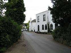 Whittington village | |
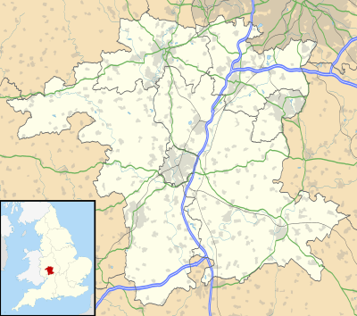 Whittington Location within Worcestershire | |
| OS grid reference | SO875527 |
| District | |
| Shire county | |
| Region | |
| Country | England |
| Sovereign state | United Kingdom |
| Post town | WORCESTER |
| Postcode district | WR5 |
| Dialling code | 01905 |
| Police | West Mercia |
| Fire | Hereford and Worcester |
| Ambulance | West Midlands |
Amenities
There is one public house – The Swan, a village and parish church, and an active village hall.
History
There is an ancient burial mound referred to as Whittington Tump or just "The Tump" across the main road A44 from the pub. The tump is thought to have been a barrow but no burial remains have been found there. The hill was built by the order of Oliver Cromwell where soldiers used their helmets to carry dirt to build the hill in celebration of the victory of the battle of Worcester. The context of this ancient monument was devastated by the building of the M5 motorway a very short distance away, further damage being caused by the widening of the A44, which was rebuilt to bypass the village. It was then damaged again by the building on the north side of the Tump of the road going west to the new crossing of the River Severn south of Worcester.
Tump is Worcestershire dialect for a small hill and may be derived from the Welsh language word Twmpath. An unty tump is a molehill, unty being local dialect for a mole.
The village has a primary school.
The parish of Whittington also includes the hamlet of Swinsherd, part of which was also lost to the building of the M5 motorway.
External links
| Wikimedia Commons has media related to Whittington, Worcestershire. |
| Authority control |
|
|---|