White Hall, Alabama
White Hall is a town in Lowndes County, Alabama, United States. The community was named for a plantation which was destroyed in an 1882 tornado. At the 2010 census the population was 858, down from its record high of 1,014 in 2000. It is part of the Montgomery Metropolitan Statistical Area. It was established during the Great Depression in 1935 as a New Deal project under the Resettlement Administration, similar to the town of Skyline, although it was aimed towards blacks, who made up the majority population in the area. The town did not incorporate until 1979.[3]
White Hall, Alabama | |
|---|---|
 White Hall Town Hall | |
 Location of White Hall in Lowndes County, Alabama. | |
| Coordinates: 32°18′50″N 86°42′50″W | |
| Country | United States |
| State | Alabama |
| County | Lowndes |
| Area | |
| • Total | 15.54 sq mi (40.24 km2) |
| • Land | 15.32 sq mi (39.67 km2) |
| • Water | 0.22 sq mi (0.57 km2) |
| Elevation | 184 ft (56 m) |
| Population (2010) | |
| • Total | 858 |
| • Estimate (2019)[2] | 751 |
| • Density | 49.03/sq mi (18.93/km2) |
| Time zone | UTC-6 (Central (CST)) |
| • Summer (DST) | UTC-5 (CDT) |
| FIPS code | 01-81912 |
| GNIS feature ID | 0153961 |
Geography
White Hall is located at 32°18′50″N 86°42′50″W (32.313866, -86.714019).[4]
According to the U.S. Census Bureau, the town has a total area of 15.5 square miles (40 km2), of which 15.5 square miles (40 km2) is land and 0.1 square miles (0.26 km2) (0.39%) is water.
Demographics
| Historical population | |||
|---|---|---|---|
| Census | Pop. | %± | |
| 1970 | 367 | — | |
| 1980 | 251 | −31.6% | |
| 1990 | 814 | 224.3% | |
| 2000 | 1,014 | 24.6% | |
| 2010 | 858 | −15.4% | |
| Est. 2019 | 751 | [2] | −12.5% |
| U.S. Decennial Census[5] 2013 Estimate[6] | |||

As of the census[7] of 2000, there were 1,014 people, 361 households, and 266 families residing in the town. The population density was 65.6 people per square mile (25.3/km2). There were 398 housing units at an average density of 25.7 per square mile (9.9/km2). The racial makeup of the town was 98.03% Black or African American, 1.38% White, 0.10% Native American, 0.20% Asian, and 0.30% from two or more races. 0.79% of the population were Hispanic or Latino of any race.
There were 361 households out of which 40.4% had children under the age of 18 living with them, 33.5% were married couples living together, 35.7% had a female householder with no husband present, and 26.3% were non-families. 23.5% of all households were made up of individuals and 10.8% had someone living alone who was 65 years of age or older. The average household size was 2.81 and the average family size was 3.33.
In the town, the population was spread out with 32.4% under the age of 18, 10.1% from 18 to 24, 25.7% from 25 to 44, 20.8% from 45 to 64, and 10.9% who were 65 years of age or older. The median age was 31 years. For every 100 females, there were 77.0 males. For every 100 females age 18 and over, there were 70.8 males.
The median income for a household in the town was $18,158, and the median income for a family was $21,875. Males had a median income of $20,885 versus $18,125 for females. The per capita income for the town was $10,062. About 29.4% of families and 31.7% of the population were below the poverty line, including 35.8% of those under age 18 and 47.5% of those age 65 or over.
Notable people
- Ben Wallace, NBA basketball player
See also
References
- "2019 U.S. Gazetteer Files". United States Census Bureau. Retrieved June 29, 2020.
- "Population and Housing Unit Estimates". United States Census Bureau. May 24, 2020. Retrieved May 27, 2020.
- http://www.encyclopediaofalabama.org/article/h-3381
- "US Gazetteer files: 2010, 2000, and 1990". United States Census Bureau. 2011-02-12. Retrieved 2011-04-23.
- "U.S. Decennial Census". Census.gov. Retrieved June 6, 2013.
- "Annual Estimates of the Resident Population: April 1, 2010 to July 1, 2013". Retrieved June 3, 2014.
- "U.S. Census website". United States Census Bureau. Retrieved 2008-01-31.
Municipalities and communities of Lowndes County, Alabama, United States | ||
|---|---|---|
| Towns | 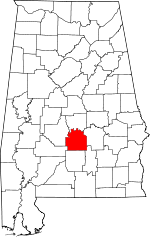 Map of Alabama highlighting Lowndes County | |
| Unincorporated communities | ||
| Authority control |
|---|