Westmont, California
Westmont is a census designated place (CDP) in Los Angeles County, California. The population was 31,853 at the 2010 census, up from 31,623 at the 2000 census. The community is an unincorporated area adjacent to South Los Angeles.
Westmont, California | |
|---|---|
Census designated place | |
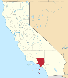
 Location of Westmont in Los Angeles County, California. | |
 Westmont, California Location in the United States | |
| Coordinates: 33°56′29″N 118°18′8″W | |
| Country | |
| State | |
| County | |
| Area | |
| • Total | 1.848 sq mi (4.785 km2) |
| • Land | 1.848 sq mi (4.785 km2) |
| • Water | 0 sq mi (0 km2) 0% |
| Elevation | 217 ft (66 m) |
| Population | |
| • Total | 31,853 |
| • Density | 17,000/sq mi (6,700/km2) |
| Time zone | UTC-8 (Pacific) |
| • Summer (DST) | UTC-7 (PDT) |
| ZIP code | 90047 |
| Area codes | 213/323[4] |
| FIPS code | 06-84592 |
| GNIS feature ID | 1867072 |
Geography
Westmont is located at 33°56′29″N 118°18′8″W (33.941514, -118.302306).[5]
According to the United States Census Bureau, the CDP has a total area of 1.8 square miles (4.7 km2), all land.
Demographics
| Historical population | |||
|---|---|---|---|
| Census | Pop. | %± | |
| 1970 | 29,310 | — | |
| 1980 | 27,916 | −4.8% | |
| 1990 | 31,044 | 11.2% | |
| 2000 | 31,623 | 1.9% | |
| 2010 | 31,853 | 0.7% | |
| [6] | |||
2010
At the 2010 census Westmont had a population of 31,853. The population density was 17,239.9 people per square mile (6,656.4/km2). The racial makeup of Westmont was 16,262 (51.1%) African American, 5,037 (15.8%) White (including 1.0% Non-Hispanic White)[7], 188 (0.6%) Native American, 126 (0.4%) Asian, 31 (0.1%) Pacific Islander, 9,180 (28.8%) from other races, and 1,029 (3.2%) from two or more races. Hispanic or Latino of any race were 14,871 persons (46.7%).[8]
The census reported that 31,693 people (99.5% of the population) lived in households, 119 (0.4%) lived in non-institutionalized group quarters, and 41 (0.1%) were institutionalized.
There were 9,695 households, 4,750 (49.0%) had children under the age of 18 living in them, 2,995 (30.9%) were opposite-sex married couples living together, 3,194 (32.9%) had a female householder with no husband present, 904 (9.3%) had a male householder with no wife present. There were 776 (8.0%) unmarried opposite-sex partnerships, and 52 (0.5%) same-sex married couples or partnerships. 2,141 households (22.1%) were one person and 669 (6.9%) had someone living alone who was 65 or older. The average household size was 3.27. There were 7,093 families (73.2% of households); the average family size was 3.78.
The age distribution was 9,860 people (31.0%) under the age of 18, 3,759 people (11.8%) aged 18 to 24, 8,577 people (26.9%) aged 25 to 44, 6,979 people (21.9%) aged 45 to 64, and 2,678 people (8.4%) who were 65 or older. The median age was 29.9 years. For every 100 females, there were 86.8 males. For every 100 females age 18 and over, there were 80.3 males.
There were 10,588 housing units at an average density of 5,730.6 per square mile, of the occupied units 3,012 (31.1%) were owner-occupied and 6,683 (68.9%) were rented. The homeowner vacancy rate was 2.5%; the rental vacancy rate was 8.8%. 10,864 people (34.1% of the population) lived in owner-occupied housing units and 20,829 people (65.4%) lived in rental housing units.
2000
At the 2000 census there were 31,623 people, 9,255 households, and 7,089 families living in the CDP. The population density was 17,103.0 inhabitants per square mile (6,599.8/km2). There were 10,186 housing units at an average density of 5,509.0 per square mile (2,125.9/km2). The racial makeup of the CDP was 11.8% White, 58.0% African American, 0.6% Native American, 0.4% Asian, 0.2% Pacific Islander, 25.8% from other races, and 3.3% from two or more races. Hispanic or Latino of any race were 39.5%.[9]
Of the 9,255 households 47.3% had children under the age of 18 living with them, 33.9% were married couples living together, 34.9% had a female householder with no husband present, and 23.4% were non-families. 19.2% of households were one person and 5.0% were one person aged 65 or older. The average household size was 3.41 and the average family size was 3.85.
The age distribution was 37.8% under the age of 18, 10.5% from 18 to 24, 29.3% from 25 to 44, 16.3% from 45 to 64, and 6.0% 65 or older. The median age was 26 years. For every 100 females, there were 86.6 males. For every 100 females age 18 and over, there were 78.5 males.
The median household income was $23,323 and the median family income was $23,712. Males had a median income of $24,682 versus $25,775 for females. The per capita income for the CDP was $9,765. About 35.3% of families and 36.9% of the population were below the poverty line, including 46.7% of those under age 18 and 22.1% of those age 65 or over.
Education
The area is within the Los Angeles Unified School District.
Areas considered to be in Westmont are generally zoned to:
- Century Park Elementary School
- Woodcrest Elementary School
- Clay Middle School
- Washington Preparatory High School
- Middle College High School
- Animo South Los Angeles Charter High School
Library Service:
- Woodcrest Community Library, County of Los Angeles Public Library
Government
In the California State Legislature, Westmont is in the 30th Senate District, represented by Democrat Holly Mitchell, and in the 62nd Assembly District, represented by Democrat Autumn Burke.[10]
In the United States House of Representatives, Westmont is in California's 43rd congressional district, represented by Democrat Maxine Waters.[11]
References
- "2010 Census U.S. Gazetteer Files – Places – California". United States Census Bureau.
- "Westmont". Geographic Names Information System. United States Geological Survey. Retrieved March 25, 2015.
- "Westmont CDP QuickFacts". United States Census Bureau. Retrieved March 25, 2015.
- "Planning Letter PL-494 NPA 213 and 323 Boundary Elimination Overlay (California)" (PDF). North American Numbering Plan Administration. 2016-08-09. p. 6. Retrieved 2020-06-13.
- "US Gazetteer files: 2010, 2000, and 1990". United States Census Bureau. 2011-02-12. Retrieved 2011-04-23.
- "Archived copy". Archived from the original on 2007-03-11. Retrieved 2007-03-11.CS1 maint: archived copy as title (link)
- "Census data". quickfacts.census.gov.
- "2010 Census Interactive Population Search: CA - Westmont CDP". U.S. Census Bureau. Archived from the original on July 15, 2014. Retrieved July 12, 2014.
- "U.S. Census website". United States Census Bureau. Retrieved 2008-01-31.
- "Statewide Database". UC Regents. Archived from the original on February 1, 2015. Retrieved December 7, 2014.
- "California's 43rd Congressional District - Representatives & District Map". Civic Impulse, LLC.

| Authority control |
|---|