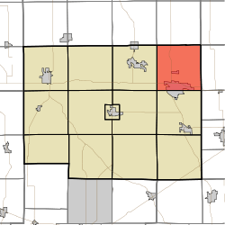
Wayne Township, Noble County, Indiana
Wayne Township is one of thirteen townships in Noble County, Indiana. As of the 2010 census, its population was 10,260 and it contained 4,554 housing units.[3]
Wayne Township | |
|---|---|
 | |
| Coordinates: 41°28′47″N 85°15′20″W | |
| Country | United States |
| State | Indiana |
| County | Noble |
| Government | |
| • Type | Indiana township |
| Area | |
| • Total | 36.37 sq mi (94.2 km2) |
| • Land | 35.46 sq mi (91.8 km2) |
| • Water | 0.91 sq mi (2.4 km2) |
| Elevation | 984 ft (300 m) |
| Population (2010) | |
| • Total | 10,260 |
| • Density | 289.3/sq mi (111.7/km2) |
| Time zone | UTC-5 (Eastern (EST)) |
| • Summer (DST) | UTC-4 (EDT) |
| Area code(s) | 260 |
| FIPS code | 18-81836[2] |
| GNIS feature ID | 454037 |
Geography
According to the 2010 census, the township has a total area of 36.37 square miles (94.2 km2), of which 35.46 square miles (91.8 km2) (or 97.50%) is land and 0.91 square miles (2.4 km2) (or 2.50%) is water.[3] Sand Hill, the second highest named point in Indiana, is located in northeastern Wayne Township, near the intersection of county roads 1000E and 1100N.
Cities and towns
- Kendallville (north side)
Unincorporated towns
(This list is based on USGS data and may include former settlements.)
Major highways
Education
Wayne Township residents may obtain a free library card from the Kendallville Public Library in Kendallville.[4]
References
- "US Board on Geographic Names". United States Geological Survey. 2007-10-25. Retrieved 2008-01-31.
- "U.S. Census website". United States Census Bureau. Retrieved 2008-01-31.
- "Population, Housing Units, Area, and Density: 2010 - County -- County Subdivision and Place -- 2010 Census Summary File 1". United States Census. Archived from the original on 2020-02-12. Retrieved 2013-05-10.
- "Kendallville Public Library Cards". Kendallville Public Library. Retrieved 14 March 2018.
External links
Municipalities and communities of Noble County, Indiana, United States | ||
|---|---|---|
| Cities | Map of Indiana highlighting Noble County | |
| Towns | ||
| Townships | ||
| CDP | ||
| Unincorporated communities | ||
| Footnotes | ‡This populated place also has portions in an adjacent county or counties | |
This article is issued from Wikipedia. The text is licensed under Creative Commons - Attribution - Sharealike. Additional terms may apply for the media files.