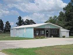
Waldenburg, Arkansas
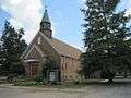
Waldenburg is a town in Poinsett County, Arkansas, United States. The population was 80 at the 2000 census. It is included in the Jonesboro, Arkansas Metropolitan Statistical Area. Waldenburg is home to Zion Lutheran Church. Zion was founded in 1881 and is a member congregation of the Lutheran Church–Missouri Synod.[3]
.jpg)
Waldenburg, Arkansas | |
|---|---|
 | |
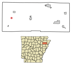 Location of Waldenburg in Poinsett County, Arkansas. | |
| Coordinates: 35°33′58″N 90°56′2″W | |
| Country | United States |
| State | Arkansas |
| County | Poinsett |
| Area | |
| • Total | 0.14 sq mi (0.35 km2) |
| • Land | 0.14 sq mi (0.35 km2) |
| • Water | 0.00 sq mi (0.00 km2) |
| Elevation | 240 ft (73 m) |
| Population (2010) | |
| • Total | 61 |
| • Estimate (2019)[2] | 58 |
| • Density | 426.47/sq mi (164.99/km2) |
| Time zone | UTC-6 (Central (CST)) |
| • Summer (DST) | UTC-5 (CDT) |
| ZIP code | 72475 |
| Area code(s) | 870 |
| FIPS code | 05-72320 |
| GNIS feature ID | 0058812 |
Geography
Waldenburg is located at 35°33′58″N 90°56′2″W (35.565984, -90.933779).[4]
According to the United States Census Bureau, the town has a total area of 0.1 square miles (0.26 km2), all land.
Demographics
| Historical population | |||
|---|---|---|---|
| Census | Pop. | %± | |
| 1960 | 113 | — | |
| 1970 | 164 | 45.1% | |
| 1980 | 124 | −24.4% | |
| 1990 | 103 | −16.9% | |
| 2000 | 80 | −22.3% | |
| 2010 | 61 | −23.7% | |
| Est. 2019 | 58 | [2] | −4.9% |
| U.S. Decennial Census[5] | |||
As of the census[6] of 2000, there were 80 people, 33 households, and 20 families residing in the town. The population density was 588.2 inhabitants per square mile (220.6/km2). There were 39 housing units at an average density of 286.7 per square mile (107.6/km2). The racial makeup of the town was 93.75% White, 5.00% Black or African American, and 1.25% from two or more races.
There were 33 households, out of which 27.3% had children under the age of 18 living with them, 54.5% were married couples living together, 6.1% had a female householder with no husband present, and 36.4% were non-families. 33.3% of all households were made up of individuals, and 3.0% had someone living alone who was 65 years of age or older. The average household size was 2.42 and the average family size was 3.19.
In the town, the population was spread out, with 23.8% under the age of 18, 10.0% from 18 to 24, 22.5% from 25 to 44, 32.5% from 45 to 64, and 11.3% who were 65 years of age or older. The median age was 39 years. For every 100 females, there were 110.5 males. For every 100 females age 18 and over, there were 134.6 males.
The median income for a household in the town was $23,750, and the median income for a family was $33,250. Males had a median income of $16,250 versus $16,250 for females. The per capita income for the town was $11,452. There were no families and 12.0% of the population living below the poverty line, including no under eighteens and 20.0% of those over 64.
References
- "2019 U.S. Gazetteer Files". United States Census Bureau. Retrieved June 30, 2020.
- "Population and Housing Unit Estimates". United States Census Bureau. May 24, 2020. Retrieved May 27, 2020.
- http://locator.lcms.org/nchurches_frm/c_detail.asp?C941061
- "US Gazetteer files: 2010, 2000, and 1990". United States Census Bureau. 2011-02-12. Retrieved 2011-04-23.
- "Census of Population and Housing". Census.gov. Retrieved June 4, 2015.
- "U.S. Census website". United States Census Bureau. Retrieved 2008-01-31.
Gallery
Municipalities and communities of Poinsett County, Arkansas, United States | ||
|---|---|---|
| Cities | 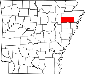 Map of Arkansas highlighting Poinsett County | |
| Town | ||
| Unincorporated communities | ||