Villas, New Jersey
Villas, also known as the Villas, is an unincorporated community and census-designated place (CDP) located within Lower Township, in Cape May County, New Jersey, United States.[7][8][9][10] At the 2010 census, the CDP's population was 9,483.[3]
Villas, New Jersey | |
|---|---|
 Judge Nathaniel Foster House | |
 Map of Villas highlighted within Cape May County. Right: Location of Cape May County in New Jersey. | |
| Coordinates: 39.016266°N 74.935969°W | |
| Country | |
| State | |
| County | Cape May |
| Township | Lower |
| Area | |
| • Total | 3.909 sq mi (10.124 km2) |
| • Land | 3.883 sq mi (10.058 km2) |
| • Water | 0.026 sq mi (0.067 km2) 0.66% |
| Elevation | 16 ft (5 m) |
| Population | |
| • Total | 9,483 |
| • Density | 2,442.0/sq mi (942.9/km2) |
| Time zone | UTC-5 (Eastern (EST)) |
| • Summer (DST) | UTC-4 (Eastern (EDT)) |
| ZIP code | 08251[4] |
| Area code(s) | 609 |
| FIPS code | 3476010[1][5] |
| GNIS feature ID | 02390438[1][6] |
Villas is the site of Blitz's Market, where one of the four winning Mega Millions lottery tickets was sold to a veteran with a disability on August 31, 2007.[11]
Geography
According to the United States Census Bureau, the CDP had a total area of 3.909 square miles (10.124 km2), including 3.883 square miles (10.058 km2) of land and 0.026 square miles (0.067 km2) of water (0.66%).[1][12]
Demographics

| Historical population | |||
|---|---|---|---|
| Census | Pop. | %± | |
| 1970 | 1,505 | — | |
| 1980 | 2,734 | 81.7% | |
| 1990 | 8,136 | 197.6% | |
| 2000 | 9,064 | 11.4% | |
| 2010 | 9,483 | 4.6% | |
| Population sources: 1970-1980[13] 1990-2010[9] 2000[14] 2010[3] | |||
Census 2010

The 2010 United States Census counted 9,483 people, 3,896 households, and 2,567.464 families in the CDP. The population density was 2,442.0 per square mile (942.9/km2). There were 5,849 housing units at an average density of 1,506.2 per square mile (581.5/km2). The racial makeup was 93.49% (8,866) White, 1.95% (185) Black or African American, 0.17% (16) Native American, 0.33% (31) Asian, 0.06% (6) Pacific Islander, 1.76% (167) from other races, and 2.24% (212) from two or more races. Hispanic or Latino of any race were 6.18% (586) of the population.[3]
Of the 3,896 households, 25.0% had children under the age of 18; 44.6% were married couples living together; 15.2% had a female householder with no husband present and 34.1% were non-families. Of all households, 28.5% were made up of individuals and 13.9% had someone living alone who was 65 years of age or older. The average household size was 2.43 and the average family size was 2.95.[3]
22.3% of the population were under the age of 18, 8.3% from 18 to 24, 22.9% from 25 to 44, 28.8% from 45 to 64, and 17.7% who were 65 years of age or older. The median age was 42.1 years. For every 100 females, the population had 89.7 males. For every 100 females ages 18 and older there were 86.8 males.[3]
Census 2000
At the 2000 census[5] there were 9,064 people, 3,733 households, and 2,456 families in the CDP. The population density was 881.5/km2 (2,281.4/mi2). There were 5,694 housing units at an average density of 553.8/km2 (1,433.2/mi2). The racial makeup of the CDP was 96.35% White, 1.19% African American, 0.28% Native American, 0.35% Asian, 0.03% Pacific Islander, 0.86% from other races, and 0.94% from two or more races. Hispanic or Latino of any race were 2.41% of the population.[14]
Of the 3,733 households 28.9% had children under the age of 18 living with them, 47.9% were married couples living together, 13.3% had a female householder with no husband present, and 34.2% were non-families. 29.5% of households were one person and 15.5% were one person aged 65 or older. The average household size was 2.43 and the average family size was 2.98.[14]
The age distribution was 25.6% under the age of 18, 6.6% from 18 to 24, 26.5% from 25 to 44, 22.3% from 45 to 64, and 19.1% 65 or older. The median age was 39 years. For every 100 females, there were 91.9 males. For every 100 females age 18 and over, there were 86.4 males.[14]
The median household income was $33,563 and the median family income was $38,950. Males had a median income of $32,996 versus $21,723 for females. The per capita income for the CDP was $16,696. About 8.3% of families and 10.4% of the population were below the poverty line, including 14.3% of those under age 18 and 5.8% of those age 65 or over.[14]
Education
As with other parts of Lower Township, it is served by Lower Township School District for primary grades and Lower Cape May Regional School District for secondary grades; the latter operates Lower Cape May Regional High School.
Notable people

People who were born in, residents of, or otherwise closely associated with Villas include:
- Steven Rappaport, performer with The Ran-Dells, which was a one-hit wonder with the song "Martian Hop".[15]
References
- Gazetteer of New Jersey Places, United States Census Bureau. Accessed July 21, 2016.
- U.S. Geological Survey Geographic Names Information System: Villas Census Designated Place, Geographic Names Information System. Accessed October 18, 2012.
- DP-1 - Profile of General Population and Housing Characteristics: 2010 Demographic Profile Data for Villas CDP, New Jersey, United States Census Bureau. Accessed October 18, 2012.
- Look Up a ZIP Code for Villas, NJ, United States Postal Service. Accessed October 18, 2012.
- U.S. Census website, United States Census Bureau. Accessed September 4, 2014.
- US Board on Geographic Names, United States Geological Survey. Accessed September 4, 2014.
- GCT-PH1 - Population, Housing Units, Area, and Density: 2010 - County -- County Subdivision and Place from the 2010 Census Summary File 1 for Cape May County, New Jersey Archived 2020-02-12 at Archive.today, United States Census Bureau. Accessed January 13, 2013.
- 2006-2010 American Community Survey Geography for New Jersey, United States Census Bureau. Accessed January 13, 2013.
- New Jersey: 2010 - Population and Housing Unit Counts - 2010 Census of Population and Housing (CPH-2-32), United States Census Bureau, August 2012. Accessed January 13, 2013.
- Locality Search, State of New Jersey. Accessed April 19, 2015.
- Winning Mega Millions ticket sold in N.J. The Associated Press
- US Gazetteer files: 2010, 2000, and 1990, United States Census Bureau. Accessed September 4, 2014.
- Staff. 1980 Census of Population: Number of Inhabitants United States Summary, p. 1-141. United States Census Bureau, June 1983. Accessed January 12, 2012.
- DP-1 - Profile of General Demographic Characteristics: 2000 from the Census 2000 Summary File 1 (SF 1) 100-Percent Data for Villas CDP, New Jersey Archived 2020-02-12 at Archive.today, United States Census Bureau. Accessed October 18, 2012.
- The Ran-Dells: Biography, AllMusic. Accessed October 18, 2012. "Steven Rappaport, Robert Rappaport, and John Spirt - three first cousins were the Ran-Dells. Home for Steven was Villas, NJ, Robert and John lived in Cape May, NJ."
External links
Municipalities and communities of Cape May County, New Jersey, United States | ||
|---|---|---|
| Cities | 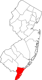 Map of New Jersey highlighting Cape May County | |
| Boroughs | ||
| Townships | ||
| CDPs | ||
| Other unincorporated communities | ||