Tsukubamirai, Ibaraki
Tsukubamirai (つくばみらい市, Tsukubamirai-shi) is a city located in Ibaraki Prefecture, Japan. As of September 2015, the city had an estimated population of 48,807, and a population density of 617 persons per km². Its total area is 79.16 square kilometres (30.56 sq mi).
Tsukubamirai つくばみらい市 | |
|---|---|
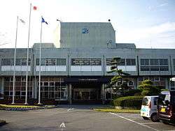 Tsukubamirai city hall | |
 Flag  Seal | |
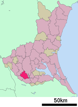 Location of Tsukubamirai in Ibaraki Prefecture | |
 Tsukubamirai | |
| Coordinates: 35°57′47″N 140°2′13.3″E | |
| Country | Japan |
| Region | Kantō |
| Prefecture | Ibaraki Prefecture |
| Government | |
| • Mayor | Masao Kataniwa (since May 2010) |
| Area | |
| • Total | 79.16 km2 (30.56 sq mi) |
| Population (September 2015) | |
| • Total | 48,807 |
| • Density | 617/km2 (1,600/sq mi) |
| Time zone | UTC+9 (Japan Standard Time) |
| - Tree | Sakura |
| - Flower | Brassica napus |
| - Bird | Eurasian skylark |
| Phone number | 0297-58-2111 |
| Address | 195 Fukuda, Tsukubamirai-shi, Ibarak-ken 300-2395 |
| Website | https://www.city.tsukubamirai.lg.jp/ |
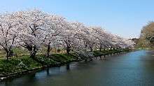
Sakura at Fukuoka Dam Park
Geography
Tsukubamirai is located in southern Ibaraki Prefecture, in the low-lying marshy flatlands south of Lake Kasumigaura. It is about 40 kilometers from central Tokyo.
History
The city of Tsukubamirai was established on March 27, 2006, from the merger of the town of Ina, and the village of Yawara (both from Tsukuba District).
Economy
Education
Tsukubamirai has 11 elementary schools, four middle schools, and one high school.
Transportation
Railway
Highway
.png)


Local attractions
- Fukuoka Dam
- Itabashi Fudouson temple
- Warp Station Edo
- Tatsunami Sumo Stable
- Mamiya Rinzo Museum
External links
![]()
- Official Website (in Japanese)
Mito (capital) | ||
| Core city | ||
| Special city | ||
| Cities | ||
| Districts | ||
| Authority control |
|
|---|
This article is issued from Wikipedia. The text is licensed under Creative Commons - Attribution - Sharealike. Additional terms may apply for the media files.