Tenryū, Nagano
Tenryū (天龍村, Tenryū-mura) is a village located in Nagano Prefecture, Japan. As of 1 April 2019, the village had an estimated population of 1,275 in 712 households,[1] and a population density of 12.1 persons per km². The total area of the village is 109.44 square kilometres (42.26 sq mi).
Tenryū 天龍村 | |
|---|---|
Village | |
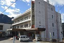 Tenryū Village Hall | |
 Flag  Seal | |
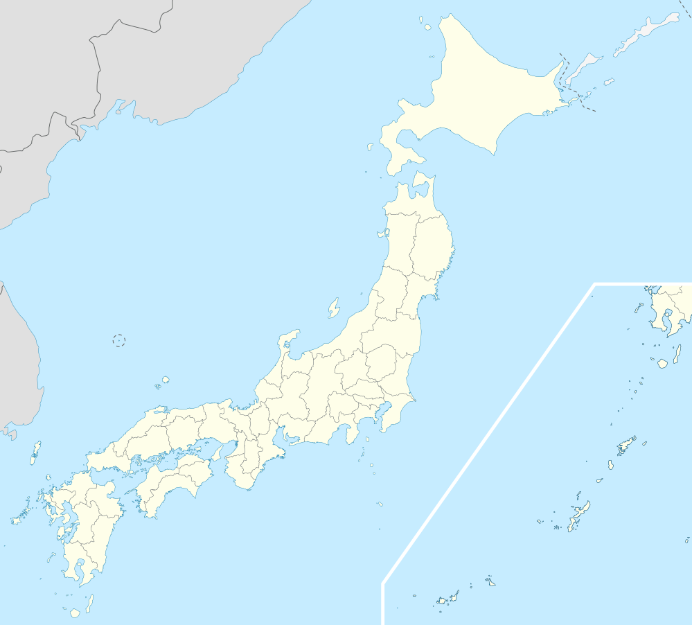
 Location of Tenryū in Nagano Prefecture | |
 Tenryū | |
| Coordinates: 35°16′34.9″N 137°51′15.2″E | |
| Country | Japan |
| Region | Chūbu (Kōshin'etsu) |
| Prefecture | Nagano |
| District | Shimoina |
| Area | |
| • Total | 109.44 km2 (42.26 sq mi) |
| Population (April 2019) | |
| • Total | 1,275 |
| • Density | 12/km2 (30/sq mi) |
| Time zone | UTC+9 (Japan Standard Time) |
| Symbols | |
| • Tree | Trachycarpus |
| • Flower | Lilium auratum |
| • Bird | Dollarbird |
| Phone number | 0260-26-2111 |
| Address | 878 Hiraoka Tenryū-mura, Shimoina-gun, Nagano-ken 399-1201 |
| Website | Official website |
Geography
Tenryū is located in mountainous far south of Nagano Prefecture on its border with Aichi Prefecture and Shizuoka Prefecture. The Tenryū River runs through the village, which is over 90% covered in mountains and forest. Hiraoka Dam is located within Tenryū.
Surrounding municipalities
- Nagano Prefecture
- Aichi Prefecture
- Shizuoka Prefecture
- Hamamatsu
Demographics
Per Japanese census data,[2] the population of Tenryū has dropped rapidly over the past 50 years.
| Year | Pop. | ±% |
|---|---|---|
| 1940 | 5,763 | — |
| 1950 | 8,337 | +44.7% |
| 1960 | 5,792 | −30.5% |
| 1970 | 4,222 | −27.1% |
| 1980 | 3,389 | −19.7% |
| 1990 | 2,822 | −16.7% |
| 2000 | 2,239 | −20.7% |
| 2010 | 1,657 | −26.0% |
Climate
The town has a climate characterized by hot and humid summers, and cold winters (Köppen climate classification Cfa). The average annual temperature in Tenryū is 13.3 °C. The average annual rainfall is 1964 mm with September as the wettest month. The temperatures are highest on average in August, at around 25.1 °C, and lowest in January, at around 1.9 °C.[3]
History
The area of present-day Tenryū was part of ancient Shinano Province. The village was established on September 30, 1956 by the merger of the villages of Hiraoka and Kamihara.
Education
Tenryū has one public elementary school and one public middle school operated by the village government, and one private elementary school and one private middle school. The village does not have a high school.
Transportation
Railway
.svg.png)
- Nakaisamurai - Ina-Kozawa - Ugusu - Hiraoka - Shiteguri
Highway
References
External links

- Official Website (in Japanese)
| Authority control |
|
|---|
Nagano (capital) | |
| Core city |
|
| Special city | |
| Cities | |
| Districts | |