Matsukawa, Nagano (Kitaazumi)
Matsukawa (松川村, Matsukawa-mura) is a village located in Nagano Prefecture, Japan. As of 1 April 2019, the village had an estimated population of 9,689 in 3813 households,[1] and a population density of 210 persons per km². The total area of the village is 47.07 square kilometres (18.17 sq mi).[2]
Matsukawa 松川村 | |
|---|---|
Village | |
 Matsukawa Village Hall | |
 Flag  Seal | |
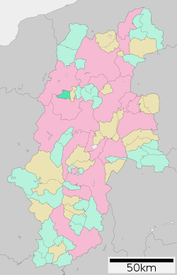 Location of Matsukawa Village in Nagano Prefecture | |
 Matsukawa | |
| Coordinates: 36°25′26.3″N 137°51′16.5″E | |
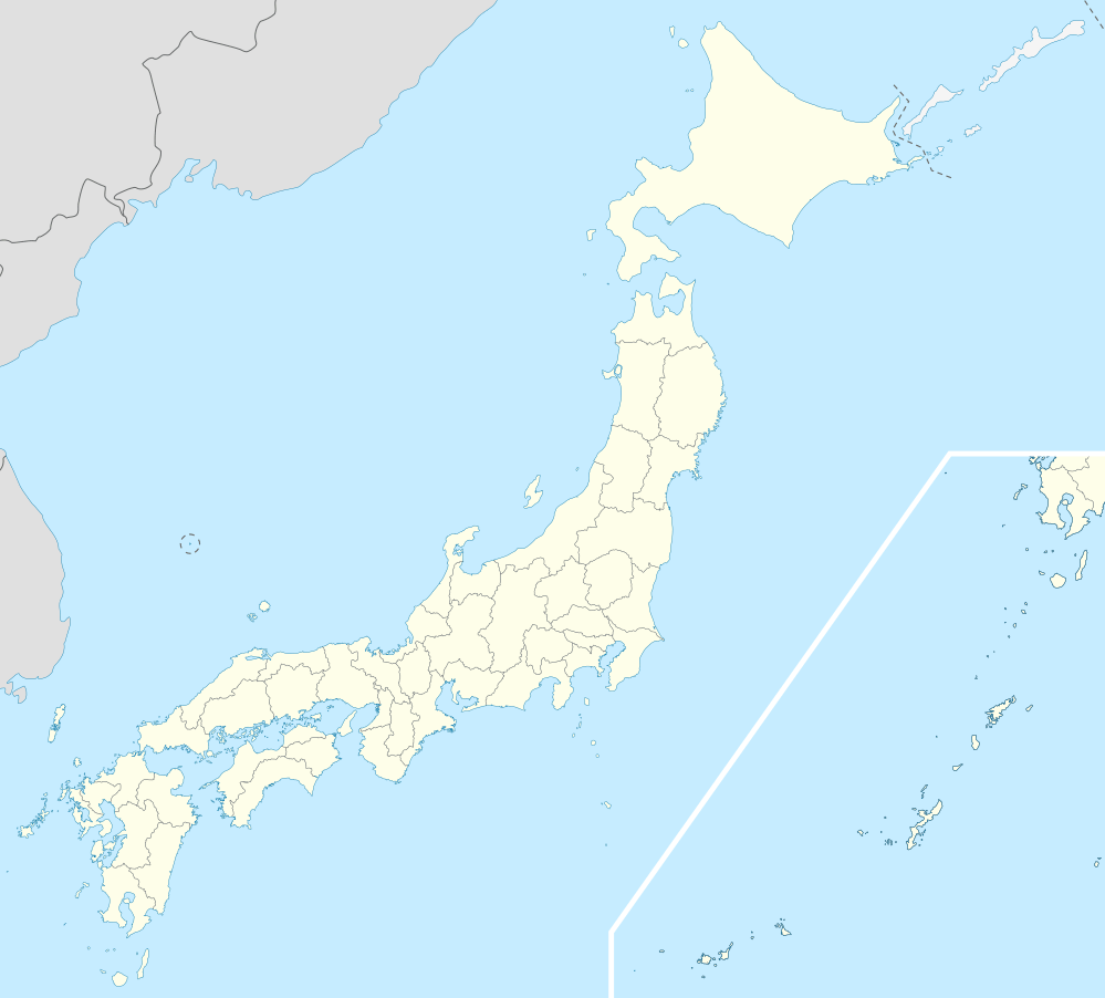
| Country | Japan |
| Region | Chūbu (Kōshin'etsu) |
| Prefecture | Nagano |
| District | Kitaazumi |
| Area | |
| • Total | 47.07 km2 (18.17 sq mi) |
| Population (April 2019) | |
| • Total | 9,689 |
| • Density | 210/km2 (530/sq mi) |
| Time zone | UTC+9 (Japan Standard Time) |
| Symbols | |
| • Tree | Pinus densiflora |
| • Flower | Rhododendron |
| Phone number | 0261-62-3111 |
| Address | 76-5, Matsukawa-mura, Kitaazumi-gun, Nagano-ken 399-8501 |
| Website | Official website |
Geography
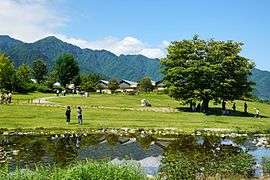
Matsukawa is located in northwestern Nagano Prefecture, in the Azumidaira plateau, bordered by the Hida Mountains to the north and west.
Demographics
Per Japanese census data,[3] the population of Matsukawa has increased steadily over the past 50 years.
| Year | Pop. | ±% |
|---|---|---|
| 1940 | 4,176 | — |
| 1950 | 5,912 | +41.6% |
| 1960 | 6,200 | +4.9% |
| 1970 | 6,342 | +2.3% |
| 1980 | 7,496 | +18.2% |
| 1990 | 8,337 | +11.2% |
| 2000 | 9,701 | +16.4% |
| 2010 | 10,093 | +4.0% |
Climate
The village has a climate characterized by characterized by hot and humid summers, and cold winters (Köppen climate classification Cfa). The average annual temperature in Matsukawa is 10.1 °C. The average annual rainfall is 1278 mm with September as the wettest month. The temperatures are highest on average in August, at around 23.4 °C, and lowest in January, at around -2.4 °C.[4]
History
The area of present-day Matsukawa was part of ancient Shinano Province and was part of the territory controlled by Matsumoto Domain under the Tokugawa shogunate of the Edo period. The modern village of Matsukawa was established on April 1, 1889 by the establishment of the municipalities system.
Education
Matsukawa has one public elementary school and one public middle school operated by the village government. The village does not have a high school.
Transportation
Railway
Highway
International relations
References
- Matsukawa Village official statistics(in Japanese)
- 松川村の紹介 > 位置図. Matsukawa Village official website (in Japanese). Matsukawa Village. Retrieved 27 September 2011.
- Matsukawa population statistics
- Matsukawa climate data
- "International Exchange". List of Affiliation Partners within Prefectures. Council of Local Authorities for International Relations (CLAIR). Archived from the original on 2 January 2017. Retrieved 21 November 2015.
External links

- Official website (in Japanese)
| Authority control |
|
|---|
Nagano (capital) | |
| Core city |
|
| Special city | |
| Cities | |
| Districts | |