Tarama, Okinawa
Tarama (多良間村, Tarama-son, Miyako & Okinawan: Tarama) is a village located in Miyako District, Okinawa Prefecture, Japan. The village consists of Tarama Island and Minna Island between Ishigaki Island and Miyako Island.
Tarama 多良間村 | |
|---|---|
Village | |
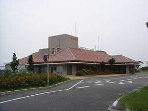
 Tarama Village Hall | |
 Flag  Emblem | |
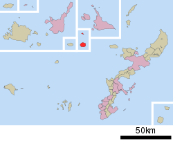 Location of Tarama in Okinawa Prefecture | |
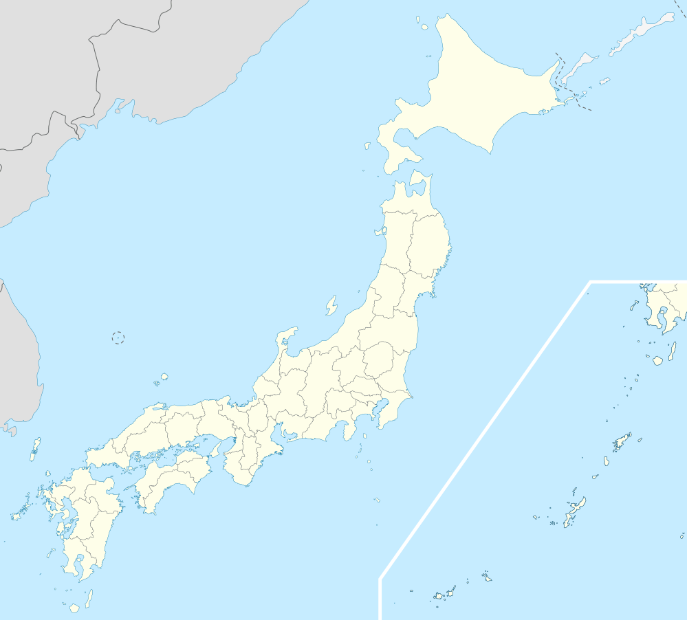 Tarama Location in Japan | |
| Coordinates: 24°40′10″N 124°42′6″E | |
| Country | Japan |
| Region | Kyushu (Ryukyu) |
| Prefecture | Okinawa Prefecture |
| District | Miyako |
| Government | |
| • Mayor | Masaaki Shimoji |
| Area | |
| • Total | 21.91 km2 (8.46 sq mi) |
| Population (2015 National Census)[1] | |
| • Total | 1,194 |
| • Density | 54.5/km2 (141/sq mi) |
| Symbols | |
| • Tree | Fukugi (Garcinia subelliptica) |
| • Flower | Safflower |
| • Bird | Japanese quail |
| • Fish | Grouper |
| Time zone | UTC+9 (JST) |
| City hall address | 99-2 Nakasuji, Tarama-son, Miyako-gun, Okinawa-ken 906-0602 |
| Website | www |
As of 2013, the village has a population of 1,276 residents and 543 households. Tarama has a density of 58.2 persons per km2. The total area is 21.91 square kilometres (8.46 square miles).[2]
Geography

The two islands of the village, Tarama and Minna, are located at the midpoint between Ishigaki Island and Miyako Island. The islands face the Pacific Ocean to the south and the East China Sea to the north. The two islands have historically suffered from typhoon damage and drought.[3]
History
Under the Ryukyu Kingdom Tarama is said to have been used as a penal colony for political prisoners.[4]
In 1879, with the abolition of the han system and creation of the prefectures of Japan, Tarama became part of the newly formed Okinawa Prefecture. In 1896 the village became part of Miyaki District. In 1908, with the abolishment of the magiri system in Okinawa, the three districts of present-day village, Nakasuzu, Shiyugaa, and Minna, became part of the village of Hirara. They were separated from Hirara in 1913 as part of a further redistricting of Okinawa, and incorporated as the Village of Tarama.[3][4]
The village hall of Tarama was the first modern tiled structured to be built on the islands, and the first village council consisted of eight citizens. Residents of Minna completed a planned relocation to the Takano district of Hirara in 1961.
Tarama was electrified and received direct telephone service in 1964, and residents were supplied with power for five hours a day. This increased to 17 hours a day by 1969, and the village was fully electrified in 1972. Regular ferry service to the village began in the same period, and Tarama Airport was opened in December 1971.[3]
Demographics
Tarama has seen population decline since the beginning of the 20th century. In the period prior to World War II typhoon damage and drought caused many residents to leave the island, mostly to Osaka and areas of the newly formed Japanese Empire. Residents of Tarama emigrated to Taiwan, the South Pacific, Korea, and Manchuria in this period. Residents of Minna completed a planned relocation to the Takano district of Hirara in 1961. At present the population of Minna Island has only one household and two people.[3][4]
Education
The Village of Tarama has one preschool, one elementary school, and one junior high school, all named Tarama. The preschool and Tarama Elementary school are connected, and located directly south of the village hall at the north of the island. Tarama Junior High School is located .5 kilometres (0.31 mi) south of the village hall. Minna, due to its depopulation, no longer has any educational institutions. The village has no high school; students must leave the island to attend high schools in other areas of Okinawa Prefecture.[5]
References
- "Remote island related materials (離 島 関 係 資 料)" (PDF). Archived (PDF) from the original on 2020-02-15. Retrieved 2020-02-15.
- 多良間村の人口 [Population of Tarama] (in Japanese). Tarama, Okinawa Prefecture, Japan: Village of Tarama. 2013. Retrieved 2013-06-28.
- "多良間村" [Tarama]. Nihon Rekishi Chimei Taikei (in Japanese). Tokyo: Shogakukan. 2013. OCLC 173191044. Archived from the original on 2007-08-25. Retrieved 2013-05-07.
- "多良間(村)". Nihon Daihyakka Zensho (Nipponika) (in Japanese). Tokyo: Shogakukan. 2013. OCLC 153301537. Archived from the original on 2007-08-25. Retrieved 2013-05-07.
- 教育施設 [Educational Facilities] (in Japanese). Village of Tarama, Okinawa Prefecture, Japan: Village of Tarama. 2013. Retrieved 2013-05-07.
External links

- Tarama official website (in Japanese)
Naha (capital) | ||
| Core city | ||
| Cities |
| |
| Districts | ||
List of mergers in Okinawa Prefecture
| ||
| Authority control |
|
|---|