Tagudin
Tagudin, officially the Municipality of Tagudin (Ilocano: Ili ti Tagudin; Filipino: Bayan ng Tagudin), is a 2nd class municipality in the province of Ilocos Sur, Philippines. According to the 2015 census, it has a population of 39,277 people.[3]
Tagudin | |
|---|---|
| Municipality of Tagudin | |
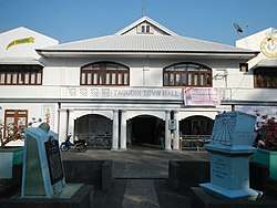 Tagudin Town Hall | |
 Seal | |
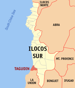 Map of Ilocos Sur with Tagudin highlighted | |
| |
.svg.png) Tagudin Location within the Philippines | |
| Coordinates: 16°56′N 120°27′E | |
| Country | |
| Region | Ilocos Region (Region I) |
| Province | Ilocos Sur |
| District | 2nd District |
| Barangays | 43 (see Barangays) |
| Government | |
| • Type | Sangguniang Bayan |
| • Mayor | Roque "Jun" S. Verzosa Jr. |
| • Vice Mayor | Bernardo F. Tovera Jr. |
| • Congressman | Kristine Singson-Meehan |
| • Electorate | 25,809 voters (2019) |
| Area | |
| • Total | 151.19 km2 (58.37 sq mi) |
| Population (2015 census)[3] | |
| • Total | 39,277 |
| • Density | 260/km2 (670/sq mi) |
| • Households | 8,492 |
| Economy | |
| • Income class | 2nd municipal income class |
| • Poverty incidence | 13.51% (2015)[4] |
| • Revenue (₱) | 188,714,647.12 (2016) |
| Time zone | UTC+8 (PST) |
| ZIP code | 2714 |
| PSGC | |
| IDD : area code | +63 (0)77 |
| Climate type | tropical monsoon climate |
| Native languages | Ilocano Tagalog |
| Website | www |
Tagudin is 316 kilometres (196 mi) from Metro Manila and 91 kilometres (57 mi) from Vigan City, the provincial capital.
Etymology
The name of the municipality was derived from a native cotton drying rack called "tagudan." A Spaniard who came to the place asking its name wrote it as its name when told by a resident, who thought that he was asking the name of the traditional apparatus she's using.
History
According to William Scott, "Chinese and Japanese ships bartered gold in Tagudin in Juan de Salcedo's day."[5]
- Records of Saint Augustine’s Parish record that Spanish Conquistadors headed by Juan de Salcedo, together with the Augustinian missionaries started to move northward of Manila in 1574.
- On 5 January 1586 they founded the first towns of Laoag, Bulatao, Kaog and Tagudin.[6]
- In 1818 Tagudin became a part of Ilocos Sur and thus the southern gateway to the province.
- The first two sundials were constructed in Tagudin in 1841 and 1845, respectively, by Father Juan Sorolla.
- The decisive Battle of Bessang Pass started in this municipality, at Bitalag.
- On 18 August 1908, Tagudin replaced Alilem as the capital of the sub-province of Amburayan,[7] which included Lepanto (that became a sub-province now included in the province of Benguet), Angkaki (now Quirino), Suyo, and Alilem (now with Ilocos Sur), and Sudipen, Santol, and San Gabriel (formerly with Ilocos Sur but became part of La Union).[6][8]
- Tagudin was made the site of the Base Hospital of the United States Armed Forces in the Philippines-Northern Luzon (USAFIP-NL) in 1945 during World War II.
- Tagudin was the site of the military general headquarters of the Philippine Commonwealth Army 1st and 12th Infantry Division and the USAFIP-NL 121st Infantry Regiments. They were stationed in the town and was active during World War II (1942 to 1945) and Post-War Era (1945 to 1946).
Barangays
Tagudin is politically subdivided into 43 barangays. [2]
- Ag-aguman
- Ambalayat
- Baracbac
- Bario-an
- Baritao
- Becques
- Bimmanga
- Bio
- Bitalag
- Borono
- Bucao East
- Bucao West
- Cabaroan
- Cabugbugan
- Cabulanglangan
- Dacutan
- Dardarat
- Del Pilar
- Farola
- Gabur
- Garitan
- Jardin
- Lacong
- Lantag
- Las-ud
- Libtong
- Lubnac
- Magsaysay
- Malacañang
- Pacac
- Pallogan
- Pula
- Pudoc East
- Pudoc West
- Quirino
- Ranget
- Rizal
- Salvacion
- San Miguel
- Sawat
- Tallaoen
- Tampugo
- Tarangotong
Climate
| Climate data for Tagudin, Ilocos Sur | |||||||||||||
|---|---|---|---|---|---|---|---|---|---|---|---|---|---|
| Month | Jan | Feb | Mar | Apr | May | Jun | Jul | Aug | Sep | Oct | Nov | Dec | Year |
| Average high °C (°F) | 30 (86) |
31 (88) |
33 (91) |
34 (93) |
32 (90) |
31 (88) |
30 (86) |
30 (86) |
30 (86) |
31 (88) |
31 (88) |
31 (88) |
31 (88) |
| Average low °C (°F) | 20 (68) |
21 (70) |
23 (73) |
25 (77) |
26 (79) |
26 (79) |
25 (77) |
25 (77) |
25 (77) |
23 (73) |
22 (72) |
21 (70) |
24 (74) |
| Average precipitation mm (inches) | 27 (1.1) |
31 (1.2) |
40 (1.6) |
71 (2.8) |
207 (8.1) |
237 (9.3) |
286 (11.3) |
261 (10.3) |
261 (10.3) |
254 (10.0) |
88 (3.5) |
46 (1.8) |
1,809 (71.3) |
| Average rainy days | 9.4 | 9.3 | 12.7 | 17.0 | 25.4 | 26.8 | 27.4 | 26.1 | 25.0 | 21.0 | 15.5 | 10.6 | 226.2 |
| Source: Meteoblue [9] | |||||||||||||
Demographics
| Year | Pop. | ±% p.a. |
|---|---|---|
| 1903 | 8,503 | — |
| 1918 | 11,237 | +1.88% |
| 1939 | 13,115 | +0.74% |
| 1948 | 15,637 | +1.97% |
| 1960 | 18,191 | +1.27% |
| 1970 | 19,575 | +0.74% |
| 1975 | 22,887 | +3.18% |
| 1980 | 23,432 | +0.47% |
| 1990 | 29,295 | +2.26% |
| 1995 | 30,697 | +0.88% |
| 2000 | 34,427 | +2.49% |
| 2007 | 35,791 | +0.54% |
| 2010 | 38,122 | +2.32% |
| 2015 | 39,277 | +0.57% |
| Source: Philippine Statistics Authority[3][10][11][12] | ||
In the 2015 census, the population of Tagudin was 39,277 people,[3] with a density of 260 inhabitants per square kilometre or 670 inhabitants per square mile.
References
- "Municipality". Quezon City, Philippines: Department of the Interior and Local Government. Retrieved 31 May 2013.
- "Province: Ilocos Sur". PSGC Interactive. Quezon City, Philippines: Philippine Statistics Authority. Retrieved 12 November 2016.
- Census of Population (2015). "Region I (Ilocos Region)". Total Population by Province, City, Municipality and Barangay. PSA. Retrieved 20 June 2016.
- "PSA releases the 2015 Municipal and City Level Poverty Estimates". Quezon City, Philippines. Retrieved 1 January 2020.
- Scott, William (1974). The Discovery of the Igorots. Quezon City: New Day Publishers. p. 58. ISBN 9711000873.
- "History of Tagudin". The Official Web Portal of the Municipality of Tagudin, Ilocos Sur. Retrieved 1 June 2016.
- "Brief History". Alilem, Ilocos Sur (Weebly website). Retrieved 1 June 2016.
- "Act No. 1876". PhilippineLaw.info. Retrieved 5 January 2015.
- "Tagudin: Average Temperatures and Rainfall". Meteoblue. Retrieved 14 May 2020.
- Census of Population and Housing (2010). "Region I (Ilocos Region)". Total Population by Province, City, Municipality and Barangay. NSO. Retrieved 29 June 2016.
- Censuses of Population (1903–2007). "Region I (Ilocos Region)". Table 1. Population Enumerated in Various Censuses by Province/Highly Urbanized City: 1903 to 2007. NSO.
- "Province of Ilocos Sur". Municipality Population Data. Local Water Utilities Administration Research Division. Retrieved 17 December 2016.
External links
| Wikimedia Commons has media related to Tagudin, Ilocos Sur. |
- Tagudin Profile at PhilAtlas.com
- Tagudin website
- Pasyalang Ilocos Sur
- Philippine Standard Geographic Code
- Philippine Census Information
- Local Governance Performance Management System
Places adjacent to Tagudin | ||||||||||
|---|---|---|---|---|---|---|---|---|---|---|
| ||||||||||