Santol, La Union
Santol, officially the Municipality of Santol (Ilocano: Ili ti Santol; Filipino: Bayan ng Santol), is a 4th class municipality in the province of La Union, Philippines. According to the 2015 census, it has a population of 12,476 people.[3]
Santol | |
|---|---|
| Municipality of Santol | |
 | |
 Seal | |
| Motto(s): Isem Metru Santol | |
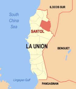 Map of La Union with Santol highlighted | |
OpenStreetMap 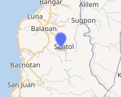
| |
.svg.png) Santol Location within the Philippines | |
| Coordinates: 16°46′N 120°27′E | |
| Country | |
| Region | Ilocos Region (Region I) |
| Province | La Union |
| District | 1st District |
| Barangays | 11 (see Barangays) |
| Government | |
| • Type | Sangguniang Bayan |
| • Mayor | Magno A. Wailan |
| • Vice Mayor | Monico A. Oriente Jr. |
| • Congressman | Pablo C. Ortega |
| • Electorate | 9,310 voters (2019) |
| Area | |
| • Total | 93.70 km2 (36.18 sq mi) |
| Population (2015 census)[3] | |
| • Total | 12,476 |
| • Density | 130/km2 (340/sq mi) |
| • Households | 2,780 |
| Economy | |
| • Income class | 4th municipal income class |
| • Poverty incidence | 12.57% (2015)[4] |
| • Revenue (₱) | |
| • Assets (₱) | |
| • Expenditure (₱) | |
| Time zone | UTC+8 (PST) |
| ZIP code | 2505 |
| PSGC | |
| IDD : area code | +63 (0)72 |
| Climate type | tropical monsoon climate |
| Native languages | Kankanaey language Ilocano Tagalog |
| Website | www |
Santol is situated in the north-eastern part of the Province of La Union. It is bounded on the north by the Municipality of Sudipen, on the north-east by the upland Municipality of Sugpon in Ilocos Sur, on the south by the Municipality of San Gabriel, and on the west by the Municipality of Balaoan. The town center of Santol is 40 kilometres (25 mi) north of the City of San Fernando, the provincial capital and regional administrative center; 310 kilometres (190 mi) north of Manila and 113 kilometres (70 mi) of the country's summer capital Baguio via the Naguilian Road.
Barangays
Santol is politically subdivided into 11 barangays. [2]
Barangay (with Land Area (has))
- Corro-oy - 1,506
- Lettac Norte - 977
- Lettac Sur - 986
- Mangaan - 804
- Paagan - 903
- Poblacion - 936
- Puguil - 1,575
- Ramot - 975
- Sapdaan - 1,206
- Sasaba - 1,232
- Tubaday - 1,032
Climate
| Climate data for Santol, La Union | |||||||||||||
|---|---|---|---|---|---|---|---|---|---|---|---|---|---|
| Month | Jan | Feb | Mar | Apr | May | Jun | Jul | Aug | Sep | Oct | Nov | Dec | Year |
| Average high °C (°F) | 30 (86) |
31 (88) |
32 (90) |
33 (91) |
32 (90) |
31 (88) |
30 (86) |
29 (84) |
30 (86) |
31 (88) |
31 (88) |
30 (86) |
31 (88) |
| Average low °C (°F) | 21 (70) |
22 (72) |
23 (73) |
25 (77) |
26 (79) |
25 (77) |
25 (77) |
25 (77) |
25 (77) |
24 (75) |
23 (73) |
21 (70) |
24 (75) |
| Average precipitation mm (inches) | 42 (1.7) |
48 (1.9) |
74 (2.9) |
110 (4.3) |
269 (10.6) |
275 (10.8) |
362 (14.3) |
325 (12.8) |
330 (13.0) |
306 (12.0) |
126 (5.0) |
61 (2.4) |
2,328 (91.7) |
| Average rainy days | 11.2 | 12.0 | 17.1 | 21.2 | 27.1 | 26.8 | 28.1 | 27.0 | 26.0 | 24.5 | 17.7 | 12.4 | 251.1 |
| Source: Meteoblue [5] | |||||||||||||
Demographics
| Year | Pop. | ±% p.a. |
|---|---|---|
| 1918 | 3,536 | — |
| 1939 | 4,901 | +1.57% |
| 1948 | 5,060 | +0.36% |
| 1960 | 6,125 | +1.60% |
| 1970 | 7,316 | +1.79% |
| 1975 | 7,686 | +0.99% |
| 1980 | 7,836 | +0.39% |
| 1990 | 9,544 | +1.99% |
| 1995 | 10,209 | +1.27% |
| 2000 | 11,202 | +2.01% |
| 2007 | 11,712 | +0.62% |
| 2010 | 12,007 | +0.91% |
| 2015 | 12,476 | +0.73% |
| Source: Philippine Statistics Authority[3][6][7][8] | ||
In the 2015 census, the population of Santol, La Union, was 12,476 people,[3] with a density of 130 inhabitants per square kilometre or 340 inhabitants per square mile.
Gallery
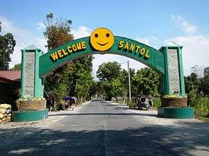 Welcome arch
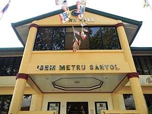 Municipal hall
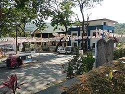
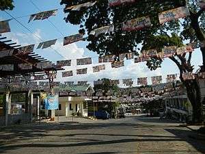 Town center
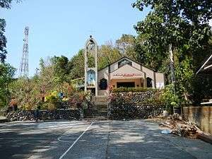 Our Lady of Victory Church
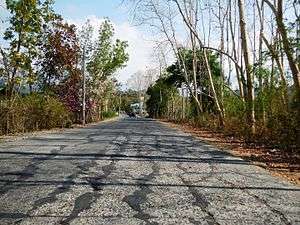 Street view and landscape
References
- "Municipality". Quezon City, Philippines: Department of the Interior and Local Government. Retrieved 31 May 2013.
- "Province: La Union". PSGC Interactive. Quezon City, Philippines: Philippine Statistics Authority. Retrieved 12 November 2016.
- Census of Population (2015). "Region I (Ilocos Region)". Total Population by Province, City, Municipality and Barangay. PSA. Retrieved 20 June 2016.
- "PSA releases the 2015 Municipal and City Level Poverty Estimates". Quezon City, Philippines. Retrieved 1 January 2020.
- "Santol: Average Temperatures and Rainfall". Meteoblue. Retrieved 26 April 2020.
- Census of Population and Housing (2010). "Region I (Ilocos Region)". Total Population by Province, City, Municipality and Barangay. NSO. Retrieved 29 June 2016.
- Censuses of Population (1903–2007). "Region I (Ilocos Region)". Table 1. Population Enumerated in Various Censuses by Province/Highly Urbanized City: 1903 to 2007. NSO.
- "Province of La Union". Municipality Population Data. Local Water Utilities Administration Research Division. Retrieved 17 December 2016.
External links
| Wikimedia Commons has media related to Santol, La Union. |
- Santol Profile at PhilAtlas.com
- Philippine Standard Geographic Code
- Philippine Census Information
- Local Governance Performance Management System
Places adjacent to Santol, La Union | ||||||||||
|---|---|---|---|---|---|---|---|---|---|---|
| ||||||||||