Suldalsvatnet
Suldalsvatnet (English: Lake Suldal)[1][2][3] is the sixth-deepest lake in Norway. The 376-metre (1,234 ft) deep lake lies in the municipality of Suldal in Rogaland county, Norway. The 28-square-kilometre (11 sq mi) lake is the headwaters of the river Suldalslågen and it sits at an elevation of 69 metres (226 ft) above sea level. The lake has a volume of 4.49 cubic kilometres (1.08 cu mi).[4]
| Suldalsvatnet | |
|---|---|
 | |
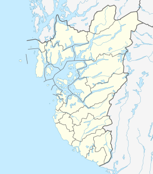 Suldalsvatnet Location of the lake 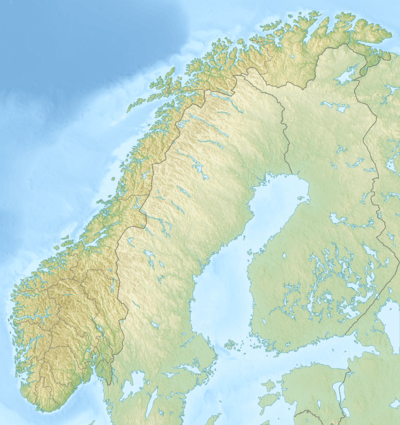 Suldalsvatnet Suldalsvatnet (Norway) | |
| Location | Suldal, Rogaland |
| Coordinates | 59.5267°N 6.5991°E |
| Primary outflows | Suldalslågen |
| Basin countries | Norway |
| Max. length | 28 kilometres (17 mi) |
| Max. width | 1.8 kilometres (1.1 mi) |
| Surface area | 28 km2 (11 sq mi) |
| Max. depth | 376 metres (1,234 ft) |
| Water volume | 4.49 km3 (1.08 cu mi) |
| Shore length1 | 69.43 kilometres (43.14 mi) |
| Surface elevation | 69 metres (226 ft) |
| References | NVE |
| 1 Shore length is not a well-defined measure. | |
The 28-kilometre (17 mi) long lake is regulated for use in two nearby hydroelectric power plants.[4]
References
- Wilson, Damon (2004). The World's Greatest Unsolved Mysteries. New York: Barnes and Noble Books. p. 271.
- Fodor, Eugene (1977). Fodor's Scandinavia 1977. New York: David McKay Co. p. 272.
- Nordland, Odd (1969). Brewing and Beer Traditions in Norway: The Social Anthropological Background of the Brewing Industry. Oslo: Universitetsforlaget. p. 141.
- Store norske leksikon. "Suldalsvatnet" (in Norwegian). Retrieved 2015-05-18.
This article is issued from Wikipedia. The text is licensed under Creative Commons - Attribution - Sharealike. Additional terms may apply for the media files.