Silver Lake, Ohio
Silver Lake is a village in Summit County, Ohio, United States. It is a suburb of Akron and is part of the Akron Metropolitan Statistical Area. The population was 2,519 at the 2010 census. Silver Lake is between, and surrounded by, the cities of Stow and Cuyahoga Falls.
Silver Lake, Ohio | |
|---|---|
 | |
 Location in Summit County and the state of Ohio. | |
| Coordinates: 41°9′13″N 81°27′39″W | |
| Country | United States |
| State | Ohio |
| County | Summit |
| Founded | 1918 |
| Incorporated | 1918 |
| Government | |
| • Mayor | Bernie Hovey [1] |
| Area | |
| • Total | 1.60 sq mi (4.15 km2) |
| • Land | 1.42 sq mi (3.68 km2) |
| • Water | 0.18 sq mi (0.47 km2) |
| Elevation | 1,053 ft (321 m) |
| Population | |
| • Total | 2,519 |
| • Estimate (2019)[4] | 2,494 |
| • Density | 1,753.87/sq mi (676.95/km2) |
| Time zone | UTC-5 (EST) |
| • Summer (DST) | UTC-4 (EDT) |
| ZIP code | 44224 |
| Area code(s) | 330 |
| FIPS code | 39-72494[5] |
| GNIS feature ID | 1065326[6] |
| Website | http://www.villageofsilverlake.com |
| Reference:[7] | |
Geography
Silver Lake is located at 41°9′13″N 81°27′39″W (41.153556, -81.460860).[8]
According to the United States Census Bureau, the village has a total area of 1.60 square miles (4.14 km2), of which 1.42 square miles (3.68 km2) is land and 0.18 square miles (0.47 km2) is water.[9]
The village includes two lakes: Silver Lake and Crystal Lake.
History

Beginning in 1874, the lake and the land surrounding it was a popular amusement park in the Akron area. The lake was acquired in 1876 by Ralph H. Lodge and he subsequently also purchased the land surrounding the body of water. It was originally a picnicking and swimming area, but before it closed Silver Lake Amusement Park featured animal exhibits, a roller coaster, sport facilities, a dance hall, and a hotel, becoming one of the "biggest attractions in Ohio."[10] In its prime, the Silver Lake Amusement Park received over 10,000 visitors per day. It was sold in 1917 and subdivided for residential development, leading to the incorporation of the village in 1918.[11]
Demographics
| Historical population | |||
|---|---|---|---|
| Census | Pop. | %± | |
| 1920 | 120 | — | |
| 1930 | 478 | 298.3% | |
| 1940 | 642 | 34.3% | |
| 1950 | 1,040 | 62.0% | |
| 1960 | 2,655 | 155.3% | |
| 1970 | 3,286 | 23.8% | |
| 1980 | 2,915 | −11.3% | |
| 1990 | 3,052 | 4.7% | |
| 2000 | 3,019 | −1.1% | |
| 2010 | 2,519 | −16.6% | |
| Est. 2019 | 2,494 | [4] | −1.0% |
| U.S. Decennial Census[12] | |||
2010 census
As of the census[3] of 2010, there were 2,519 people, 1,004 households, and 789 families residing in the village. The population density was 1,773.9 inhabitants per square mile (684.9/km2). There were 1,066 housing units at an average density of 750.7 per square mile (289.8/km2). The racial makeup of the village was 96.9% White, 0.6% African American, 0.1% Native American, 1.5% Asian, 0.1% Pacific Islander, 0.2% from other races, and 0.6% from two or more races. Hispanic or Latino of any race were 1.3% of the population.
There were 1,004 households, of which 28.0% had children under the age of 18 living with them, 69.9% were married couples living together, 6.3% had a female householder with no husband present, 2.4% had a male householder with no wife present, and 21.4% were non-families. 19.2% of all households were made up of individuals, and 9.9% had someone living alone who was 65 years of age or older. The average household size was 2.50 and the average family size was 2.85.
The median age in the village was 49.9 years. 20.5% of residents were under the age of 18; 5.7% were between the ages of 18 and 24; 15.3% were from 25 to 44; 38.9% were from 45 to 64; and 19.7% were 65 years of age or older. The gender makeup of the village was 49.8% male and 50.2% female.
2000 census
As of the census[5] of 2000, there were 3,019 people, 1,235 households, and 918 families residing in the village. The population density was 2,129.2 people per square mile (820.9/km2). There were 1,316 housing units at an average density of 928.1 per square mile (357.8/km2). The racial makeup of the village was 98.24% White, 0.13% African American, 0.10% Native American, 0.70% Asian, 0.17% from other races, and 0.66% from two or more races. Hispanic or Latino of any race were 0.79% of the population.
There were 1,235 households, out of which 27.3% had children under the age of 18 living with them, 68.6% were married couples living together, 4.5% had a female householder with no husband present, and 25.6% were non-families. 23.9% of all households were made up of individuals, and 17.7% had someone living alone who was 65 years of age or older. The average household size was 2.43 and the average family size was 2.88.
In the village, the population was spread out, with 22.7% under the age of 18, 3.8% from 18 to 24, 19.1% from 25 to 44, 27.2% from 45 to 64, and 27.1% who were 65 years of age or older. The median age was 48 years. For every 100 females there were 89.8 males. For every 100 females age 18 and over, there were 84.4 males.
The median income for a household in the village was $70,875, and the median income for a family was $79,286. Males had a median income of $64,265 versus $38,529 for females. The per capita income for the village was $35,614. About 1.1% of families and 2.8% of the population were below the poverty line, including none of those under age 18 and 6.8% of those age 65 or over.
Transport
From 1902 to 1917 the Miniature Railway at Silver Lake operated in the recreation park at Silver Lake.
References
- main_nav3.gif Archived 2007-09-28 at the Wayback Machine
- "2019 U.S. Gazetteer Files". United States Census Bureau. Retrieved July 28, 2020.
- "U.S. Census website". United States Census Bureau. Retrieved 2013-01-06.
- "Population and Housing Unit Estimates". United States Census Bureau. May 24, 2020. Retrieved May 27, 2020.
- "U.S. Census website". United States Census Bureau. Retrieved 2008-01-31.
- "US Board on Geographic Names". United States Geological Survey. 2007-10-25. Retrieved 2008-01-31.
- Welcome to the Village of Silver Lake Archived 2006-09-03 at the Wayback Machine
- "US Gazetteer files: 2010, 2000, and 1990". United States Census Bureau. 2011-02-12. Retrieved 2011-04-23.
- "US Gazetteer files 2010". United States Census Bureau. Archived from the original on 2012-01-25. Retrieved 2013-01-06.
- Daugherty, Beth E. (2010). Images of America: Stow and Munroe Falls. Arcadia Publishing. p. 27. ISBN 978-0-7385-8388-4.
- main_nav3.gif Archived 2007-09-28 at the Wayback Machine
- "Census of Population and Housing". Census.gov. Retrieved June 4, 2015.
External links
- Village website
- Village of Silver Lake - History
Municipalities and communities of Summit County, Ohio, United States | ||
|---|---|---|
| Cities | 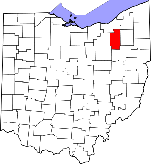 Map of Ohio highlighting Summit County | |
| Villages | ||
| Townships | ||
| CDPs | ||
| Unincorporated communities | ||
| Footnotes | ‡This populated place also has portions in an adjacent county or counties | |
| Authority control |
|
|---|